 Aerial imagery: USGS National Map (public domain)
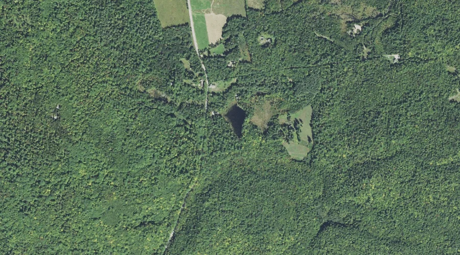
Tilton Pond — Lakes 44.6 Miles SW of Chapman Inn
Carroll County, New Hampshire · USGS Mount Chocorua Quadrangle · GNIS 872819
Within Carroll County, New Hampshire, on the USGS Mount Chocorua quadrangle, the lake known as Tilton Pond sits 44.6 miles southwest of Chapman Inn.
Landmark Profile
Classification & USGS reference
Within Carroll County, New Hampshire, the U.S. Geological Survey lists Tilton Pond as a lake on the Mount Chocorua topographic quadrangle (FIPS 33/003), under Feature ID 872819. Catalogued in GNIS since 08/27/1980.
Coordinates & physical setting
Tilton Pond sits at 43.89924° N, 71.34729° W (DMS 43°53′57″ N, 71°20′50″ W).
Other lakes in Carroll County, New Hampshire
Carroll County, NH contains 62 lakes catalogued in the USGS Geographic Names Information System, counting Tilton Pond itself. The ones closest to Tilton Pond:
| Feature | USGS Quadrangle | Distance |
|---|---|---|
| James Pond | Mount Chocorua | 3.8 mi |
| Miles Pond | Tamworth | 4.2 mi |
| Taylor Pond | Tamworth | 4.3 mi |
| Braga Pond | Tamworth | 4.3 mi |
| Jackman Pond | Tamworth | 4.4 mi |
| Lonely Lake | Silver Lake | 5 mi |
| Chocorua Lake | Silver Lake | 5.5 mi |
| Beaver Pond | Tamworth | 5.8 mi |
| Little Lake | Silver Lake | 5.8 mi |
| Haunted Pond | Silver Lake | 7.4 mi |
Features on the USGS Mount Chocorua Quadrangle
The Mount Chocorua 7.5-minute topographic quadrangle holds 39 catalogued natural features alongside Tilton Pond. A sampling nearest to this location:
| Feature | Type | County | Offset |
|---|---|---|---|
| Mount Katherine | Summits | Carroll County, NH | 0.6 mi |
| Birch Intervale | Basins | Carroll County, NH | 0.7 mi |
| Great Hill Pond | Reservoirs | Carroll County, NH | 1 mi |
| Spring Brook | Streams | Grafton County, NH | 1.2 mi |
| Kelly Brook | Streams | Carroll County, NH | 1.3 mi |
| Tewksberry Brook | Streams | Carroll County, NH | 1.4 mi |
| Wonalancet River | Streams | Carroll County, NH | 1.7 mi |
| Sanborn Brook | Streams | Carroll County, NH | 1.8 mi |
| Mount Mexico | Summits | Carroll County, NH | 1.9 mi |
| Paugus Brook | Streams | Carroll County, NH | 2.6 mi |
Visiting from Chapman Inn
Distance, bearing & drive time
Follow the compass bearing SW out of Bethel for 44.6 miles (southwest) and you reach Tilton Pond; at typical rural speeds the trip runs roughly 76 minutes.
Best time to visit
June through September for paddling and swimming; January through March for ice fishing. At this latitude (43.899°), the shoulder seasons are workable — April and November can be comfortable on mild years. At 44.6 miles from the Inn, block the full day — sunrise start, late return, packed meals. Conditions at Tilton Pond track the nearby Mount Katherine summit (0.6 mi away) closely — if that is runnable, so is this.
Nearest features to Tilton Pond
| Feature | Type | County | Distance |
|---|---|---|---|
| Mount Katherine | Summits | Carroll County, NH | 0.6 mi |
| Birch Intervale | Basins | Carroll County, NH | 0.7 mi |
| Great Hill Pond | Reservoirs | Carroll County, NH | 1 mi |
| Spring Brook | Streams | Grafton County, NH | 1.2 mi |
| Kelly Brook | Streams | Carroll County, NH | 1.3 mi |
Frequently Asked Questions
Where is Tilton Pond located?
Tilton Pond is in Carroll County, New Hampshire, approximately 44.6 miles southwest of Chapman Inn in Bethel, Maine. It appears on the USGS Mount Chocorua topographic quadrangle.
How far is Tilton Pond from Chapman Inn?
The drive runs about 76 minutes, 44.6 miles southwest (bearing SW) of the Inn.
What type of natural feature is Tilton Pond?
The U.S. Geological Survey classifies Tilton Pond as a lake, catalogued under GNIS Feature ID 872819 on the Mount Chocorua quadrangle.
When is the best time to visit Tilton Pond?
June through September for paddling and swimming; January through March for ice fishing.
How many other lakes are in Carroll County, New Hampshire?
GNIS lists 61 other lakes in Carroll County, New Hampshire.