 Aerial imagery: USGS National Map (public domain)
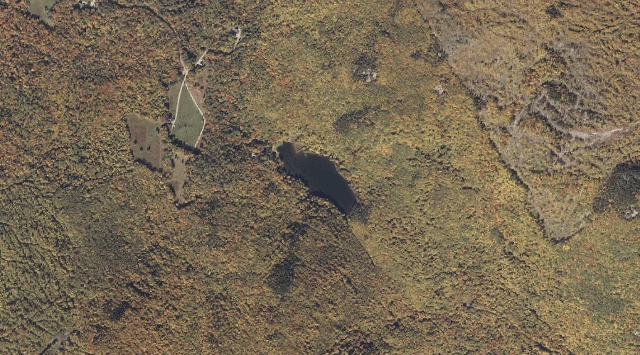
Swains Pond — Lakes 15.6 Miles NNE of Chapman Inn
Oxford County, Maine · USGS Rumford Quadrangle · GNIS 576572
Within Oxford County, Maine, on the USGS Rumford quadrangle, the lake known as Swains Pond sits 15.6 miles north-northeast of Chapman Inn.
Landmark Profile
Classification & USGS reference
Within Oxford County, Maine, the U.S. Geological Survey lists Swains Pond as a lake on the Rumford topographic quadrangle (FIPS 23/017), under Feature ID 576572. Last revised by the Board on Geographic Names on 05/12/2018.
Coordinates & physical setting
Swains Pond sits at 44.59809° N, 70.62374° W (DMS 44°35′53″ N, 70°37′25″ W).
Other lakes in Oxford County, Maine
Oxford County, ME contains 157 lakes catalogued in the USGS Geographic Names Information System, counting Swains Pond itself. The ones closest to Swains Pond:
| Feature | USGS Quadrangle | Distance |
|---|---|---|
| Horseshoe Pond | East Andover | 2.2 mi |
| Birch Pond | Roxbury | 4.5 mi |
| Bunker Pond | Roxbury | 4.6 mi |
| Joes Pond | Rumford | 4.9 mi |
| Ellis Pond | Ellis Pond | 5 mi |
| Davis Pond | East Andover | 5.7 mi |
| Little Ellis Pond | Ellis Pond | 7.7 mi |
| Howard Pond | East Andover | 8 mi |
| Muskrat Pond | Roxbury | 8.2 mi |
| Jims Pond | Puzzle Mountain | 9.3 mi |
Features on the USGS Rumford Quadrangle
The Rumford 7.5-minute topographic quadrangle holds 28 catalogued natural features alongside Swains Pond. A sampling nearest to this location:
| Feature | Type | County | Offset |
|---|---|---|---|
| Swains Notch | Gaps | Oxford County, ME | 0.2 mi |
| Swift River Reservoir | Reservoirs | Oxford County, ME | 3.1 mi |
| Goff Brook | Streams | Oxford County, ME | 3.1 mi |
| Mitchell Brook | Streams | Franklin County, ME | 3.2 mi |
| Walton Brook | Streams | Oxford County, ME | 3.3 mi |
| Scotty Brook | Streams | Oxford County, ME | 3.8 mi |
| Thompson Hill | Summits | Oxford County, ME | 4.6 mi |
| Swift River | Streams | Oxford County, ME | 4.9 mi |
| Joes Pond | Lakes | Oxford County, ME | 4.9 mi |
| Androscoggin River Reservoir | Reservoirs | Oxford County, ME | 5.2 mi |
Visiting from Chapman Inn
Distance, bearing & drive time
Follow the compass bearing NNE out of Bethel for 15.6 miles (north-northeast) and you reach Swains Pond; at typical rural speeds the trip runs roughly 27 minutes.
Best time to visit
June through September for paddling and swimming; January through March for ice fishing. At this latitude (44.598°), the shoulder seasons are workable — April and November can be comfortable on mild years. At 15.6 miles from the Inn, plan on a comfortable day trip with time for lunch on the road. Conditions at Swains Pond track the nearby Swains Notch mountain gap (0.2 mi away) closely — if that is runnable, so is this.
Nearest features to Swains Pond
| Feature | Type | County | Distance |
|---|---|---|---|
| Swains Notch | Gaps | Oxford County, ME | 0.2 mi |
| Black Mountain | Summits | Oxford County, ME | 1.2 mi |
| Roxbury Notch | Gaps | Oxford County, ME | 1.9 mi |
| Horseshoe Pond | Lakes | Oxford County, ME | 2.2 mi |
| Partridge Peak | Summits | Oxford County, ME | 2.5 mi |
Frequently Asked Questions
Where is Swains Pond located?
Swains Pond is in Oxford County, Maine, approximately 15.6 miles north-northeast of Chapman Inn in Bethel, Maine. It appears on the USGS Rumford topographic quadrangle.
How far is Swains Pond from Chapman Inn?
The drive runs about 27 minutes, 15.6 miles north-northeast (bearing NNE) of the Inn.
What type of natural feature is Swains Pond?
The U.S. Geological Survey classifies Swains Pond as a lake, catalogued under GNIS Feature ID 576572 on the Rumford quadrangle.
When is the best time to visit Swains Pond?
June through September for paddling and swimming; January through March for ice fishing.
How many other lakes are in Oxford County, Maine?
GNIS lists 156 other lakes in Oxford County, Maine.