 Aerial imagery: USGS National Map (public domain)
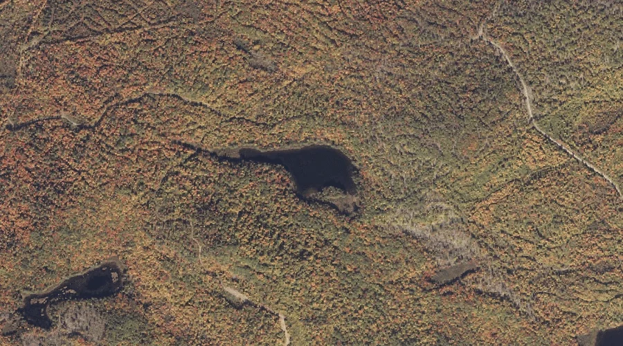
Stetson Pond — Lakes 34.3 Miles NNE of Chapman Inn
Franklin County, Maine · USGS Madrid Quadrangle · GNIS 576306
34.3 miles north-northeast of Chapman Inn, on the USGS Madrid topographic quadrangle, Stetson Pond is a lake recorded in Franklin County, Maine by the federal Geographic Names Information System.
Landmark Profile
Classification & USGS reference
The USGS Madrid 7.5-minute topographic quadrangle places Stetson Pond in Franklin County, Maine (FIPS 23/007), classified as a lake in the federal GNIS (Feature ID 576306). Last revised by the Board on Geographic Names on 05/13/2018.
Coordinates & physical setting
Stetson Pond sits at 44.84821° N, 70.47748° W (DMS 44°50′54″ N, 70°28′39″ W).
Other lakes in Franklin County, Maine
Franklin County, ME contains 98 lakes catalogued in the USGS Geographic Names Information System, counting Stetson Pond itself. The ones closest to Stetson Pond:
| Feature | USGS Quadrangle | Distance |
|---|---|---|
| Mud Pond | Madrid | 0.6 mi |
| Lufkin Pond | Madrid | 0.9 mi |
| Harvey Pond | Jackson Mountain | 1.3 mi |
| Pearl Pond | Madrid | 1.5 mi |
| Perry Pond | Saddleback Mountain | 2.3 mi |
| Winslow Pond | Redington | 2.4 mi |
| Bog Pond | Madrid | 3.3 mi |
| South Pond | Jackson Mountain | 4.1 mi |
| Little Saddleback Pond | Saddleback Mountain | 4.2 mi |
| Toothaker Pond | Madrid | 4.2 mi |
Features on the USGS Madrid Quadrangle
The Madrid 7.5-minute topographic quadrangle holds 18 catalogued natural features alongside Stetson Pond. A sampling nearest to this location:
| Feature | Type | County | Offset |
|---|---|---|---|
| Mud Pond | Lakes | Franklin County, ME | 0.6 mi |
| Lufkin Pond | Lakes | Franklin County, ME | 0.9 mi |
| Crossman Stream | Streams | Franklin County, ME | 0.9 mi |
| Rowe Hill | Summits | Franklin County, ME | 1.2 mi |
| Saddleback Stream | Streams | Franklin County, ME | 1.3 mi |
| Pearl Pond | Lakes | Franklin County, ME | 1.5 mi |
| Beech Hill | Summits | Franklin County, ME | 1.7 mi |
| South Branch Sandy River | Streams | Franklin County, ME | 2.1 mi |
| Jont Stream | Streams | Franklin County, ME | 2.2 mi |
| Bear Hill | Summits | Franklin County, ME | 2.2 mi |
Visiting from Chapman Inn
Distance, bearing & drive time
Chapman Inn sits 34.3 miles north-northeast (bearing NNE) of Stetson Pond. At moderate back-road speeds the drive runs about 59 minutes — comfortably inside a half-day outing window after breakfast.
Best time to visit
June through September for paddling and swimming; January through March for ice fishing. Being this far north (lat 44.848°), first snows typically arrive by mid-October and linger into early May — narrow the window accordingly. At 34.3 miles from the Inn, block the full day — sunrise start, late return, packed meals. Conditions at Stetson Pond track the nearby Mud Pond lake (0.6 mi away) closely — if that is runnable, so is this.
Nearest features to Stetson Pond
| Feature | Type | County | Distance |
|---|---|---|---|
| Mud Pond | Lakes | Franklin County, ME | 0.6 mi |
| Lufkin Pond | Lakes | Franklin County, ME | 0.9 mi |
| Crossman Stream | Streams | Franklin County, ME | 0.9 mi |
| Rowe Hill | Summits | Franklin County, ME | 1.2 mi |
| Harvey Pond | Lakes | Franklin County, ME | 1.3 mi |
Frequently Asked Questions
Where is Stetson Pond located?
Stetson Pond is in Franklin County, Maine, approximately 34.3 miles north-northeast of Chapman Inn in Bethel, Maine. It appears on the USGS Madrid topographic quadrangle.
How far is Stetson Pond from Chapman Inn?
The drive runs about 59 minutes, 34.3 miles north-northeast (bearing NNE) of the Inn.
What type of natural feature is Stetson Pond?
The U.S. Geological Survey classifies Stetson Pond as a lake, catalogued under GNIS Feature ID 576306 on the Madrid quadrangle.
When is the best time to visit Stetson Pond?
June through September for paddling and swimming; January through March for ice fishing.
How many other lakes are in Franklin County, Maine?
GNIS lists 97 other lakes in Franklin County, Maine.