 Aerial imagery: USGS National Map (public domain)
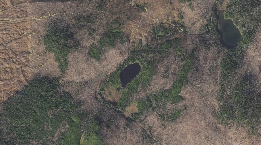
Signal Pond — Lakes 32.6 Miles NW of Chapman Inn
Coos County, New Hampshire · USGS Errol Quadrangle · GNIS 869920
Catalogued on the USGS Errol quadrangle in Coos County, New Hampshire, Signal Pond — a lake — lies 32.6 miles northwest of Chapman Inn.
Landmark Profile
Classification & USGS reference
Catalogued under GNIS Feature ID 869920, Signal Pond is recorded as a lake on the USGS Errol quadrangle in Coos County, New Hampshire (FIPS 33/007). Last revised by the Board on Geographic Names on 05/15/2018.
Coordinates & physical setting
Signal Pond sits at 44.76910° N, 71.21118° W (DMS 44°46′09″ N, 71°12′40″ W).
Other lakes in Coos County, New Hampshire
Coos County, NH contains 99 lakes catalogued in the USGS Geographic Names Information System, counting Signal Pond itself. The ones closest to Signal Pond:
| Feature | USGS Quadrangle | Distance |
|---|---|---|
| Sweat Pond | Errol | 0.6 mi |
| Long Pond | Errol | 1.6 mi |
| Bragg Pond | Dixville Notch | 1.9 mi |
| Lake Metalak | Dixville Notch | 2.6 mi |
| Millsfield Pond | Dixville Notch | 2.7 mi |
| Munn Pond | Teakettle Ridge | 2.8 mi |
| Rock Pond | Teakettle Ridge | 2.9 mi |
| Moose Pond | Teakettle Ridge | 2.9 mi |
| Sessions Pond | Teakettle Ridge | 4.5 mi |
| Round Pond Lake | Umbagog Lake North | 5.1 mi |
Features on the USGS Errol Quadrangle
The Errol 7.5-minute topographic quadrangle holds 19 catalogued natural features alongside Signal Pond. A sampling nearest to this location:
| Feature | Type | County | Offset |
|---|---|---|---|
| Sweat Pond | Lakes | Coos County, NH | 0.6 mi |
| Signal Mountain | Summits | Coos County, NH | 1 mi |
| Long Pond | Lakes | Coos County, NH | 1.6 mi |
| Millsfield Pond Brook | Streams | Coos County, NH | 1.9 mi |
| Corser Brook | Streams | Coos County, NH | 2.3 mi |
| Welch Brook | Streams | Coos County, NH | 3 mi |
| Greenough Brook | Streams | Coos County, NH | 3.1 mi |
| Akers Pond | Reservoirs | Coos County, NH | 3.3 mi |
| Clear Stream | Streams | Coos County, NH | 3.6 mi |
| West Branch Clear Stream | Streams | Coos County, NH | 4 mi |
Visiting from Chapman Inn
Distance, bearing & drive time
A 56-minute drive along back roads separates the front door of Chapman Inn from Signal Pond — 32.6 miles northwest as the crow flies, on compass bearing NW.
Best time to visit
June through September for paddling and swimming; January through March for ice fishing. Being this far north (lat 44.769°), first snows typically arrive by mid-October and linger into early May — narrow the window accordingly. At 32.6 miles from the Inn, block the full day — sunrise start, late return, packed meals. Conditions at Signal Pond track the nearby Sweat Pond lake (0.6 mi away) closely — if that is runnable, so is this.
Nearest features to Signal Pond
| Feature | Type | County | Distance |
|---|---|---|---|
| Sweat Pond | Lakes | Coos County, NH | 0.6 mi |
| Signal Mountain | Summits | Coos County, NH | 1 mi |
| Long Pond | Lakes | Coos County, NH | 1.6 mi |
| Millsfield Pond Brook | Streams | Coos County, NH | 1.9 mi |
| Bragg Pond | Lakes | Coos County, NH | 1.9 mi |
Frequently Asked Questions
Where is Signal Pond located?
Signal Pond is in Coos County, New Hampshire, approximately 32.6 miles northwest of Chapman Inn in Bethel, Maine. It appears on the USGS Errol topographic quadrangle.
How far is Signal Pond from Chapman Inn?
The drive runs about 56 minutes, 32.6 miles northwest (bearing NW) of the Inn.
What type of natural feature is Signal Pond?
The U.S. Geological Survey classifies Signal Pond as a lake, catalogued under GNIS Feature ID 869920 on the Errol quadrangle.
When is the best time to visit Signal Pond?
June through September for paddling and swimming; January through March for ice fishing.
How many other lakes are in Coos County, New Hampshire?
GNIS lists 98 other lakes in Coos County, New Hampshire.