 Aerial imagery: USGS National Map (public domain)
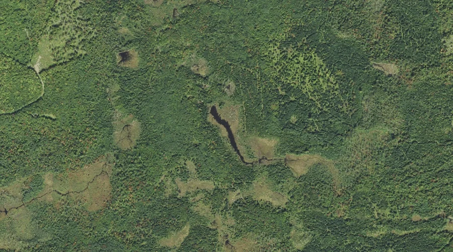
Richardson Pond — Lakes 40.2 Miles W of Chapman Inn
Coos County, New Hampshire · USGS Twin Mountain Quadrangle · GNIS 869493
40.2 miles west of Chapman Inn, on the USGS Twin Mountain topographic quadrangle, Richardson Pond is a lake recorded in Coos County, New Hampshire by the federal Geographic Names Information System.
Landmark Profile
Classification & USGS reference
The USGS Twin Mountain 7.5-minute topographic quadrangle places Richardson Pond in Coos County, New Hampshire (FIPS 33/007), classified as a lake in the federal GNIS (Feature ID 869493). Last revised by the Board on Geographic Names on 11/20/2024.
Coordinates & physical setting
Richardson Pond sits at 44.31284° N, 71.59161° W (DMS 44°18′46″ N, 71°35′30″ W).
Other lakes in Coos County, New Hampshire
Coos County, NH contains 99 lakes catalogued in the USGS Geographic Names Information System, counting Richardson Pond itself. The ones closest to Richardson Pond:
| Feature | USGS Quadrangle | Distance |
|---|---|---|
| Hazens Pond | Twin Mountain | 4.3 mi |
| Forest Lake | Bethlehem | 4.6 mi |
| Mirror Lake | Lancaster | 5.2 mi |
| Little Cherry Pond | Lancaster | 5.7 mi |
| Cherry Pond | Lancaster | 5.8 mi |
| Mud Pond | Lancaster | 6.6 mi |
| Clark Pond | Gilman | 7.4 mi |
| Weed Pond | Lancaster | 7.4 mi |
| Blood Pond | Lancaster | 8 mi |
| Weeks Pond | Lancaster | 8.1 mi |
Features on the USGS Twin Mountain Quadrangle
The Twin Mountain 7.5-minute topographic quadrangle holds 21 catalogued natural features alongside Richardson Pond. A sampling nearest to this location:
| Feature | Type | County | Offset |
|---|---|---|---|
| Pine Knob | Summits | Grafton County, NH | 1.2 mi |
| Beech Hill | Summits | Coos County, NH | 1.6 mi |
| Carter Brook | Streams | Coos County, NH | 1.7 mi |
| Cherry Mountain Brook | Streams | Coos County, NH | 2.1 mi |
| Osburn Hill | Summits | Coos County, NH | 2.2 mi |
| Haystack Brook | Streams | Grafton County, NH | 2.9 mi |
| Alder Brook | Streams | Coos County, NH | 3 mi |
| Little River | Streams | Coos County, NH | 3 mi |
| Bear Brook | Streams | Coos County, NH | 3.8 mi |
| Airport Marsh Reservoir | Reservoirs | Coos County, NH | 4.1 mi |
Visiting from Chapman Inn
Distance, bearing & drive time
Chapman Inn sits 40.2 miles west (bearing W) of Richardson Pond. At moderate back-road speeds the drive runs about 69 minutes — comfortably inside a half-day outing window after breakfast.
Best time to visit
June through September for paddling and swimming; January through March for ice fishing. Being this far north (lat 44.313°), first snows typically arrive by mid-October and linger into early May — narrow the window accordingly. At 40.2 miles from the Inn, block the full day — sunrise start, late return, packed meals. Conditions at Richardson Pond track the nearby Pine Knob summit (1.2 mi away) closely — if that is runnable, so is this.
Nearest features to Richardson Pond
| Feature | Type | County | Distance |
|---|---|---|---|
| Pine Knob | Summits | Grafton County, NH | 1.2 mi |
| Beech Hill | Summits | Coos County, NH | 1.6 mi |
| Carter Brook | Streams | Coos County, NH | 1.7 mi |
| Cherry Mountain Brook | Streams | Coos County, NH | 2.1 mi |
| Osburn Hill | Summits | Coos County, NH | 2.2 mi |
Frequently Asked Questions
Where is Richardson Pond located?
Richardson Pond is in Coos County, New Hampshire, approximately 40.2 miles west of Chapman Inn in Bethel, Maine. It appears on the USGS Twin Mountain topographic quadrangle.
How far is Richardson Pond from Chapman Inn?
The drive runs about 69 minutes, 40.2 miles west (bearing W) of the Inn.
What type of natural feature is Richardson Pond?
The U.S. Geological Survey classifies Richardson Pond as a lake, catalogued under GNIS Feature ID 869493 on the Twin Mountain quadrangle.
When is the best time to visit Richardson Pond?
June through September for paddling and swimming; January through March for ice fishing.
How many other lakes are in Coos County, New Hampshire?
GNIS lists 98 other lakes in Coos County, New Hampshire.