 Aerial imagery: USGS National Map (public domain)
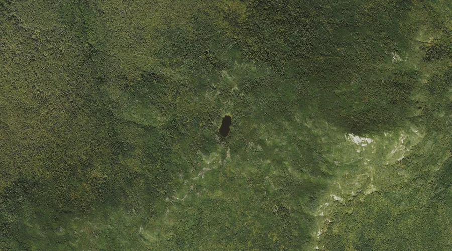
Garfield Pond — Lakes 43.7 Miles WSW of Chapman Inn
Grafton County, New Hampshire · USGS South Twin Mountain Quadrangle · GNIS 871921
Catalogued on the USGS South Twin Mountain quadrangle in Grafton County, New Hampshire, Garfield Pond — a lake — lies 43.7 miles west-southwest of Chapman Inn.
Landmark Profile
Classification & USGS reference
Catalogued under GNIS Feature ID 871921, Garfield Pond is recorded as a lake on the USGS South Twin Mountain quadrangle in Grafton County, New Hampshire (FIPS 33/009). Last revised by the Board on Geographic Names on 02/28/2018.
Coordinates & physical setting
Garfield Pond sits at 44.18772° N, 71.61863° W (DMS 44°11′16″ N, 71°37′07″ W).
Other lakes in Grafton County, New Hampshire
Grafton County, NH contains 24 lakes catalogued in the USGS Geographic Names Information System, counting Garfield Pond itself. The ones closest to Garfield Pond:
| Feature | USGS Quadrangle | Distance |
|---|---|---|
| Eagles Lakes | Franconia | 2.7 mi |
| Profile Lake | Franconia | 3.4 mi |
| Echo Lake | Franconia | 3.8 mi |
| Lonesome Lake | Franconia | 5.3 mi |
| Zeacliff Pond | South Twin Mountain | 5.6 mi |
| Black Pond | Mount Osceola | 5.8 mi |
| Zealand Pond | Crawford Notch | 6.3 mi |
| Ice Pond | Mount Osceola | 6.4 mi |
| The Pool | Lincoln | 6.5 mi |
| Shoal Pond | Crawford Notch | 8.2 mi |
Features on the USGS South Twin Mountain Quadrangle
The South Twin Mountain 7.5-minute topographic quadrangle holds 22 catalogued natural features alongside Garfield Pond. A sampling nearest to this location:
| Feature | Type | County | Offset |
|---|---|---|---|
| Mount Garfield | Summits | Grafton County, NH | 0.4 mi |
| Hawthorne Falls | Waterfalls | Grafton County, NH | 1 mi |
| Flat Top Mountain | Summits | Grafton County, NH | 1.3 mi |
| Thirteen Falls | Waterfalls | Grafton County, NH | 2 mi |
| Galehead Mountain | Summits | Grafton County, NH | 2.3 mi |
| Twin Brook | Streams | Grafton County, NH | 2.4 mi |
| South Twin Mountain | Summits | Grafton County, NH | 3.2 mi |
| North Twin Mountain | Summits | Grafton County, NH | 3.2 mi |
| Redrock Brook | Streams | Grafton County, NH | 3.3 mi |
| Littleton Reservoir | Reservoirs | Grafton County, NH | 3.5 mi |
Visiting from Chapman Inn
Distance, bearing & drive time
A 75-minute drive along back roads separates the front door of Chapman Inn from Garfield Pond — 43.7 miles west-southwest as the crow flies, on compass bearing WSW.
Best time to visit
June through September for paddling and swimming; January through March for ice fishing. At this latitude (44.188°), the shoulder seasons are workable — April and November can be comfortable on mild years. At 43.7 miles from the Inn, block the full day — sunrise start, late return, packed meals. Conditions at Garfield Pond track the nearby Mount Garfield summit (0.4 mi away) closely — if that is runnable, so is this.
Nearest features to Garfield Pond
| Feature | Type | County | Distance |
|---|---|---|---|
| Mount Garfield | Summits | Grafton County, NH | 0.4 mi |
| Hawthorne Falls | Waterfalls | Grafton County, NH | 1 mi |
| Flat Top Mountain | Summits | Grafton County, NH | 1.3 mi |
| Burnt Brook | Streams | Grafton County, NH | 1.6 mi |
| Big Bickford Mountain | Summits | Grafton County, NH | 1.9 mi |
Frequently Asked Questions
Where is Garfield Pond located?
Garfield Pond is in Grafton County, New Hampshire, approximately 43.7 miles west-southwest of Chapman Inn in Bethel, Maine. It appears on the USGS South Twin Mountain topographic quadrangle.
How far is Garfield Pond from Chapman Inn?
The drive runs about 75 minutes, 43.7 miles west-southwest (bearing WSW) of the Inn.
What type of natural feature is Garfield Pond?
The U.S. Geological Survey classifies Garfield Pond as a lake, catalogued under GNIS Feature ID 871921 on the South Twin Mountain quadrangle.
When is the best time to visit Garfield Pond?
June through September for paddling and swimming; January through March for ice fishing.
How many other lakes are in Grafton County, New Hampshire?
GNIS lists 23 other lakes in Grafton County, New Hampshire.