 Aerial imagery: USGS National Map (public domain)
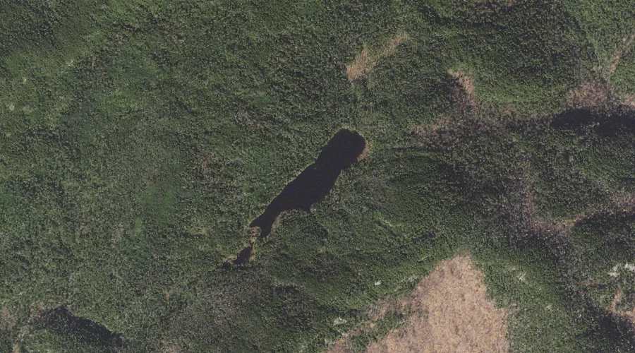
Dream Lake — Lakes 15.3 Miles W of Chapman Inn
Coos County, New Hampshire · USGS Shelburne Quadrangle · GNIS 871800
15.3 miles west of Chapman Inn, on the USGS Shelburne topographic quadrangle, Dream Lake is a lake recorded in Coos County, New Hampshire by the federal Geographic Names Information System.
Landmark Profile
Classification & USGS reference
The USGS Shelburne 7.5-minute topographic quadrangle places Dream Lake in Coos County, New Hampshire (FIPS 33/007), classified as a lake in the federal GNIS (Feature ID 871800). Last revised by the Board on Geographic Names on 05/12/2018.
Coordinates & physical setting
Dream Lake sits at 44.44239° N, 71.09510° W (DMS 44°26′33″ N, 71°05′42″ W).
Other lakes in Coos County, New Hampshire
Coos County, NH contains 99 lakes catalogued in the USGS Geographic Names Information System, counting Dream Lake itself. The ones closest to Dream Lake:
| Feature | USGS Quadrangle | Distance |
|---|---|---|
| Upper Gentian Pond | Shelburne | 1.2 mi |
| Page Pond | Shelburne | 1.2 mi |
| Gentian Pond | Shelburne | 1.4 mi |
| Judson Pond | Shelburne | 2.9 mi |
| Shadow Pool | Shelburne | 3.5 mi |
| Reflection Pond | Shelburne | 3.6 mi |
| Wheeler Pond | Shelburne | 4.2 mi |
| Moose Pond | Shelburne | 4.6 mi |
| Mascot Pond | Berlin | 5.1 mi |
| Dead River Pond | Berlin | 6.6 mi |
Features on the USGS Shelburne Quadrangle
The Shelburne 7.5-minute topographic quadrangle holds 47 catalogued natural features alongside Dream Lake. A sampling nearest to this location:
| Feature | Type | County | Offset |
|---|---|---|---|
| Bald Cap Peak | Summits | Coos County, NH | 0.4 mi |
| Bald Cap | Summits | Coos County, NH | 0.6 mi |
| Wocket Ledge | Summits | Coos County, NH | 0.7 mi |
| Dryad Falls | Waterfalls | Coos County, NH | 0.9 mi |
| Giant Falls | Waterfalls | Coos County, NH | 0.9 mi |
| Middle Mountain | Summits | Coos County, NH | 1 mi |
| Upper Gentian Pond | Lakes | Coos County, NH | 1.2 mi |
| Page Pond | Lakes | Coos County, NH | 1.2 mi |
| Dryad Brook | Streams | Coos County, NH | 1.3 mi |
| First Mountain | Summits | Coos County, NH | 1.3 mi |
Visiting from Chapman Inn
Distance, bearing & drive time
Chapman Inn sits 15.3 miles west (bearing W) of Dream Lake. At moderate back-road speeds the drive runs about 26 minutes — comfortably inside a half-day outing window after breakfast.
Best time to visit
June through September for paddling and swimming; January through March for ice fishing. Being this far north (lat 44.442°), first snows typically arrive by mid-October and linger into early May — narrow the window accordingly. At 15.3 miles from the Inn, plan on a comfortable day trip with time for lunch on the road. Conditions at Dream Lake track the nearby Bald Cap Peak summit (0.4 mi away) closely — if that is runnable, so is this.
Nearest features to Dream Lake
| Feature | Type | County | Distance |
|---|---|---|---|
| Bald Cap Peak | Summits | Coos County, NH | 0.4 mi |
| Bald Cap | Summits | Coos County, NH | 0.6 mi |
| Wocket Ledge | Summits | Coos County, NH | 0.7 mi |
| Dryad Falls | Waterfalls | Coos County, NH | 0.9 mi |
| Giant Falls | Waterfalls | Coos County, NH | 0.9 mi |
Frequently Asked Questions
Where is Dream Lake located?
Dream Lake is in Coos County, New Hampshire, approximately 15.3 miles west of Chapman Inn in Bethel, Maine. It appears on the USGS Shelburne topographic quadrangle.
How far is Dream Lake from Chapman Inn?
The drive runs about 26 minutes, 15.3 miles west (bearing W) of the Inn.
What type of natural feature is Dream Lake?
The U.S. Geological Survey classifies Dream Lake as a lake, catalogued under GNIS Feature ID 871800 on the Shelburne quadrangle.
When is the best time to visit Dream Lake?
June through September for paddling and swimming; January through March for ice fishing.
How many other lakes are in Coos County, New Hampshire?
GNIS lists 98 other lakes in Coos County, New Hampshire.