 Aerial imagery: USGS National Map (public domain)
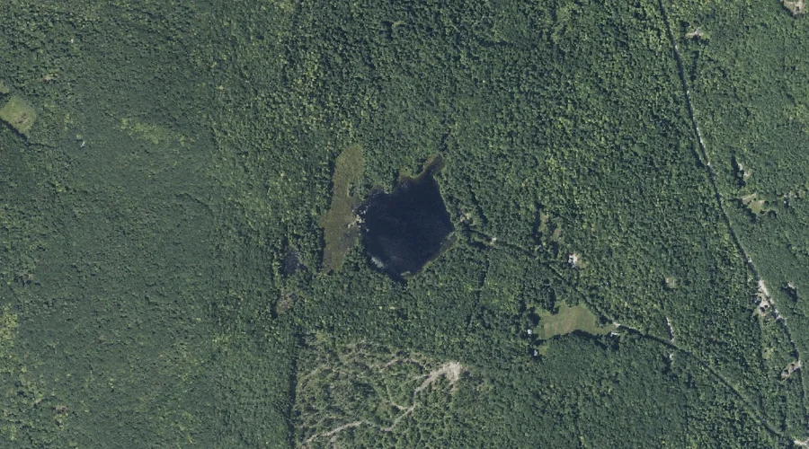
Davis Pond — Lakes 40.4 Miles ENE of Chapman Inn
Kennebec County, Maine · USGS Belgrade Lakes Quadrangle · GNIS 564824
Within Kennebec County, Maine, on the USGS Belgrade Lakes quadrangle, the lake known as Davis Pond sits 40.4 miles east-northeast of Chapman Inn.
Landmark Profile
Classification & USGS reference
Within Kennebec County, Maine, the U.S. Geological Survey lists Davis Pond as a lake on the Belgrade Lakes topographic quadrangle (FIPS 23/011), under Feature ID 564824. Last revised by the Board on Geographic Names on 05/12/2018.
Coordinates & physical setting
Davis Pond sits at 44.55787° N, 69.99872° W (DMS 44°33′28″ N, 69°59′55″ W).
Other lakes in Kennebec County, Maine
Kennebec County, ME contains 64 lakes catalogued in the USGS Geographic Names Information System, counting Davis Pond itself. The ones closest to Davis Pond:
| Feature | USGS Quadrangle | Distance |
|---|---|---|
| Kimball Pond | Belgrade Lakes | 1.5 mi |
| Boody Pond | Belgrade Lakes | 1.6 mi |
| Black Pond | Farmington Falls | 2.1 mi |
| Kidder Pond | Belgrade Lakes | 2.4 mi |
| Whittier Pond | Farmington Falls | 2.8 mi |
| Round Pond | Belgrade Lakes | 3.4 mi |
| Beaver Pond | Belgrade Lakes | 3.5 mi |
| Egypt Pond | Farmington Falls | 3.7 mi |
| Watson Pond | Belgrade Lakes | 3.8 mi |
| Minnehonk Lake | Readfield | 4.4 mi |
Features on the USGS Belgrade Lakes Quadrangle
The Belgrade Lakes 7.5-minute topographic quadrangle holds 45 catalogued natural features alongside Davis Pond. A sampling nearest to this location:
| Feature | Type | County | Offset |
|---|---|---|---|
| Eaton Mountain | Summits | Kennebec County, ME | 0.4 mi |
| Berry Hill | Summits | Kennebec County, ME | 0.8 mi |
| Hoyt Hill | Summits | Kennebec County, ME | 1.1 mi |
| John Brown Mountain | Summits | Kennebec County, ME | 1.3 mi |
| Kimball Pond | Lakes | Kennebec County, ME | 1.5 mi |
| Boody Pond | Lakes | Kennebec County, ME | 1.6 mi |
| Mill Pond | Reservoirs | Kennebec County, ME | 1.7 mi |
| Big Island | Islands | Kennebec County, ME | 2.1 mi |
| Mill Stream | Streams | Kennebec County, ME | 2.1 mi |
| Kidder Pond | Lakes | Kennebec County, ME | 2.4 mi |
Visiting from Chapman Inn
Distance, bearing & drive time
Follow the compass bearing ENE out of Bethel for 40.4 miles (east-northeast) and you reach Davis Pond; at typical rural speeds the trip runs roughly 69 minutes.
Best time to visit
June through September for paddling and swimming; January through March for ice fishing. At this latitude (44.558°), the shoulder seasons are workable — April and November can be comfortable on mild years. At 40.4 miles from the Inn, block the full day — sunrise start, late return, packed meals. Conditions at Davis Pond track the nearby Eaton Mountain summit (0.4 mi away) closely — if that is runnable, so is this.
Nearest features to Davis Pond
| Feature | Type | County | Distance |
|---|---|---|---|
| Eaton Mountain | Summits | Kennebec County, ME | 0.4 mi |
| Vienna Mountain | Summits | Kennebec County, ME | 0.5 mi |
| Berry Hill | Summits | Kennebec County, ME | 0.8 mi |
| York Hill | Summits | Kennebec County, ME | 0.9 mi |
| Hoyt Hill | Summits | Kennebec County, ME | 1.1 mi |
Frequently Asked Questions
Where is Davis Pond located?
Davis Pond is in Kennebec County, Maine, approximately 40.4 miles east-northeast of Chapman Inn in Bethel, Maine. It appears on the USGS Belgrade Lakes topographic quadrangle.
How far is Davis Pond from Chapman Inn?
The drive runs about 69 minutes, 40.4 miles east-northeast (bearing ENE) of the Inn.
What type of natural feature is Davis Pond?
The U.S. Geological Survey classifies Davis Pond as a lake, catalogued under GNIS Feature ID 564824 on the Belgrade Lakes quadrangle.
When is the best time to visit Davis Pond?
June through September for paddling and swimming; January through March for ice fishing.
How many other lakes are in Kennebec County, Maine?
GNIS lists 63 other lakes in Kennebec County, Maine.
Wikidata: Q33244581.