 Aerial imagery: USGS National Map (public domain)
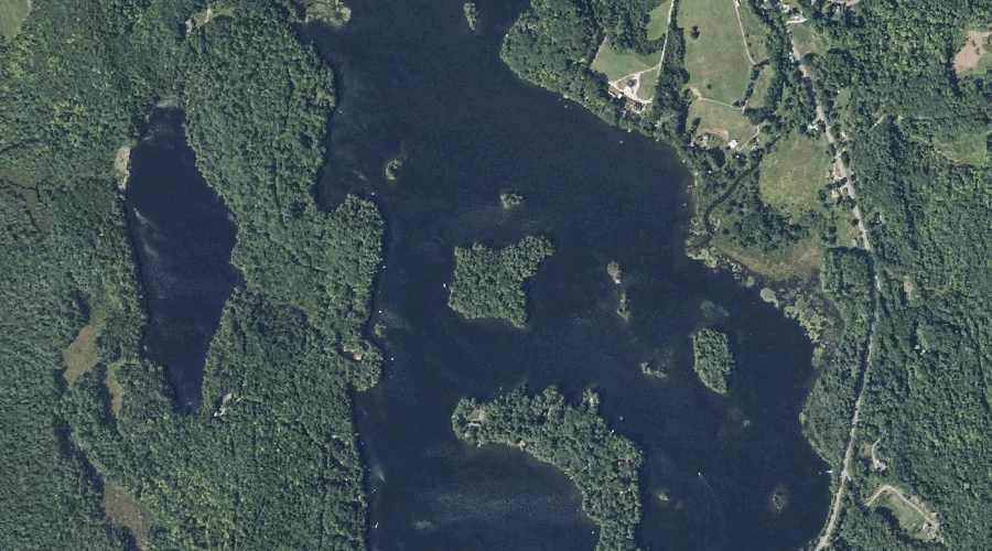
Big Island — Islands 40.2 Miles ENE of Chapman Inn
Kennebec County, Maine · USGS Belgrade Lakes Quadrangle · GNIS 562188
40.2 miles east-northeast of Chapman Inn, on the USGS Belgrade Lakes topographic quadrangle, Big Island is a island recorded in Kennebec County, Maine by the federal Geographic Names Information System.
Landmark Profile
Classification & USGS reference
The USGS Belgrade Lakes 7.5-minute topographic quadrangle places Big Island in Kennebec County, Maine (FIPS 23/011), classified as a island in the federal GNIS (Feature ID 562188). Catalogued in GNIS since 09/30/1980.
Coordinates & physical setting
Big Island sits at 44.52756° N, 69.99172° W (DMS 44°31′39″ N, 69°59′30″ W).
Other islands in Kennebec County, Maine
Kennebec County, ME contains 50 islands catalogued in the USGS Geographic Names Information System, counting Big Island itself. The ones closest to Big Island:
| Feature | USGS Quadrangle | Distance |
|---|---|---|
| Gooseneck Island | Fayette | 3.1 mi |
| Spruce Island | Fayette | 3.4 mi |
| Causeway Island | Fayette | 3.6 mi |
| Birch Island | Fayette | 3.7 mi |
| Green Island | Readfield | 4.2 mi |
| Castle Island | Belgrade Lakes | 4.2 mi |
| Frink Island | Belgrade Lakes | 4.3 mi |
| Loon Island | Belgrade Lakes | 4.3 mi |
| Ram Island | Belgrade Lakes | 6.3 mi |
| Hoyt Island | Rome | 6.4 mi |
Features on the USGS Belgrade Lakes Quadrangle
The Belgrade Lakes 7.5-minute topographic quadrangle holds 45 catalogued natural features alongside Big Island. A sampling nearest to this location:
| Feature | Type | County | Offset |
|---|---|---|---|
| Mill Stream | Streams | Kennebec County, ME | 0.3 mi |
| Flying Pond | Reservoirs | Kennebec County, ME | 0.3 mi |
| Mill Pond | Reservoirs | Kennebec County, ME | 0.7 mi |
| McGaffey Mountain | Summits | Kennebec County, ME | 1.6 mi |
| John Brown Mountain | Summits | Kennebec County, ME | 1.6 mi |
| Eaton Mountain | Summits | Kennebec County, ME | 1.7 mi |
| Davis Pond | Lakes | Kennebec County, ME | 2.1 mi |
| Berry Hill | Summits | Kennebec County, ME | 2.4 mi |
| Doloff Pond | Lakes | Kennebec County, ME | 2.5 mi |
| Round Top | Summits | Kennebec County, ME | 2.9 mi |
Visiting from Chapman Inn
Distance, bearing & drive time
Chapman Inn sits 40.2 miles east-northeast (bearing ENE) of Big Island. At moderate back-road speeds the drive runs about 69 minutes — comfortably inside a half-day outing window after breakfast.
Best time to visit
Late May through early October, when the water is safe for small-boat access. At this latitude (44.528°), the shoulder seasons are workable — April and November can be comfortable on mild years. At 40.2 miles from the Inn, block the full day — sunrise start, late return, packed meals. Conditions at Big Island track the nearby Mill Stream (0.3 mi away) closely — if that is runnable, so is this.
Nearest features to Big Island
| Feature | Type | County | Distance |
|---|---|---|---|
| Mill Stream | Streams | Kennebec County, ME | 0.3 mi |
| Flying Pond | Reservoirs | Kennebec County, ME | 0.3 mi |
| Black Pond | Lakes | Kennebec County, ME | 0.4 mi |
| Mill Pond | Reservoirs | Kennebec County, ME | 0.7 mi |
| Whittier Pond | Lakes | Kennebec County, ME | 1.1 mi |
Frequently Asked Questions
Where is Big Island located?
Big Island is in Kennebec County, Maine, approximately 40.2 miles east-northeast of Chapman Inn in Bethel, Maine. It appears on the USGS Belgrade Lakes topographic quadrangle.
How far is Big Island from Chapman Inn?
The drive runs about 69 minutes, 40.2 miles east-northeast (bearing ENE) of the Inn.
What type of natural feature is Big Island?
The U.S. Geological Survey classifies Big Island as a island, catalogued under GNIS Feature ID 562188 on the Belgrade Lakes quadrangle.
When is the best time to visit Big Island?
Late May through early October, when the water is safe for small-boat access.
How many other islands are in Kennebec County, Maine?
GNIS lists 49 other islands in Kennebec County, Maine.
Wikidata: Q49632942.