 Aerial imagery: USGS National Map (public domain)
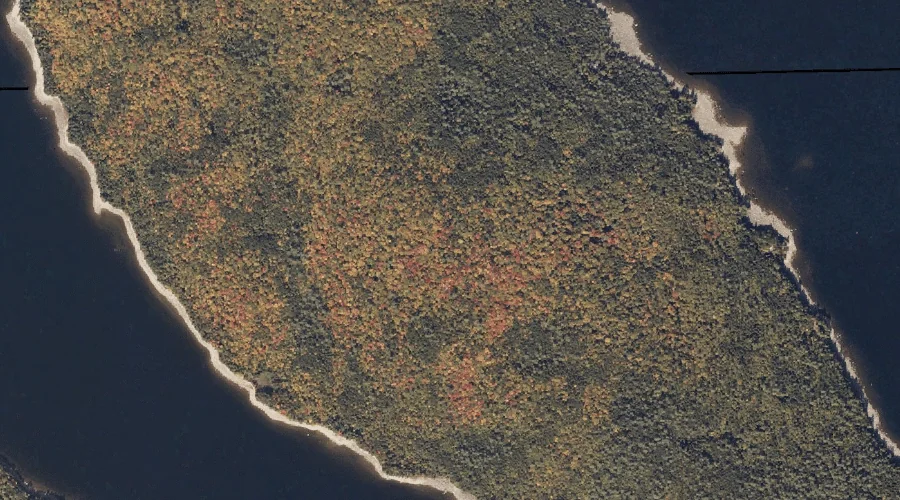
Toothaker Island — Islands 32.0 Miles N of Chapman Inn
Franklin County, Maine · USGS Metallak Mountain Quadrangle · GNIS 577199
Within Franklin County, Maine, on the USGS Metallak Mountain quadrangle, the island known as Toothaker Island sits 32.0 miles north of Chapman Inn.
Wikidata short description: “island in Franklin County, Maine, United States”
Landmark Profile
Classification & USGS reference
Within Franklin County, Maine, the U.S. Geological Survey lists Toothaker Island as a island on the Metallak Mountain topographic quadrangle (FIPS 23/007), under Feature ID 577199. Catalogued in GNIS since 09/30/1980.
Coordinates & physical setting
Toothaker Island sits at 44.86811° N, 70.77896° W (DMS 44°52′05″ N, 70°46′44″ W).
Features on the USGS Metallak Mountain Quadrangle
The Metallak Mountain 7.5-minute topographic quadrangle holds 16 catalogued natural features alongside Toothaker Island. A sampling nearest to this location:
| Feature | Type | County | Offset |
|---|---|---|---|
| Whitneys Point | Capes | Oxford County, ME | 3.6 mi |
| Mosquito Brook | Streams | Oxford County, ME | 3.7 mi |
| Metallak Pond | Lakes | Oxford County, ME | 3.9 mi |
| Black Point | Capes | Oxford County, ME | 4.1 mi |
| Metallak Brook | Streams | Oxford County, ME | 4.5 mi |
| Metallak Stream | Streams | Oxford County, ME | 4.6 mi |
| Pine Island | Islands | Oxford County, ME | 4.9 mi |
| Bemis Mountain | Summits | Franklin County, ME | 5.1 mi |
| Icicle Brook | Streams | Oxford County, ME | 5.2 mi |
| Upper Richardson Lake | Lakes | Oxford County, ME | 5.4 mi |
Visiting from Chapman Inn
Distance, bearing & drive time
Follow the compass bearing N out of Bethel for 32.0 miles (north) and you reach Toothaker Island; at typical rural speeds the trip runs roughly 55 minutes.
Best time to visit
Late May through early October, when the water is safe for small-boat access. Being this far north (lat 44.868°), first snows typically arrive by mid-October and linger into early May — narrow the window accordingly. At 32.0 miles from the Inn, block the full day — sunrise start, late return, packed meals. Conditions at Toothaker Island track the nearby Toothaker Brook stream (2.2 mi away) closely — if that is runnable, so is this.
Nearest features to Toothaker Island
| Feature | Type | County | Distance |
|---|---|---|---|
| Toothaker Brook | Streams | Franklin County, ME | 2.2 mi |
| Students Island | Islands | Oxford County, ME | 2.2 mi |
| Mooselookmeguntic Lake | Reservoirs | Oxford County, ME | 2.6 mi |
| Bemis Stream | Streams | Franklin County, ME | 2.9 mi |
| Brandy Point | Capes | Oxford County, ME | 3.1 mi |
Frequently Asked Questions
Where is Toothaker Island located?
Toothaker Island is in Franklin County, Maine, approximately 32.0 miles north of Chapman Inn in Bethel, Maine. It appears on the USGS Metallak Mountain topographic quadrangle.
How far is Toothaker Island from Chapman Inn?
The drive runs about 55 minutes, 32.0 miles north (bearing N) of the Inn.
What type of natural feature is Toothaker Island?
The U.S. Geological Survey classifies Toothaker Island as a island, catalogued under GNIS Feature ID 577199 on the Metallak Mountain quadrangle.
When is the best time to visit Toothaker Island?
Late May through early October, when the water is safe for small-boat access.
Wikidata: Q130310450.