 Aerial imagery: USGS National Map (public domain)
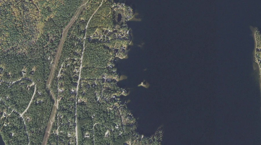
Loon Island — Islands 42.2 Miles SSW of Chapman Inn
Carroll County, New Hampshire · USGS Ossipee Lake Quadrangle · GNIS 868161
42.2 miles south-southwest of Chapman Inn, on the USGS Ossipee Lake topographic quadrangle, Loon Island is a island recorded in Carroll County, New Hampshire by the federal Geographic Names Information System.
Landmark Profile
Classification & USGS reference
The USGS Ossipee Lake 7.5-minute topographic quadrangle places Loon Island in Carroll County, New Hampshire (FIPS 33/003), classified as a island in the federal GNIS (Feature ID 868161). Catalogued in GNIS since 08/27/1980.
Coordinates & physical setting
Loon Island sits at 43.86257° N, 71.18035° W (DMS 43°51′45″ N, 71°10′49″ W).
Features on the USGS Ossipee Lake Quadrangle
The Ossipee Lake 7.5-minute topographic quadrangle holds 38 catalogued natural features alongside Loon Island. A sampling nearest to this location:
| Feature | Type | County | Offset |
|---|---|---|---|
| Silver Lake | Reservoirs | Carroll County, NH | 0.5 mi |
| Moores Pond | Lakes | Carroll County, NH | 1 mi |
| Deer Brook | Streams | Carroll County, NH | 1.4 mi |
| Cooks Pond | Lakes | Carroll County, NH | 1.5 mi |
| Lily Pond | Lakes | Carroll County, NH | 1.8 mi |
| Jackman Ridge | Ridges | Carroll County, NH | 1.9 mi |
| Ryan Hill | Summits | Carroll County, NH | 1.9 mi |
| White Lake | Lakes | Carroll County, NH | 2.7 mi |
| Stacy Mountain | Summits | Carroll County, NH | 2.7 mi |
| Page Hill | Summits | Carroll County, NH | 2.8 mi |
Visiting from Chapman Inn
Distance, bearing & drive time
Chapman Inn sits 42.2 miles south-southwest (bearing SSW) of Loon Island. At moderate back-road speeds the drive runs about 72 minutes — comfortably inside a half-day outing window after breakfast.
Best time to visit
Late May through early October, when the water is safe for small-boat access. At this latitude (43.863°), the shoulder seasons are workable — April and November can be comfortable on mild years. At 42.2 miles from the Inn, block the full day — sunrise start, late return, packed meals. Conditions at Loon Island track the nearby Silver Lake reservoir (0.5 mi away) closely — if that is runnable, so is this.
Nearest features to Loon Island
| Feature | Type | County | Distance |
|---|---|---|---|
| Silver Lake | Reservoirs | Carroll County, NH | 0.5 mi |
| Moores Pond | Lakes | Carroll County, NH | 1 mi |
| Bimba Island | Islands | Carroll County, NH | 1.3 mi |
| Deer Hill | Summits | Carroll County, NH | 1.4 mi |
| Big Island | Islands | Carroll County, NH | 1.4 mi |
Frequently Asked Questions
Where is Loon Island located?
Loon Island is in Carroll County, New Hampshire, approximately 42.2 miles south-southwest of Chapman Inn in Bethel, Maine. It appears on the USGS Ossipee Lake topographic quadrangle.
How far is Loon Island from Chapman Inn?
The drive runs about 72 minutes, 42.2 miles south-southwest (bearing SSW) of the Inn.
What type of natural feature is Loon Island?
The U.S. Geological Survey classifies Loon Island as a island, catalogued under GNIS Feature ID 868161 on the Ossipee Lake quadrangle.
When is the best time to visit Loon Island?
Late May through early October, when the water is safe for small-boat access.
Wikidata: Q49654663.