 Aerial imagery: USGS National Map (public domain)
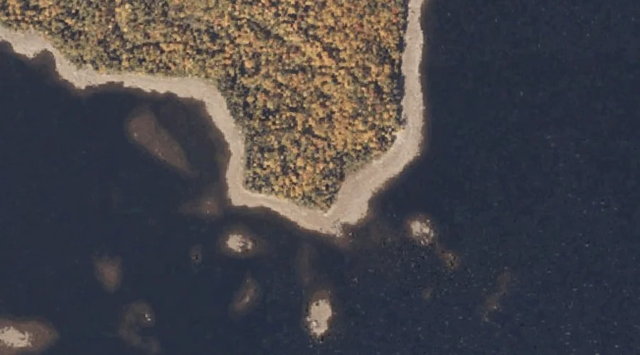
Stony Batter Point — Capes 37.6 Miles N of Chapman Inn
Oxford County, Maine · USGS Oquossoc Quadrangle · GNIS 576392
Within Oxford County, Maine, on the USGS Oquossoc quadrangle, the cape known as Stony Batter Point sits 37.6 miles north of Chapman Inn.
Landmark Profile
Classification & USGS reference
Within Oxford County, Maine, the U.S. Geological Survey lists Stony Batter Point as a cape on the Oquossoc topographic quadrangle (FIPS 23/017), under Feature ID 576392. Catalogued in GNIS since 09/30/1980.
Coordinates & physical setting
Stony Batter Point sits at 44.94867° N, 70.81174° W (DMS 44°56′55″ N, 70°48′42″ W).
Other capes in Oxford County, Maine
Oxford County, ME contains 19 capes catalogued in the USGS Geographic Names Information System, counting Stony Batter Point itself. The ones closest to Stony Batter Point:
| Feature | USGS Quadrangle | Distance |
|---|---|---|
| Birch Point | Oquossoc | 2.9 mi |
| Brandy Point | Oquossoc | 3.7 mi |
| Black Point | Oquossoc | 4.7 mi |
| Whitneys Point | Metallak Mountain | 6.4 mi |
| Black Point | Metallak Mountain | 7.2 mi |
| Portland Point | Middle Dam | 10.8 mi |
| Horse Beef Point | Middle Dam | 11.2 mi |
| Jackson Point | Middle Dam | 11.8 mi |
| Rifle Point | Middle Dam | 12.9 mi |
| Bailey Point | Metallak Mountain | 12.9 mi |
Features on the USGS Oquossoc Quadrangle
The Oquossoc 7.5-minute topographic quadrangle holds 34 catalogued natural features alongside Stony Batter Point. A sampling nearest to this location:
| Feature | Type | County | Offset |
|---|---|---|---|
| Bowley Rock | Pillars | Oxford County, ME | 0.4 mi |
| Turner Island | Islands | Oxford County, ME | 0.6 mi |
| Griffin Island | Islands | Oxford County, ME | 0.6 mi |
| Little Mud Pond | Lakes | Oxford County, ME | 0.7 mi |
| Lunch Island | Islands | Oxford County, ME | 0.8 mi |
| Johnson Island | Islands | Oxford County, ME | 0.9 mi |
| Spots Point | Capes | Franklin County, ME | 1.3 mi |
| Echo Cove | Bays | Franklin County, ME | 1.4 mi |
| Eagle Point | Capes | Franklin County, ME | 1.8 mi |
| Bald Mountain | Summits | Franklin County, ME | 1.8 mi |
Visiting from Chapman Inn
Distance, bearing & drive time
Follow the compass bearing N out of Bethel for 37.6 miles (north) and you reach Stony Batter Point; at typical rural speeds the trip runs roughly 64 minutes.
Best time to visit
Generally accessible May through October; winter access depends on snow cover. Being this far north (lat 44.949°), first snows typically arrive by mid-October and linger into early May — narrow the window accordingly. At 37.6 miles from the Inn, block the full day — sunrise start, late return, packed meals. Conditions at Stony Batter Point track the nearby Bowley Rock rock pillar (0.4 mi away) closely — if that is runnable, so is this.
Nearest features to Stony Batter Point
| Feature | Type | County | Distance |
|---|---|---|---|
| Bowley Rock | Pillars | Oxford County, ME | 0.4 mi |
| Turner Island | Islands | Oxford County, ME | 0.6 mi |
| Griffin Island | Islands | Oxford County, ME | 0.6 mi |
| Little Mud Pond | Lakes | Oxford County, ME | 0.7 mi |
| Lunch Island | Islands | Oxford County, ME | 0.8 mi |
Frequently Asked Questions
Where is Stony Batter Point located?
Stony Batter Point is in Oxford County, Maine, approximately 37.6 miles north of Chapman Inn in Bethel, Maine. It appears on the USGS Oquossoc topographic quadrangle.
How far is Stony Batter Point from Chapman Inn?
The drive runs about 64 minutes, 37.6 miles north (bearing N) of the Inn.
What type of natural feature is Stony Batter Point?
The U.S. Geological Survey classifies Stony Batter Point as a cape, catalogued under GNIS Feature ID 576392 on the Oquossoc quadrangle.
When is the best time to visit Stony Batter Point?
Generally accessible May through October; winter access depends on snow cover.
How many other capes are in Oxford County, Maine?
GNIS lists 18 other capes in Oxford County, Maine.