 Aerial imagery: USGS National Map (public domain)
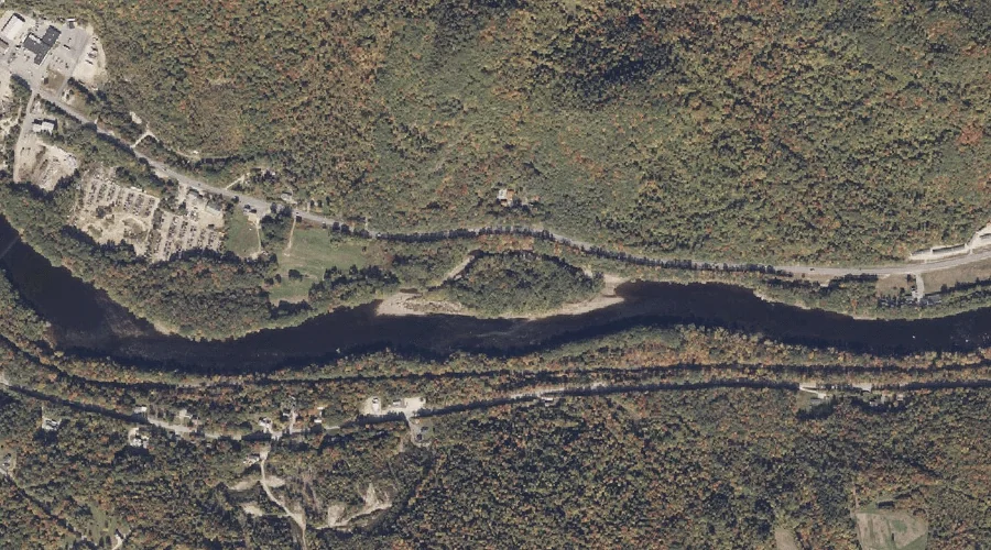
Burke Island — Islands 17.0 Miles ENE of Chapman Inn
Oxford County, Maine · USGS Dixfield Quadrangle · GNIS 563208
17.0 miles east-northeast of Chapman Inn, on the USGS Dixfield topographic quadrangle, Burke Island is a island recorded in Oxford County, Maine by the federal Geographic Names Information System.
Wikidata short description: “island in Oxford County, Maine, United States”
Landmark Profile
Classification & USGS reference
The USGS Dixfield 7.5-minute topographic quadrangle places Burke Island in Oxford County, Maine (FIPS 23/017), classified as a island in the federal GNIS (Feature ID 563208). Catalogued in GNIS since 09/30/1980.
Coordinates & physical setting
Burke Island sits at 44.53118° N, 70.49395° W (DMS 44°31′52″ N, 70°29′38″ W).
Other islands in Oxford County, Maine
Oxford County, ME contains 44 islands catalogued in the USGS Geographic Names Information System, counting Burke Island itself. The ones closest to Burke Island:
| Feature | USGS Quadrangle | Distance |
|---|---|---|
| Wheeler Island | Rumford | 2.4 mi |
| Green Island | Dixfield | 5.5 mi |
| Stevens Island | Canton | 11.5 mi |
| French Island | Ellis Pond | 12.5 mi |
| Hastings Island | Bethel | 16.6 mi |
| Bond Island | Bethel | 17.4 mi |
| Philbrook Island | Gilead | 23.4 mi |
| Peabody Island | Gilead | 24.9 mi |
| Spirt Island | Middle Dam | 25.1 mi |
| Hardscrabble Island | Middle Dam | 25.6 mi |
Features on the USGS Dixfield Quadrangle
The Dixfield 7.5-minute topographic quadrangle holds 36 catalogued natural features alongside Burke Island. A sampling nearest to this location:
| Feature | Type | County | Offset |
|---|---|---|---|
| Lovejoy Mountain | Summits | Oxford County, ME | 0.3 mi |
| Kidder Mountain | Summits | Oxford County, ME | 0.7 mi |
| Red Hill | Summits | Oxford County, ME | 1 mi |
| Trask Ledge | Summits | Oxford County, ME | 1.3 mi |
| Burgess Hill | Summits | Oxford County, ME | 1.4 mi |
| Webb River | Streams | Franklin County, ME | 1.7 mi |
| Spears Stream | Streams | Oxford County, ME | 2 mi |
| Mitchell Brook | Streams | Oxford County, ME | 2.3 mi |
| Aunt Hannah Brook | Streams | Oxford County, ME | 2.5 mi |
| Harlow Ridge | Ridges | Oxford County, ME | 2.8 mi |
Visiting from Chapman Inn
Distance, bearing & drive time
Chapman Inn sits 17.0 miles east-northeast (bearing ENE) of Burke Island. At moderate back-road speeds the drive runs about 29 minutes — comfortably inside a half-day outing window after breakfast.
Best time to visit
Late May through early October, when the water is safe for small-boat access. At this latitude (44.531°), the shoulder seasons are workable — April and November can be comfortable on mild years. At 17.0 miles from the Inn, plan on a comfortable day trip with time for lunch on the road. Conditions at Burke Island track the nearby Lovejoy Mountain summit (0.3 mi away) closely — if that is runnable, so is this.
Nearest features to Burke Island
| Feature | Type | County | Distance |
|---|---|---|---|
| Lovejoy Mountain | Summits | Oxford County, ME | 0.3 mi |
| Wyman Brook | Streams | Oxford County, ME | 0.6 mi |
| Kidder Mountain | Summits | Oxford County, ME | 0.7 mi |
| Farrington Mountain | Summits | Oxford County, ME | 0.8 mi |
| Red Hill | Summits | Oxford County, ME | 1 mi |
Frequently Asked Questions
Where is Burke Island located?
Burke Island is in Oxford County, Maine, approximately 17.0 miles east-northeast of Chapman Inn in Bethel, Maine. It appears on the USGS Dixfield topographic quadrangle.
How far is Burke Island from Chapman Inn?
The drive runs about 29 minutes, 17.0 miles east-northeast (bearing ENE) of the Inn.
What type of natural feature is Burke Island?
The U.S. Geological Survey classifies Burke Island as a island, catalogued under GNIS Feature ID 563208 on the Dixfield quadrangle.
When is the best time to visit Burke Island?
Late May through early October, when the water is safe for small-boat access.
How many other islands are in Oxford County, Maine?
GNIS lists 43 other islands in Oxford County, Maine.
Wikidata: Q34688314.