 Aerial imagery: USGS National Map (public domain)
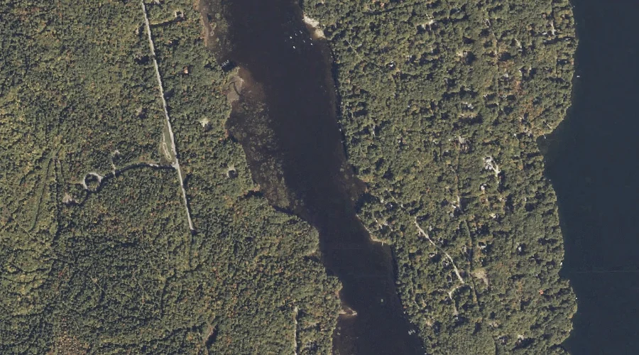
Sebago Cove — Bays 33.3 Miles SSE of Chapman Inn
Cumberland County, Maine · USGS Naples Quadrangle · GNIS 1913040
33.3 miles south-southeast of Chapman Inn, on the USGS Naples topographic quadrangle, Sebago Cove is a bay recorded in Cumberland County, Maine by the federal Geographic Names Information System.
Wikidata short description: “bay in Cumberland County, Maine, United States of America”
Landmark Profile
Classification & USGS reference
The USGS Naples 7.5-minute topographic quadrangle places Sebago Cove in Cumberland County, Maine (FIPS 23/005), classified as a bay in the federal GNIS (Feature ID 1913040). Catalogued in GNIS since 05/08/2001.
Coordinates & physical setting
Sebago Cove sits at 43.93757° N, 70.62173° W (DMS 43°56′15″ N, 70°37′18″ W).
Other bays in Cumberland County, Maine
Cumberland County, ME contains 32 bays catalogued in the USGS Geographic Names Information System, counting Sebago Cove itself. The ones closest to Sebago Cove:
| Feature | USGS Quadrangle | Distance |
|---|---|---|
| Witch Cove | Naples | 1.7 mi |
| Jackson Cove | Naples | 2.5 mi |
| Cub Cove | Naples | 3.6 mi |
| New Place Cove | Naples | 3.7 mi |
| Mast Cove | North Sebago | 3.7 mi |
| North Cove | North Sebago | 3.8 mi |
| Maple Cove | Naples | 3.8 mi |
| Wards Cove | North Sebago | 4 mi |
| Kettle Cove | Naples | 4.1 mi |
| Loon Cove | North Sebago | 5.5 mi |
Features on the USGS Naples Quadrangle
The Naples 7.5-minute topographic quadrangle holds 65 catalogued natural features alongside Sebago Cove. A sampling nearest to this location:
| Feature | Type | County | Offset |
|---|---|---|---|
| Trickey Pond | Lakes | Cumberland County, ME | 0.7 mi |
| Witch Cove | Bays | Cumberland County, ME | 1.7 mi |
| Breezy Point | Capes | Cumberland County, ME | 1.9 mi |
| Inner Island | Islands | Cumberland County, ME | 1.9 mi |
| Brandy Pond | Lakes | Cumberland County, ME | 2 mi |
| Bay of Naples | Reservoirs | Cumberland County, ME | 2.1 mi |
| Whitney Brook | Streams | Cumberland County, ME | 2.2 mi |
| Outer Island | Islands | Cumberland County, ME | 2.3 mi |
| Crooked River | Streams | Cumberland County, ME | 2.3 mi |
| Chute River | Other Natural Features | Cumberland County, ME | 2.4 mi |
Visiting from Chapman Inn
Distance, bearing & drive time
Chapman Inn sits 33.3 miles south-southeast (bearing SSE) of Sebago Cove. At moderate back-road speeds the drive runs about 57 minutes — comfortably inside a half-day outing window after breakfast.
Best time to visit
June through September for paddling and swimming; January through March for ice fishing. At this latitude (43.938°), the shoulder seasons are workable — April and November can be comfortable on mild years. At 33.3 miles from the Inn, block the full day — sunrise start, late return, packed meals. Conditions at Sebago Cove track the nearby Leavitt Brook stream (0.2 mi away) closely — if that is runnable, so is this.
Nearest features to Sebago Cove
| Feature | Type | County | Distance |
|---|---|---|---|
| Leavitt Brook | Streams | Cumberland County, ME | 0.2 mi |
| Trickey Pond | Lakes | Cumberland County, ME | 0.7 mi |
| Muddy River | Streams | Cumberland County, ME | 0.9 mi |
| Witch Cove | Bays | Cumberland County, ME | 1.7 mi |
| Larrabee Mountain | Summits | Cumberland County, ME | 1.7 mi |
Frequently Asked Questions
Where is Sebago Cove located?
Sebago Cove is in Cumberland County, Maine, approximately 33.3 miles south-southeast of Chapman Inn in Bethel, Maine. It appears on the USGS Naples topographic quadrangle.
How far is Sebago Cove from Chapman Inn?
The drive runs about 57 minutes, 33.3 miles south-southeast (bearing SSE) of the Inn.
What type of natural feature is Sebago Cove?
The U.S. Geological Survey classifies Sebago Cove as a bay, catalogued under GNIS Feature ID 1913040 on the Naples quadrangle.
When is the best time to visit Sebago Cove?
June through September for paddling and swimming; January through March for ice fishing.
How many other bays are in Cumberland County, Maine?
GNIS lists 31 other bays in Cumberland County, Maine.
Wikidata: Q49391500.