 Aerial imagery: USGS National Map (public domain)
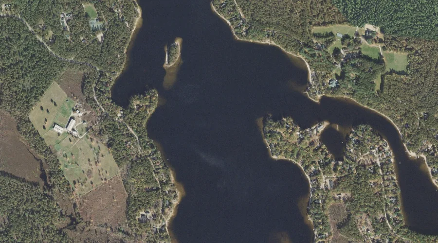
Broad Bay — Bays 44.2 Miles SSW of Chapman Inn
Carroll County, New Hampshire · USGS Freedom Quadrangle · GNIS 865800
44.2 miles south-southwest of Chapman Inn, on the USGS Freedom topographic quadrangle, Broad Bay is a bay recorded in Carroll County, New Hampshire by the federal Geographic Names Information System.
Wikidata short description: “lake in United States of America”
Landmark Profile
Classification & USGS reference
The USGS Freedom 7.5-minute topographic quadrangle places Broad Bay in Carroll County, New Hampshire (FIPS 33/003), classified as a bay in the federal GNIS (Feature ID 865800). Last revised by the Board on Geographic Names on 07/31/2018.
Coordinates & physical setting
Broad Bay sits at 43.80591° N, 71.10090° W (DMS 43°48′21″ N, 71°06′03″ W).
Features on the USGS Freedom Quadrangle
The Freedom 7.5-minute topographic quadrangle holds 43 catalogued natural features alongside Broad Bay. A sampling nearest to this location:
| Feature | Type | County | Offset |
|---|---|---|---|
| Cold Brook | Streams | Carroll County, NH | 0.6 mi |
| Stony Brook | Streams | Carroll County, NH | 0.8 mi |
| Duck Pond | Lakes | Carroll County, NH | 0.8 mi |
| Square Brook | Streams | Carroll County, NH | 1 mi |
| Leavitt Bay | Bays | Carroll County, NH | 1 mi |
| Phillips Brook | Streams | Carroll County, NH | 1.1 mi |
| Leavitt Brook | Streams | Carroll County, NH | 1.3 mi |
| Danforth Ponds | Lakes | Carroll County, NH | 1.3 mi |
| Berry Bay | Bays | Carroll County, NH | 1.4 mi |
| Shaw Pond | Lakes | Carroll County, NH | 1.4 mi |
Historical record
Broad Bay is a 431-acre (1.74 km2) freshwater lake located in Carroll County in eastern New Hampshire, United States, in the towns of Freedom and Ossipee. Broad Bay is part of a chain of four lakes with identical water levels, due to a dam located downstream in Effingham Falls. Upstream, a channel connects Broad Bay to Ossipee Lake, while a channel leads downstream through Leavitt Bay and Berry Bay to the start of the Ossipee River, which flows east into Maine and the Saco River. Read the full Wikipedia entry →
Visiting from Chapman Inn
Distance, bearing & drive time
Chapman Inn sits 44.2 miles south-southwest (bearing SSW) of Broad Bay. At moderate back-road speeds the drive runs about 76 minutes — comfortably inside a half-day outing window after breakfast.
Best time to visit
June through September for paddling and swimming; January through March for ice fishing. At this latitude (43.806°), the shoulder seasons are workable — April and November can be comfortable on mild years. At 44.2 miles from the Inn, block the full day — sunrise start, late return, packed meals. Conditions at Broad Bay track the nearby Cold Brook stream (0.6 mi away) closely — if that is runnable, so is this.
Nearest features to Broad Bay
| Feature | Type | County | Distance |
|---|---|---|---|
| Cold Brook | Streams | Carroll County, NH | 0.6 mi |
| Stony Brook | Streams | Carroll County, NH | 0.8 mi |
| Duck Pond | Lakes | Carroll County, NH | 0.8 mi |
| Square Brook | Streams | Carroll County, NH | 1 mi |
| Leavitt Bay | Bays | Carroll County, NH | 1 mi |
Frequently Asked Questions
Where is Broad Bay located?
Broad Bay is in Carroll County, New Hampshire, approximately 44.2 miles south-southwest of Chapman Inn in Bethel, Maine. It appears on the USGS Freedom topographic quadrangle.
How far is Broad Bay from Chapman Inn?
The drive runs about 76 minutes, 44.2 miles south-southwest (bearing SSW) of the Inn.
What type of natural feature is Broad Bay?
The U.S. Geological Survey classifies Broad Bay as a bay, catalogued under GNIS Feature ID 865800 on the Freedom quadrangle.
When is the best time to visit Broad Bay?
June through September for paddling and swimming; January through March for ice fishing.
Wikidata: Q4971844.