 Aerial imagery: USGS National Map (public domain)
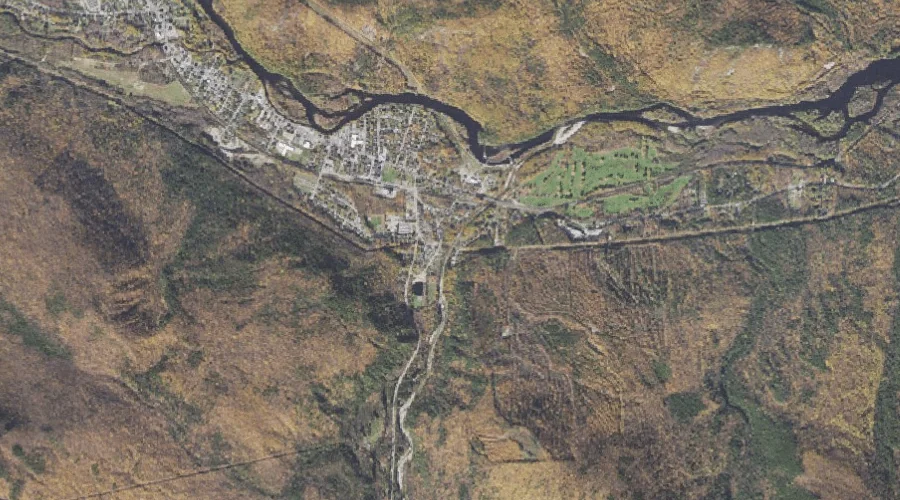
Mount Washington Valley — Valleys 18.9 Miles W of Chapman Inn
Coos County, New Hampshire · USGS Berlin Quadrangle · GNIS 1955167
Catalogued on the USGS Berlin quadrangle in Coos County, New Hampshire, Mount Washington Valley — a valley — lies 18.9 miles west of Chapman Inn.
Landmark Profile
Classification & USGS reference
Catalogued under GNIS Feature ID 1955167, Mount Washington Valley is recorded as a valley on the USGS Berlin quadrangle in Coos County, New Hampshire (FIPS 33/007). Last revised by the Board on Geographic Names on 08/01/2018.
Coordinates & physical setting
Mount Washington Valley sits at 44.38333° N, 71.16975° W (DMS 44°23′00″ N, 71°10′11″ W).
Other valleys in Coos County, New Hampshire
Coos County, NH contains 15 valleys catalogued in the USGS Geographic Names Information System, counting Mount Washington Valley itself. The ones closest to Mount Washington Valley:
| Feature | USGS Quadrangle | Distance |
|---|---|---|
| Ice Gulch | Mount Crescent | 5.5 mi |
| King Ravine | Mount Washington | 6.8 mi |
| Great Gulf | Mount Washington | 6.9 mi |
| Madison Gulf | Mount Washington | 7.1 mi |
| Jefferson Ravine | Mount Washington | 8 mi |
| Ravine of the Castles | Mount Washington | 8.7 mi |
| Ravine of the Cascades | Mount Washington | 8.7 mi |
| Huntington Ravine | Mount Washington | 9.7 mi |
| Tuckerman Ravine | Mount Washington | 9.7 mi |
| Burt Ravine | Mount Washington | 11 mi |
Features on the USGS Berlin Quadrangle
The Berlin 7.5-minute topographic quadrangle holds 38 catalogued natural features alongside Mount Washington Valley. A sampling nearest to this location:
| Feature | Type | County | Offset |
|---|---|---|---|
| Androscoggin River Reservoir | Reservoirs | Coos County, NH | 0.5 mi |
| Peabody River | Streams | Coos County, NH | 0.7 mi |
| Buck Island | Islands | Coos County, NH | 0.8 mi |
| Point Lookout | Summits | Coos County, NH | 1 mi |
| Moose River | Streams | Coos County, NH | 1.2 mi |
| Mascot Pond | Lakes | Coos County, NH | 1.3 mi |
| Leadmine Ledge | Summits | Coos County, NH | 1.4 mi |
| Stevens Point | Summits | Coos County, NH | 1.6 mi |
| Kidder Brook | Streams | Coos County, NH | 1.6 mi |
| Pea Brook | Streams | Coos County, NH | 1.7 mi |
Visiting from Chapman Inn
Distance, bearing & drive time
A 32-minute drive along back roads separates the front door of Chapman Inn from Mount Washington Valley — 18.9 miles west as the crow flies, on compass bearing W.
Best time to visit
Late May through October; avoid black-fly peak in late May. Being this far north (lat 44.383°), first snows typically arrive by mid-October and linger into early May — narrow the window accordingly. At 18.9 miles from the Inn, plan on a comfortable day trip with time for lunch on the road. Conditions at Mount Washington Valley track the nearby Androscoggin River Reservoir (0.5 mi away) closely — if that is runnable, so is this.
Nearest features to Mount Washington Valley
| Feature | Type | County | Distance |
|---|---|---|---|
| Androscoggin River Reservoir | Reservoirs | Coos County, NH | 0.5 mi |
| Peabody River | Streams | Coos County, NH | 0.7 mi |
| Buck Island | Islands | Coos County, NH | 0.8 mi |
| Point Lookout | Summits | Coos County, NH | 1 mi |
| Moose River | Streams | Coos County, NH | 1.2 mi |
Frequently Asked Questions
Where is Mount Washington Valley located?
Mount Washington Valley is in Coos County, New Hampshire, approximately 18.9 miles west of Chapman Inn in Bethel, Maine. It appears on the USGS Berlin topographic quadrangle.
How far is Mount Washington Valley from Chapman Inn?
The drive runs about 32 minutes, 18.9 miles west (bearing W) of the Inn.
What type of natural feature is Mount Washington Valley?
The U.S. Geological Survey classifies Mount Washington Valley as a valley, catalogued under GNIS Feature ID 1955167 on the Berlin quadrangle.
When is the best time to visit Mount Washington Valley?
Late May through October; avoid black-fly peak in late May.
How many other valleys are in Coos County, New Hampshire?
GNIS lists 14 other valleys in Coos County, New Hampshire.