 Aerial imagery: USGS National Map (public domain)
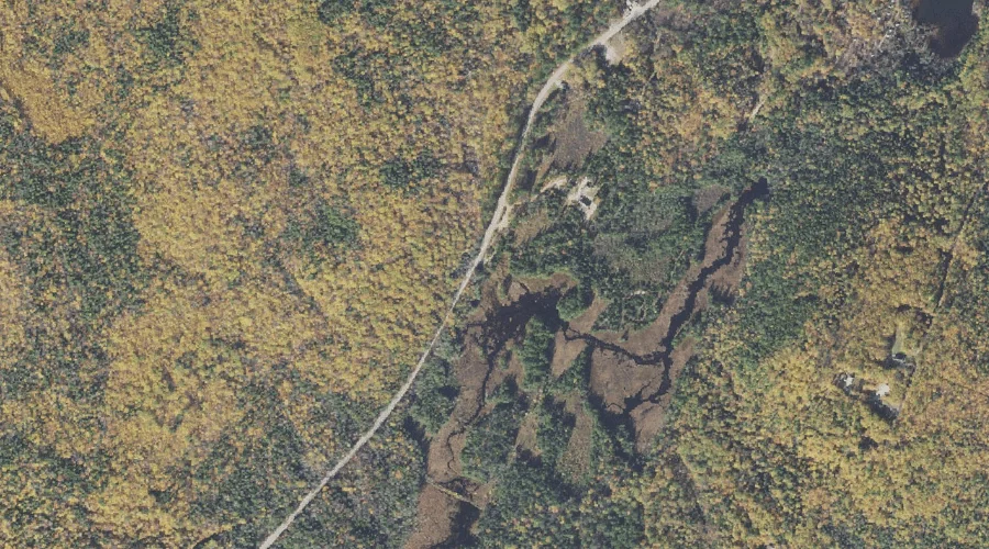
Lovejoy Marsh — Swamps 38.0 Miles SW of Chapman Inn
Carroll County, New Hampshire · USGS Silver Lake Quadrangle · GNIS 1916027
Within Carroll County, New Hampshire, on the USGS Silver Lake quadrangle, the swamp known as Lovejoy Marsh sits 38.0 miles southwest of Chapman Inn.
Wikidata short description: “swamp in Carroll County, New Hampshire, United States of America”
Landmark Profile
Classification & USGS reference
Within Carroll County, New Hampshire, the U.S. Geological Survey lists Lovejoy Marsh as a swamp on the Silver Lake topographic quadrangle (FIPS 33/003), under Feature ID 1916027. Catalogued in GNIS since 05/08/2001.
Coordinates & physical setting
Lovejoy Marsh sits at 43.94841° N, 71.21674° W (DMS 43°56′54″ N, 71°13′00″ W).
Features on the USGS Silver Lake Quadrangle
The Silver Lake 7.5-minute topographic quadrangle holds 63 catalogued natural features alongside Lovejoy Marsh. A sampling nearest to this location:
| Feature | Type | County | Offset |
|---|---|---|---|
| Meadow Brook | Streams | Carroll County, NH | 0.7 mi |
| Back Pond | Lakes | Carroll County, NH | 0.9 mi |
| Haunted Pond | Lakes | Carroll County, NH | 0.9 mi |
| Iona Lake | Lakes | Carroll County, NH | 1 mi |
| Whitton Pond | Lakes | Carroll County, NH | 1.2 mi |
| Roundtop | Summits | Carroll County, NH | 1.3 mi |
| Nickerson Ledge | Benches | Carroll County, NH | 1.3 mi |
| Bragdon Ledge | Benches | Carroll County, NH | 1.5 mi |
| Whitton Ledge | Benches | Carroll County, NH | 1.6 mi |
| Salter Hill | Summits | Carroll County, NH | 1.6 mi |
Visiting from Chapman Inn
Distance, bearing & drive time
Follow the compass bearing SW out of Bethel for 38.0 miles (southwest) and you reach Lovejoy Marsh; at typical rural speeds the trip runs roughly 65 minutes.
Best time to visit
Late May through October; avoid black-fly peak in late May. At this latitude (43.948°), the shoulder seasons are workable — April and November can be comfortable on mild years. At 38.0 miles from the Inn, block the full day — sunrise start, late return, packed meals. Conditions at Lovejoy Marsh track the nearby Meadow Brook stream (0.7 mi away) closely — if that is runnable, so is this.
Nearest features to Lovejoy Marsh
| Feature | Type | County | Distance |
|---|---|---|---|
| Meadow Brook | Streams | Carroll County, NH | 0.7 mi |
| Back Pond | Lakes | Carroll County, NH | 0.9 mi |
| Haunted Pond | Lakes | Carroll County, NH | 0.9 mi |
| Iona Lake | Lakes | Carroll County, NH | 1 mi |
| Whitton Pond | Lakes | Carroll County, NH | 1.2 mi |
Frequently Asked Questions
Where is Lovejoy Marsh located?
Lovejoy Marsh is in Carroll County, New Hampshire, approximately 38.0 miles southwest of Chapman Inn in Bethel, Maine. It appears on the USGS Silver Lake topographic quadrangle.
How far is Lovejoy Marsh from Chapman Inn?
The drive runs about 65 minutes, 38.0 miles southwest (bearing SW) of the Inn.
What type of natural feature is Lovejoy Marsh?
The U.S. Geological Survey classifies Lovejoy Marsh as a swamp, catalogued under GNIS Feature ID 1916027 on the Silver Lake quadrangle.
When is the best time to visit Lovejoy Marsh?
Late May through October; avoid black-fly peak in late May.
Wikidata: Q49208414.