 Aerial imagery: USGS National Map (public domain)
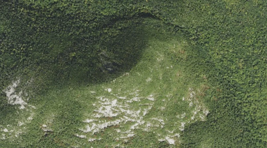
South Percy Peak — Summits 36.3 Miles WNW of Chapman Inn
Coos County, New Hampshire · USGS Percy Peaks Quadrangle · GNIS 1916362
Catalogued on the USGS Percy Peaks quadrangle in Coos County, New Hampshire, South Percy Peak — a summit — lies 36.3 miles west-northwest of Chapman Inn.
Landmark Profile
Classification & USGS reference
Catalogued under GNIS Feature ID 1916362, South Percy Peak is recorded as a summit on the USGS Percy Peaks quadrangle in Coos County, New Hampshire (FIPS 33/007). Last revised by the Board on Geographic Names on 08/31/2022.
Coordinates & physical setting
South Percy Peak sits at 44.65625° N, 71.43482° W (DMS 44°39′22″ N, 71°26′05″ W).
Other summits in Coos County, New Hampshire
Coos County, NH contains 226 summits catalogued in the USGS Geographic Names Information System, counting South Percy Peak itself. The ones closest to South Percy Peak:
| Feature | USGS Quadrangle | Elevation | Distance |
|---|---|---|---|
| North Percy Peak | Percy Peaks | — | 0.5 mi |
| Percy Peaks | Percy Peaks | — | 0.5 mi |
| Jimmy Cole Ledge | Percy Peaks | — | 1.2 mi |
| Victor Head | Percy Peaks | — | 1.5 mi |
| Potters Ledge | Percy Peaks | — | 1.6 mi |
| Bag Hill | Percy Peaks | — | 2.3 mi |
| Bald Mountain | Percy Peaks | — | 2.5 mi |
| Beach Hill | Stark | — | 2.7 mi |
| Dickey Hill | Stark | — | 2.8 mi |
| Potato Hill | Stratford | — | 3.5 mi |
Features on the USGS Percy Peaks Quadrangle
The Percy Peaks 7.5-minute topographic quadrangle holds 26 catalogued natural features alongside South Percy Peak. A sampling nearest to this location:
| Feature | Type | County | Offset |
|---|---|---|---|
| North Percy Peak | Summits | Coos County, NH | 0.5 mi |
| Percy Peaks | Summits | Coos County, NH | 0.5 mi |
| Jimmy Cole Ledge | Summits | Coos County, NH | 1.2 mi |
| Slide Brook | Streams | Coos County, NH | 1.3 mi |
| Victor Head | Summits | Coos County, NH | 1.5 mi |
| Potters Ledge | Summits | Coos County, NH | 1.6 mi |
| Boman Valley | Valleys | Coos County, NH | 1.7 mi |
| Long Mountain Brook | Streams | Coos County, NH | 1.8 mi |
| Stratford Mountain | Ridges | Coos County, NH | 2.2 mi |
| Jimmy Cole Brook | Streams | Coos County, NH | 2.2 mi |
Visiting from Chapman Inn
Distance, bearing & drive time
A 62-minute drive along back roads separates the front door of Chapman Inn from South Percy Peak — 36.3 miles west-northwest as the crow flies, on compass bearing WNW.
Best time to visit
Accessible May through November in most years. Being this far north (lat 44.656°), first snows typically arrive by mid-October and linger into early May — narrow the window accordingly. At 36.3 miles from the Inn, block the full day — sunrise start, late return, packed meals. Conditions at South Percy Peak track the nearby North Percy Peak summit (0.5 mi away) closely — if that is runnable, so is this.
Nearest features to South Percy Peak
| Feature | Type | County | Distance |
|---|---|---|---|
| North Percy Peak | Summits | Coos County, NH | 0.5 mi |
| Percy Peaks | Summits | Coos County, NH | 0.5 mi |
| Jimmy Cole Ledge | Summits | Coos County, NH | 1.2 mi |
| Slide Brook | Streams | Coos County, NH | 1.3 mi |
| Victor Head | Summits | Coos County, NH | 1.5 mi |
Frequently Asked Questions
Where is South Percy Peak located?
South Percy Peak is in Coos County, New Hampshire, approximately 36.3 miles west-northwest of Chapman Inn in Bethel, Maine. It appears on the USGS Percy Peaks topographic quadrangle.
How far is South Percy Peak from Chapman Inn?
The drive runs about 62 minutes, 36.3 miles west-northwest (bearing WNW) of the Inn.
What type of natural feature is South Percy Peak?
The U.S. Geological Survey classifies South Percy Peak as a summit, catalogued under GNIS Feature ID 1916362 on the Percy Peaks quadrangle.
When is the best time to visit South Percy Peak?
Accessible May through November in most years.
How many other summits are in Coos County, New Hampshire?
GNIS lists 225 other summits in Coos County, New Hampshire.