 Aerial imagery: USGS National Map (public domain)
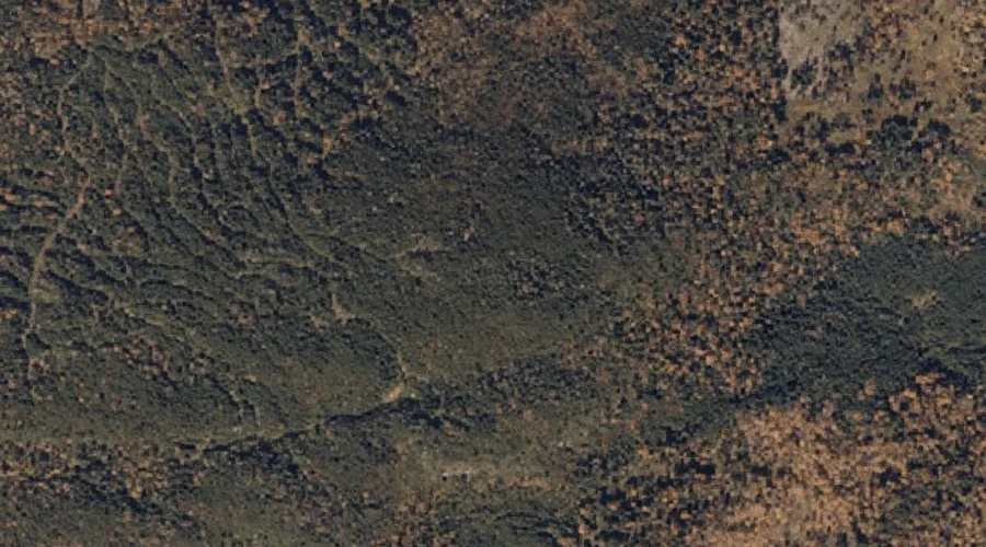
Four Ponds Mountain — Summits 31.6 Miles N of Chapman Inn
Franklin County, Maine · USGS Houghton Quadrangle · GNIS 566469
31.6 miles north of Chapman Inn, on the USGS Houghton topographic quadrangle, Four Ponds Mountain is a summit recorded in Franklin County, Maine by the federal Geographic Names Information System.
Wikidata short description: “mountain in United States of America”
Landmark Profile
Classification & USGS reference
The USGS Houghton 7.5-minute topographic quadrangle places Four Ponds Mountain in Franklin County, Maine (FIPS 23/007), classified as a summit in the federal GNIS (Feature ID 566469). Last revised by the Board on Geographic Names on 06/25/2022.
Coordinates & physical setting
Four Ponds Mountain sits at 44.85372° N, 70.66303° W (DMS 44°51′13″ N, 70°39′47″ W).
Other summits in Franklin County, Maine
Franklin County, ME contains 129 summits catalogued in the USGS Geographic Names Information System, counting Four Ponds Mountain itself. The ones closest to Four Ponds Mountain:
| Feature | USGS Quadrangle | Elevation | Distance |
|---|---|---|---|
| Spruce Mountain | Houghton | — | 1.9 mi |
| Beaver Mountain | Rangeley | — | 2.3 mi |
| Brimstone Mountain | Houghton | — | 4 mi |
| Bemis Mountain | Metallak Mountain | — | 6.6 mi |
| Perry Mountain | Saddleback Mountain | — | 7.5 mi |
| Noon Mountain | Jackson Mountain | — | 7.5 mi |
| Oakes Nubble | Saddleback Mountain | — | 7.5 mi |
| Bald Mountain | Oquossoc | — | 8.3 mi |
| Beech Hill | Madrid | — | 8.6 mi |
| Old Blue Mountain | Andover | — | 8.9 mi |
Features on the USGS Houghton Quadrangle
The Houghton 7.5-minute topographic quadrangle holds 18 catalogued natural features alongside Four Ponds Mountain. A sampling nearest to this location:
| Feature | Type | County | Offset |
|---|---|---|---|
| Long Pond | Lakes | Franklin County, ME | 0.9 mi |
| Sabbath Day Pond | Lakes | Franklin County, ME | 1 mi |
| Maxie Pond | Lakes | Franklin County, ME | 1.3 mi |
| Beaver Pond | Lakes | Franklin County, ME | 1.4 mi |
| Round Pond | Lakes | Franklin County, ME | 1.4 mi |
| Spruce Mountain | Summits | Franklin County, ME | 1.9 mi |
| Spencer Pond | Lakes | Franklin County, ME | 2.5 mi |
| Bemis Stream | Streams | Franklin County, ME | 3.1 mi |
| Beaver Pond | Lakes | Franklin County, ME | 3.1 mi |
| Four Ponds Brook | Streams | Franklin County, ME | 3.1 mi |
Visiting from Chapman Inn
Distance, bearing & drive time
Chapman Inn sits 31.6 miles north (bearing N) of Four Ponds Mountain. At moderate back-road speeds the drive runs about 54 minutes — comfortably inside a half-day outing window after breakfast.
Best time to visit
Accessible May through November in most years. Being this far north (lat 44.854°), first snows typically arrive by mid-October and linger into early May — narrow the window accordingly. At 31.6 miles from the Inn, block the full day — sunrise start, late return, packed meals. Conditions at Four Ponds Mountain track the nearby Long Pond lake (0.9 mi away) closely — if that is runnable, so is this.
Nearest features to Four Ponds Mountain
| Feature | Type | County | Distance |
|---|---|---|---|
| Long Pond | Lakes | Franklin County, ME | 0.9 mi |
| Sabbath Day Pond | Lakes | Franklin County, ME | 1 mi |
| Maxie Pond | Lakes | Franklin County, ME | 1.3 mi |
| Beaver Pond | Lakes | Franklin County, ME | 1.4 mi |
| Round Pond | Lakes | Franklin County, ME | 1.4 mi |
Frequently Asked Questions
Where is Four Ponds Mountain located?
Four Ponds Mountain is in Franklin County, Maine, approximately 31.6 miles north of Chapman Inn in Bethel, Maine. It appears on the USGS Houghton topographic quadrangle.
How far is Four Ponds Mountain from Chapman Inn?
The drive runs about 54 minutes, 31.6 miles north (bearing N) of the Inn.
What type of natural feature is Four Ponds Mountain?
The U.S. Geological Survey classifies Four Ponds Mountain as a summit, catalogued under GNIS Feature ID 566469 on the Houghton quadrangle.
When is the best time to visit Four Ponds Mountain?
Accessible May through November in most years.
How many other summits are in Franklin County, Maine?
GNIS lists 128 other summits in Franklin County, Maine.
Wikidata: Q33138801.