 Aerial imagery: USGS National Map (public domain)
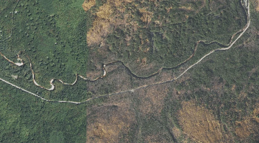
Twin Brook — Streams 38.1 Miles SW of Chapman Inn
Carroll County, New Hampshire · USGS Mount Chocorua Quadrangle · GNIS 872842
Catalogued on the USGS Mount Chocorua quadrangle in Carroll County, New Hampshire, Twin Brook — a stream — lies 38.1 miles southwest of Chapman Inn.
Landmark Profile
Classification & USGS reference
Catalogued under GNIS Feature ID 872842, Twin Brook is recorded as a stream on the USGS Mount Chocorua quadrangle in Carroll County, New Hampshire (FIPS 33/003). Catalogued in GNIS since 08/27/1980.
Coordinates & physical setting
Twin Brook sits at 43.99285° N, 71.29979° W (DMS 43°59′34″ N, 71°17′59″ W).
As a linear feature its source lies near 43.96667° N, 71.30056° W (DMS 43°58′00″ N, 71°18′02″ W) — useful for anglers and paddlers tracing the upstream end.
Other streams in Carroll County, New Hampshire
Carroll County, NH contains 152 streams catalogued in the USGS Geographic Names Information System, counting Twin Brook itself. The ones closest to Twin Brook:
| Feature | USGS Quadrangle | Distance |
|---|---|---|
| Champney Brook | Mount Chocorua | 0.4 mi |
| Currier Brook | Mount Chocorua | 0.8 mi |
| Douglas Brook | Mount Chocorua | 1.1 mi |
| Steam Mill Brook | Mount Chocorua | 1.1 mi |
| Cilley Brook | Bartlett | 1.5 mi |
| Rob Brook | Bartlett | 1.8 mi |
| Oliveran Brook | Mount Chocorua | 2.3 mi |
| Haskell Brook | Bartlett | 2.3 mi |
| White Brook | Mount Chocorua | 2.5 mi |
| Pond Brook | Bartlett | 2.9 mi |
Features on the USGS Mount Chocorua Quadrangle
The Mount Chocorua 7.5-minute topographic quadrangle holds 39 catalogued natural features alongside Twin Brook. A sampling nearest to this location:
| Feature | Type | County | Offset |
|---|---|---|---|
| Champney Brook | Streams | Carroll County, NH | 0.4 mi |
| Currier Brook | Streams | Carroll County, NH | 0.8 mi |
| Douglas Brook | Streams | Carroll County, NH | 1.1 mi |
| Steam Mill Brook | Streams | Carroll County, NH | 1.1 mi |
| Oliveran Brook | Streams | Carroll County, NH | 2.3 mi |
| White Brook | Streams | Carroll County, NH | 2.5 mi |
| Three Sisters | Ridges | Carroll County, NH | 2.5 mi |
| Moose Pond | Lakes | Carroll County, NH | 2.6 mi |
| Blue Mountain | Summits | Carroll County, NH | 2.6 mi |
| Carter Ledge | Benches | Carroll County, NH | 2.9 mi |
Visiting from Chapman Inn
Distance, bearing & drive time
A 65-minute drive along back roads separates the front door of Chapman Inn from Twin Brook — 38.1 miles southwest as the crow flies, on compass bearing SW.
Best time to visit
Best observed in late spring and early summer when flow is strong and banks are visible. At this latitude (43.993°), the shoulder seasons are workable — April and November can be comfortable on mild years. At 38.1 miles from the Inn, block the full day — sunrise start, late return, packed meals. Conditions at Twin Brook track the nearby Champney Brook stream (0.4 mi away) closely — if that is runnable, so is this.
Nearest features to Twin Brook
| Feature | Type | County | Distance |
|---|---|---|---|
| Champney Brook | Streams | Carroll County, NH | 0.4 mi |
| Currier Brook | Streams | Carroll County, NH | 0.8 mi |
| Douglas Brook | Streams | Carroll County, NH | 1.1 mi |
| Steam Mill Brook | Streams | Carroll County, NH | 1.1 mi |
| Albany Intervale | Valleys | Carroll County, NH | 1.2 mi |
Frequently Asked Questions
Where is Twin Brook located?
Twin Brook is in Carroll County, New Hampshire, approximately 38.1 miles southwest of Chapman Inn in Bethel, Maine. It appears on the USGS Mount Chocorua topographic quadrangle.
How far is Twin Brook from Chapman Inn?
The drive runs about 65 minutes, 38.1 miles southwest (bearing SW) of the Inn.
What type of natural feature is Twin Brook?
The U.S. Geological Survey classifies Twin Brook as a stream, catalogued under GNIS Feature ID 872842 on the Mount Chocorua quadrangle.
When is the best time to visit Twin Brook?
Best observed in late spring and early summer when flow is strong and banks are visible.
How many other streams are in Carroll County, New Hampshire?
GNIS lists 151 other streams in Carroll County, New Hampshire.