 Aerial imagery: USGS National Map (public domain)
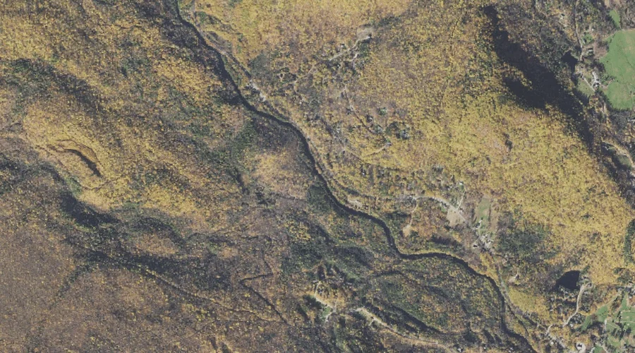
Meserve Brook — Streams 27.0 Miles SW of Chapman Inn
Carroll County, New Hampshire · USGS Jackson Quadrangle · GNIS 872283
27.0 miles southwest of Chapman Inn, on the USGS Jackson topographic quadrangle, Meserve Brook is a stream recorded in Carroll County, New Hampshire by the federal Geographic Names Information System.
Landmark Profile
Classification & USGS reference
The USGS Jackson 7.5-minute topographic quadrangle places Meserve Brook in Carroll County, New Hampshire (FIPS 33/003), classified as a stream in the federal GNIS (Feature ID 872283). Catalogued in GNIS since 08/27/1980.
Coordinates & physical setting
Meserve Brook sits at 44.15729° N, 71.21118° W (DMS 44°09′26″ N, 71°12′40″ W).
As a linear feature its source lies near 44.16840° N, 71.26924° W (DMS 44°10′06″ N, 71°16′09″ W) — useful for anglers and paddlers tracing the upstream end.
Other streams in Carroll County, New Hampshire
Carroll County, NH contains 152 streams catalogued in the USGS Geographic Names Information System, counting Meserve Brook itself. The ones closest to Meserve Brook:
| Feature | USGS Quadrangle | Distance |
|---|---|---|
| Spruce Brook | Jackson | 0.4 mi |
| Miles Brook | Jackson | 1.3 mi |
| Great Brook | Jackson | 1.4 mi |
| Marsh Brook | Jackson | 2.3 mi |
| Wildcat Brook | Jackson | 2.3 mi |
| Otis Brook | Stairs Mountain | 3 mi |
| Than Brook | Jackson | 3.1 mi |
| Lower Stairs Brook | Stairs Mountain | 3.4 mi |
| Mountain Brook | North Conway West | 3.8 mi |
| Rocky Branch | North Conway West | 3.8 mi |
Features on the USGS Jackson Quadrangle
The Jackson 7.5-minute topographic quadrangle holds 29 catalogued natural features alongside Meserve Brook. A sampling nearest to this location:
| Feature | Type | County | Offset |
|---|---|---|---|
| Spruce Brook | Streams | Carroll County, NH | 0.4 mi |
| Eagle Mountain | Summits | Carroll County, NH | 0.8 mi |
| Mirror Lake | Lakes | Carroll County, NH | 1.1 mi |
| Miles Brook | Streams | Carroll County, NH | 1.3 mi |
| Great Brook | Streams | Carroll County, NH | 1.4 mi |
| Green Hill | Summits | Carroll County, NH | 1.7 mi |
| Popple Mountain | Summits | Carroll County, NH | 1.7 mi |
| Spruce Mountain | Summits | Carroll County, NH | 1.8 mi |
| Winniweta Falls | Waterfalls | Carroll County, NH | 2 mi |
| Iron Mountain | Summits | Carroll County, NH | 2.1 mi |
Visiting from Chapman Inn
Distance, bearing & drive time
Chapman Inn sits 27.0 miles southwest (bearing SW) of Meserve Brook. At moderate back-road speeds the drive runs about 46 minutes — comfortably inside a half-day outing window after breakfast.
Best time to visit
Best observed in late spring and early summer when flow is strong and banks are visible. At this latitude (44.157°), the shoulder seasons are workable — April and November can be comfortable on mild years. At 27.0 miles from the Inn, block the full day — sunrise start, late return, packed meals. Conditions at Meserve Brook track the nearby Spruce Brook stream (0.4 mi away) closely — if that is runnable, so is this.
Nearest features to Meserve Brook
| Feature | Type | County | Distance |
|---|---|---|---|
| Spruce Brook | Streams | Carroll County, NH | 0.4 mi |
| Eagle Mountain | Summits | Carroll County, NH | 0.8 mi |
| Mirror Lake | Lakes | Carroll County, NH | 1.1 mi |
| Miles Brook | Streams | Carroll County, NH | 1.3 mi |
| Great Brook | Streams | Carroll County, NH | 1.4 mi |
Frequently Asked Questions
Where is Meserve Brook located?
Meserve Brook is in Carroll County, New Hampshire, approximately 27.0 miles southwest of Chapman Inn in Bethel, Maine. It appears on the USGS Jackson topographic quadrangle.
How far is Meserve Brook from Chapman Inn?
The drive runs about 46 minutes, 27.0 miles southwest (bearing SW) of the Inn.
What type of natural feature is Meserve Brook?
The U.S. Geological Survey classifies Meserve Brook as a stream, catalogued under GNIS Feature ID 872283 on the Jackson quadrangle.
When is the best time to visit Meserve Brook?
Best observed in late spring and early summer when flow is strong and banks are visible.
How many other streams are in Carroll County, New Hampshire?
GNIS lists 151 other streams in Carroll County, New Hampshire.