 Aerial imagery: USGS National Map (public domain)
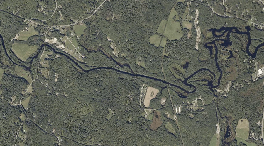
Martin Stream — Streams 27.1 Miles ESE of Chapman Inn
Androscoggin County, Maine · USGS Buckfield Quadrangle · GNIS 570859
Catalogued on the USGS Buckfield quadrangle in Androscoggin County, Maine, Martin Stream — a stream — lies 27.1 miles east-southeast of Chapman Inn.
Landmark Profile
Classification & USGS reference
Catalogued under GNIS Feature ID 570859, Martin Stream is recorded as a stream on the USGS Buckfield quadrangle in Androscoggin County, Maine (FIPS 23/001). Catalogued in GNIS since 09/30/1980.
Coordinates & physical setting
Martin Stream sits at 44.25118° N, 70.28506° W (DMS 44°15′04″ N, 70°17′06″ W).
As a linear feature its source lies near 44.38479° N, 70.24811° W (DMS 44°23′05″ N, 70°14′53″ W) — useful for anglers and paddlers tracing the upstream end.
Other streams in Androscoggin County, Maine
Androscoggin County, ME contains 62 streams catalogued in the USGS Geographic Names Information System, counting Martin Stream itself. The ones closest to Martin Stream:
| Feature | USGS Quadrangle | Distance |
|---|---|---|
| Meadow Brook | Buckfield | 1.6 mi |
| Lively Brook | Buckfield | 3.1 mi |
| Red Brook | Turner Center | 3.4 mi |
| Blanchard Stream | Buckfield | 3.4 mi |
| House Brook | Turner Center | 4.4 mi |
| Bradford Brook | Lake Auburn East | 4.7 mi |
| Nezinscot River | Turner Center | 5.8 mi |
| Allen Stream | Turner Center | 6.1 mi |
| Lapham Brook | Minot | 8.9 mi |
| Ford Brook | Livermore Falls | 9.5 mi |
Features on the USGS Buckfield Quadrangle
The Buckfield 7.5-minute topographic quadrangle holds 35 catalogued natural features alongside Martin Stream. A sampling nearest to this location:
| Feature | Type | County | Offset |
|---|---|---|---|
| Teague Hill | Summits | Androscoggin County, ME | 1.3 mi |
| Nezinscot River Reservoir (historical) | Reservoirs | Androscoggin County, ME | 1.5 mi |
| Meadow Brook | Streams | Androscoggin County, ME | 1.6 mi |
| Pickerel Pond | Lakes | Androscoggin County, ME | 1.7 mi |
| Bog Brook | Streams | Oxford County, ME | 1.8 mi |
| Ricker Hill | Summits | Androscoggin County, ME | 1.9 mi |
| Jersey Bog | Lakes | Androscoggin County, ME | 2.2 mi |
| Crystal Pond | Lakes | Androscoggin County, ME | 2.3 mi |
| General Turner Hill | Summits | Androscoggin County, ME | 2.3 mi |
| Lively Brook | Streams | Androscoggin County, ME | 3.1 mi |
Visiting from Chapman Inn
Distance, bearing & drive time
A 46-minute drive along back roads separates the front door of Chapman Inn from Martin Stream — 27.1 miles east-southeast as the crow flies, on compass bearing ESE.
Best time to visit
Best observed in late spring and early summer when flow is strong and banks are visible. At this latitude (44.251°), the shoulder seasons are workable — April and November can be comfortable on mild years. At 27.1 miles from the Inn, block the full day — sunrise start, late return, packed meals. Conditions at Martin Stream track the nearby Snell Hill summit (0.9 mi away) closely — if that is runnable, so is this.
Nearest features to Martin Stream
| Feature | Type | County | Distance |
|---|---|---|---|
| Snell Hill | Summits | Androscoggin County, ME | 0.9 mi |
| Lily Pond | Lakes | Androscoggin County, ME | 1.1 mi |
| Teague Hill | Summits | Androscoggin County, ME | 1.3 mi |
| Nezinscot River Reservoir (historical) | Reservoirs | Androscoggin County, ME | 1.5 mi |
| Mud Pond | Lakes | Oxford County, ME | 1.6 mi |
Frequently Asked Questions
Where is Martin Stream located?
Martin Stream is in Androscoggin County, Maine, approximately 27.1 miles east-southeast of Chapman Inn in Bethel, Maine. It appears on the USGS Buckfield topographic quadrangle.
How far is Martin Stream from Chapman Inn?
The drive runs about 46 minutes, 27.1 miles east-southeast (bearing ESE) of the Inn.
What type of natural feature is Martin Stream?
The U.S. Geological Survey classifies Martin Stream as a stream, catalogued under GNIS Feature ID 570859 on the Buckfield quadrangle.
When is the best time to visit Martin Stream?
Best observed in late spring and early summer when flow is strong and banks are visible.
How many other streams are in Androscoggin County, Maine?
GNIS lists 61 other streams in Androscoggin County, Maine.