 Aerial imagery: USGS National Map (public domain)
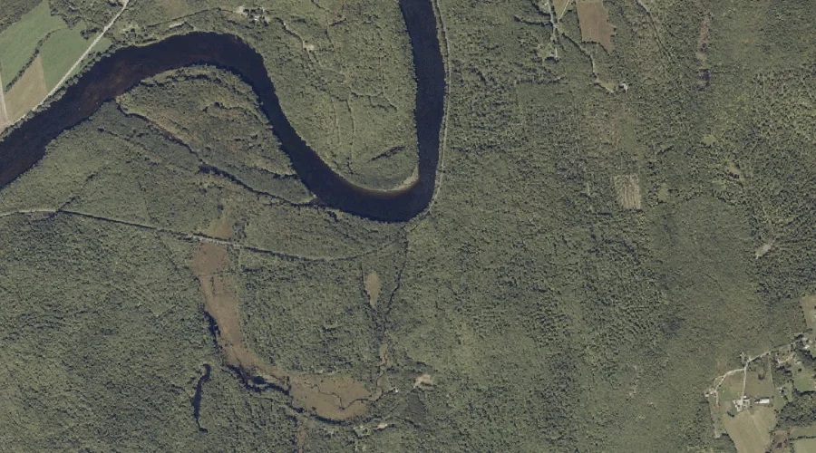
Fuller Brook — Streams 26.4 Miles E of Chapman Inn
Androscoggin County, Maine · USGS Canton Quadrangle · GNIS 566643
26.4 miles east of Chapman Inn, on the USGS Canton topographic quadrangle, Fuller Brook is a stream recorded in Androscoggin County, Maine by the federal Geographic Names Information System.
Landmark Profile
Classification & USGS reference
The USGS Canton 7.5-minute topographic quadrangle places Fuller Brook in Androscoggin County, Maine (FIPS 23/001), classified as a stream in the federal GNIS (Feature ID 566643). Catalogued in GNIS since 09/30/1980.
Coordinates & physical setting
Fuller Brook sits at 44.47201° N, 70.26284° W (DMS 44°28′19″ N, 70°15′46″ W).
As a linear feature its source lies near 44.42083° N, 70.25917° W (DMS 44°25′15″ N, 70°15′33″ W) — useful for anglers and paddlers tracing the upstream end.
Other streams in Androscoggin County, Maine
Androscoggin County, ME contains 62 streams catalogued in the USGS Geographic Names Information System, counting Fuller Brook itself. The ones closest to Fuller Brook:
| Feature | USGS Quadrangle | Distance |
|---|---|---|
| Clay Brook | Livermore Falls | 4.2 mi |
| Redwater Brook | Livermore Falls | 4.6 mi |
| Leavitt Brook | Canton | 5.2 mi |
| Fish Meadow Brook | Livermore Falls | 5.6 mi |
| Ford Brook | Livermore Falls | 6.1 mi |
| Beals Brook | Livermore Falls | 6.1 mi |
| Hunton Brook | Livermore Falls | 7.6 mi |
| Billington Brook | Livermore Falls | 7.6 mi |
| Meadow Brook | Livermore Falls | 7.7 mi |
| Keith Brook | Turner Center | 8.1 mi |
Features on the USGS Canton Quadrangle
The Canton 7.5-minute topographic quadrangle holds 32 catalogued natural features alongside Fuller Brook. A sampling nearest to this location:
| Feature | Type | County | Offset |
|---|---|---|---|
| Academy Hill | Summits | Oxford County, ME | 0.5 mi |
| Stevens Island | Islands | Oxford County, ME | 0.6 mi |
| Forest Pond | Lakes | Oxford County, ME | 1.2 mi |
| Jewett Hill | Summits | Oxford County, ME | 1.6 mi |
| Whitney Brook | Streams | Oxford County, ME | 2 mi |
| McCollister Hill | Summits | Oxford County, ME | 2.4 mi |
| Fish Hill | Summits | Oxford County, ME | 2.8 mi |
| Bog Brook | Streams | Oxford County, ME | 3 mi |
| Childs Brook | Streams | Oxford County, ME | 3.1 mi |
| Dunn Ledge | Summits | Oxford County, ME | 3.6 mi |
Visiting from Chapman Inn
Distance, bearing & drive time
Chapman Inn sits 26.4 miles east (bearing E) of Fuller Brook. At moderate back-road speeds the drive runs about 45 minutes — comfortably inside a half-day outing window after breakfast.
Best time to visit
Best observed in late spring and early summer when flow is strong and banks are visible. At this latitude (44.472°), the shoulder seasons are workable — April and November can be comfortable on mild years. At 26.4 miles from the Inn, block the full day — sunrise start, late return, packed meals. Conditions at Fuller Brook track the nearby Academy Hill summit (0.5 mi away) closely — if that is runnable, so is this.
Nearest features to Fuller Brook
| Feature | Type | County | Distance |
|---|---|---|---|
| Academy Hill | Summits | Oxford County, ME | 0.5 mi |
| Stevens Island | Islands | Oxford County, ME | 0.6 mi |
| Forest Pond | Lakes | Oxford County, ME | 1.2 mi |
| Whitney Hill | Summits | Oxford County, ME | 1.3 mi |
| Cow Hill | Summits | Franklin County, ME | 1.4 mi |
Frequently Asked Questions
Where is Fuller Brook located?
Fuller Brook is in Androscoggin County, Maine, approximately 26.4 miles east of Chapman Inn in Bethel, Maine. It appears on the USGS Canton topographic quadrangle.
How far is Fuller Brook from Chapman Inn?
The drive runs about 45 minutes, 26.4 miles east (bearing E) of the Inn.
What type of natural feature is Fuller Brook?
The U.S. Geological Survey classifies Fuller Brook as a stream, catalogued under GNIS Feature ID 566643 on the Canton quadrangle.
When is the best time to visit Fuller Brook?
Best observed in late spring and early summer when flow is strong and banks are visible.
How many other streams are in Androscoggin County, Maine?
GNIS lists 61 other streams in Androscoggin County, Maine.