 Aerial imagery: USGS National Map (public domain)
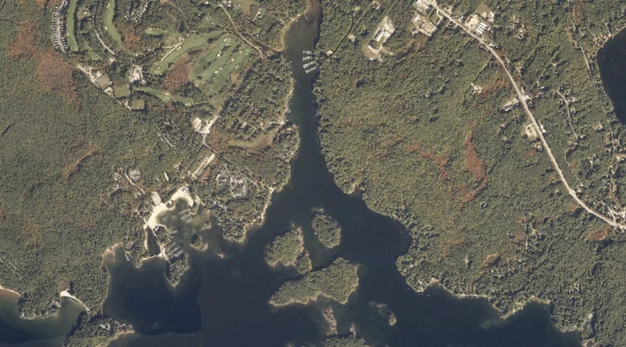
Dingley Brook — Streams 35.9 Miles SSE of Chapman Inn
Cumberland County, Maine · USGS Naples Quadrangle · GNIS 1912362
35.9 miles south-southeast of Chapman Inn, on the USGS Naples topographic quadrangle, Dingley Brook is a stream recorded in Cumberland County, Maine by the federal Geographic Names Information System.
Landmark Profile
Classification & USGS reference
The USGS Naples 7.5-minute topographic quadrangle places Dingley Brook in Cumberland County, Maine (FIPS 23/005), classified as a stream in the federal GNIS (Feature ID 1912362). Catalogued in GNIS since 05/08/2001.
Coordinates & physical setting
Dingley Brook sits at 43.91674° N, 70.54172° W (DMS 43°55′00″ N, 70°32′30″ W).
As a linear feature its source lies near 43.94806° N, 70.54528° W (DMS 43°56′53″ N, 70°32′43″ W) — useful for anglers and paddlers tracing the upstream end.
Other streams in Cumberland County, Maine
Cumberland County, ME contains 110 streams catalogued in the USGS Geographic Names Information System, counting Dingley Brook itself. The ones closest to Dingley Brook:
| Feature | USGS Quadrangle | Distance |
|---|---|---|
| Dingley Brook | Naples | 1.5 mi |
| Songo River | Naples | 1.7 mi |
| Crooked River | Naples | 2 mi |
| Whitney Brook | Naples | 2.5 mi |
| Meadow Brook | Raymond | 3 mi |
| Rolfe Brook | Raymond | 3.4 mi |
| Nubble Brook | Raymond | 3.7 mi |
| Tenny River | Raymond | 3.8 mi |
| Panther Run | Raymond | 4.1 mi |
| Hayden Brook | Raymond | 4.2 mi |
Features on the USGS Naples Quadrangle
The Naples 7.5-minute topographic quadrangle holds 65 catalogued natural features alongside Dingley Brook. A sampling nearest to this location:
| Feature | Type | County | Offset |
|---|---|---|---|
| Sheep Island | Islands | Cumberland County, ME | 0.1 mi |
| Ring Island | Islands | Cumberland County, ME | 0.3 mi |
| Kettle Cove | Bays | Cumberland County, ME | 0.3 mi |
| Maple Cove | Bays | Cumberland County, ME | 0.6 mi |
| Inner Spectacle Island | Islands | Cumberland County, ME | 0.6 mi |
| Inner Green Island | Islands | Cumberland County, ME | 0.7 mi |
| Birch Island | Islands | Cumberland County, ME | 0.7 mi |
| Dingley Islands | Islands | Cumberland County, ME | 0.7 mi |
| Outer Green Island | Islands | Cumberland County, ME | 0.7 mi |
| Outer Spectacle Island | Islands | Cumberland County, ME | 0.7 mi |
Visiting from Chapman Inn
Distance, bearing & drive time
Chapman Inn sits 35.9 miles south-southeast (bearing SSE) of Dingley Brook. At moderate back-road speeds the drive runs about 62 minutes — comfortably inside a half-day outing window after breakfast.
Best time to visit
Best observed in late spring and early summer when flow is strong and banks are visible. At this latitude (43.917°), the shoulder seasons are workable — April and November can be comfortable on mild years. At 35.9 miles from the Inn, block the full day — sunrise start, late return, packed meals. Conditions at Dingley Brook track the nearby Sheep Island (essentially adjacent) closely — if that is runnable, so is this.
Nearest features to Dingley Brook
| Feature | Type | County | Distance |
|---|---|---|---|
| Sheep Island | Islands | Cumberland County, ME | 0.1 mi |
| Ring Island | Islands | Cumberland County, ME | 0.3 mi |
| Kettle Cove | Bays | Cumberland County, ME | 0.3 mi |
| Maple Cove | Bays | Cumberland County, ME | 0.6 mi |
| Inner Spectacle Island | Islands | Cumberland County, ME | 0.6 mi |
Frequently Asked Questions
Where is Dingley Brook located?
Dingley Brook is in Cumberland County, Maine, approximately 35.9 miles south-southeast of Chapman Inn in Bethel, Maine. It appears on the USGS Naples topographic quadrangle.
How far is Dingley Brook from Chapman Inn?
The drive runs about 62 minutes, 35.9 miles south-southeast (bearing SSE) of the Inn.
What type of natural feature is Dingley Brook?
The U.S. Geological Survey classifies Dingley Brook as a stream, catalogued under GNIS Feature ID 1912362 on the Naples quadrangle.
When is the best time to visit Dingley Brook?
Best observed in late spring and early summer when flow is strong and banks are visible.
How many other streams are in Cumberland County, Maine?
GNIS lists 109 other streams in Cumberland County, Maine.