 Aerial imagery: USGS National Map (public domain)
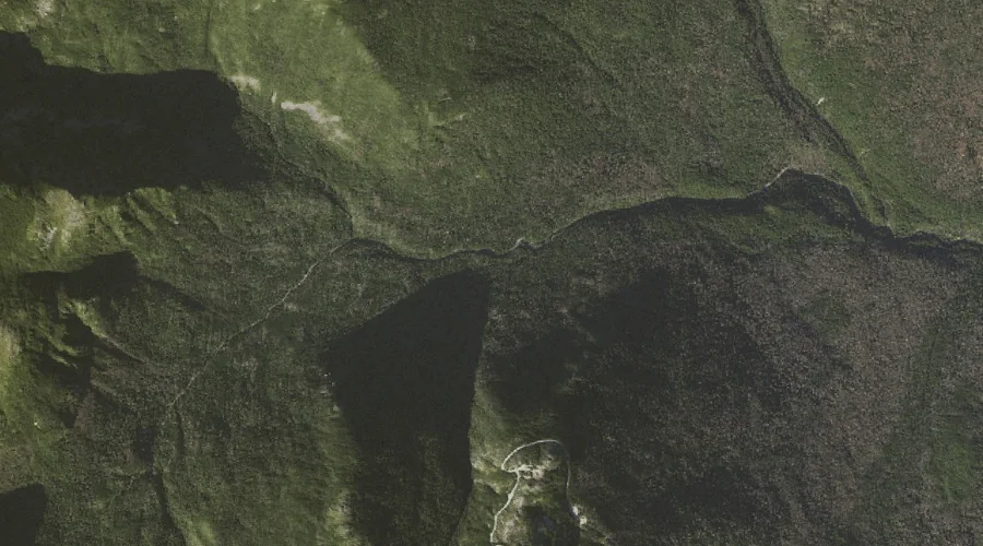
Chandler Brook — Streams 25.3 Miles WSW of Chapman Inn
Coos County, New Hampshire · USGS Mount Washington Quadrangle · GNIS 871659
25.3 miles west-southwest of Chapman Inn, on the USGS Mount Washington topographic quadrangle, Chandler Brook is a stream recorded in Coos County, New Hampshire by the federal Geographic Names Information System.
Landmark Profile
Classification & USGS reference
The USGS Mount Washington 7.5-minute topographic quadrangle places Chandler Brook in Coos County, New Hampshire (FIPS 33/007), classified as a stream in the federal GNIS (Feature ID 871659). Catalogued in GNIS since 08/27/1980.
Coordinates & physical setting
Chandler Brook sits at 44.30229° N, 71.28119° W (DMS 44°18′08″ N, 71°16′52″ W).
As a linear feature its source lies near 44.28750° N, 71.28639° W (DMS 44°17′15″ N, 71°17′11″ W) — useful for anglers and paddlers tracing the upstream end.
Other streams in Coos County, New Hampshire
Coos County, NH contains 300 streams catalogued in the USGS Geographic Names Information System, counting Chandler Brook itself. The ones closest to Chandler Brook:
| Feature | USGS Quadrangle | Distance |
|---|---|---|
| Parapet Brook | Mount Washington | 1 mi |
| Cutler River | Mount Washington | 2.9 mi |
| Nineteen Brook | Carter Dome | 3 mi |
| West Branch Peabody River | Carter Dome | 3.1 mi |
| Cowboy Brook | Carter Dome | 3.1 mi |
| Thompson Brook | Carter Dome | 3.2 mi |
| Castle Brook | Mount Washington | 3.4 mi |
| Cascade Brook | Mount Washington | 3.4 mi |
| New River | Mount Washington | 3.5 mi |
| Monroe Brook | Mount Washington | 3.5 mi |
Features on the USGS Mount Washington Quadrangle
The Mount Washington 7.5-minute topographic quadrangle holds 68 catalogued natural features alongside Chandler Brook. A sampling nearest to this location:
| Feature | Type | County | Offset |
|---|---|---|---|
| Jefferson Ravine | Valleys | Coos County, NH | 0.4 mi |
| Washburn Point | Summits | Coos County, NH | 0.6 mi |
| Parapet Brook | Streams | Coos County, NH | 1 mi |
| Madison Gulf | Valleys | Coos County, NH | 1 mi |
| Mount Adams | Summits | Coos County, NH | 1.4 mi |
| Adams Five | Summits | Coos County, NH | 1.5 mi |
| Great Gulf | Valleys | Coos County, NH | 1.5 mi |
| Nelson Crag | Pillars | Coos County, NH | 1.6 mi |
| Mount Quincy Adams | Summits | Coos County, NH | 1.6 mi |
| Star Lake | Lakes | Coos County, NH | 1.6 mi |
Visiting from Chapman Inn
Distance, bearing & drive time
Chapman Inn sits 25.3 miles west-southwest (bearing WSW) of Chandler Brook. At moderate back-road speeds the drive runs about 43 minutes — comfortably inside a half-day outing window after breakfast.
Best time to visit
Best observed in late spring and early summer when flow is strong and banks are visible. Being this far north (lat 44.302°), first snows typically arrive by mid-October and linger into early May — narrow the window accordingly. At 25.3 miles from the Inn, block the full day — sunrise start, late return, packed meals. Conditions at Chandler Brook track the nearby Jefferson Ravine valley (0.4 mi away) closely — if that is runnable, so is this.
Nearest features to Chandler Brook
| Feature | Type | County | Distance |
|---|---|---|---|
| Jefferson Ravine | Valleys | Coos County, NH | 0.4 mi |
| Washburn Point | Summits | Coos County, NH | 0.6 mi |
| Parapet Brook | Streams | Coos County, NH | 1 mi |
| Madison Gulf | Valleys | Coos County, NH | 1 mi |
| Mount Adams | Summits | Coos County, NH | 1.4 mi |
Frequently Asked Questions
Where is Chandler Brook located?
Chandler Brook is in Coos County, New Hampshire, approximately 25.3 miles west-southwest of Chapman Inn in Bethel, Maine. It appears on the USGS Mount Washington topographic quadrangle.
How far is Chandler Brook from Chapman Inn?
The drive runs about 43 minutes, 25.3 miles west-southwest (bearing WSW) of the Inn.
What type of natural feature is Chandler Brook?
The U.S. Geological Survey classifies Chandler Brook as a stream, catalogued under GNIS Feature ID 871659 on the Mount Washington quadrangle.
When is the best time to visit Chandler Brook?
Best observed in late spring and early summer when flow is strong and banks are visible.
How many other streams are in Coos County, New Hampshire?
GNIS lists 299 other streams in Coos County, New Hampshire.