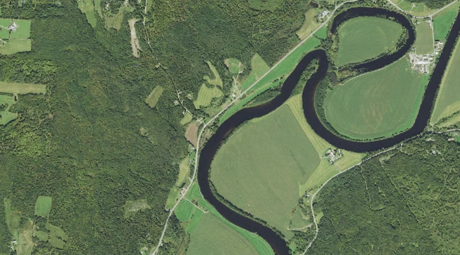
 Aerial imagery: USGS National Map (public domain)
Catbow Brook — Streams 42.5 Miles W of Chapman Inn
Essex County, New Hampshire · USGS Gilman Quadrangle · GNIS 1456085
Within Essex County, New Hampshire, on the USGS Gilman quadrangle, the stream known as Catbow Brook sits 42.5 miles west of Chapman Inn.
Wikidata short description: “natural watercourse in Essex County, Vermont, United States of America”
Landmark Profile
Classification & USGS reference
Within Essex County, New Hampshire, the U.S. Geological Survey lists Catbow Brook as a stream on the Gilman topographic quadrangle (FIPS 50/009), under Feature ID 1456085. Catalogued in GNIS since 10/29/1980.
Coordinates & physical setting
Catbow Brook sits at 44.47506° N, 71.64453° W (DMS 44°28′30″ N, 71°38′40″ W).
As a linear feature its source lies near 44.55839° N, 71.67926° W (DMS 44°33′30″ N, 71°40′45″ W) — useful for anglers and paddlers tracing the upstream end.
Other streams in Essex County, New Hampshire
Essex County, NH contains 6 streams catalogued in the USGS Geographic Names Information System, counting Catbow Brook itself. The ones closest to Catbow Brook:
| Feature | USGS Quadrangle | Distance |
|---|---|---|
| Hudson Brook | Gilman | 1 mi |
| Emery Brook | Groveton | 6 mi |
| Washburn Brook | Groveton | 6.5 mi |
| Taylor Brook | Stratford | 13.1 mi |
| Wheeler Stream | Stratford | 17.2 mi |
Features on the USGS Gilman Quadrangle
The Gilman 7.5-minute topographic quadrangle holds 10 catalogued natural features alongside Catbow Brook. A sampling nearest to this location:
| Feature | Type | County | Offset |
|---|---|---|---|
| Hudson Brook | Streams | Essex County, NH | 1 mi |
| Johns River | Streams | Coos County, NH | 3.7 mi |
| Clark Pond | Lakes | Coos County, NH | 4.2 mi |
| Wallace Hill | Summits | Coos County, NH | 6.1 mi |
| Gold Mine Pond (historical) | Reservoirs | Grafton County, NH | 6.2 mi |
| Dalton Mountain | Summits | Coos County, NH | 6.6 mi |
| Cushman Brook | Streams | Coos County, NH | 6.7 mi |
| Beede Mountain | Summits | Coos County, NH | 7.4 mi |
| Blue Hill | Summits | Coos County, NH | 8 mi |
Historical record
The U.S. Board on Geographic Names recorded a Official (Board Decision) on January 1, 1912 for this name.
Visiting from Chapman Inn
Distance, bearing & drive time
Follow the compass bearing W out of Bethel for 42.5 miles (west) and you reach Catbow Brook; at typical rural speeds the trip runs roughly 73 minutes.
Best time to visit
Best observed in late spring and early summer when flow is strong and banks are visible. At this latitude (44.475°), the shoulder seasons are workable — April and November can be comfortable on mild years. At 42.5 miles from the Inn, block the full day — sunrise start, late return, packed meals. Conditions at Catbow Brook track the nearby Hudson Brook stream (1.0 mi away) closely — if that is runnable, so is this.
Nearest features to Catbow Brook
| Feature | Type | County | Distance |
|---|---|---|---|
| Hudson Brook | Streams | Essex County, NH | 1 mi |
| Orne Mountain | Summits | Coos County, NH | 2 mi |
| Israel River | Streams | Coos County, NH | 2.6 mi |
| Martin Meadow Pond | Lakes | Coos County, NH | 3 mi |
| Mount Pleasant | Summits | Coos County, NH | 3.1 mi |
Frequently Asked Questions
Where is Catbow Brook located?
Catbow Brook is in Essex County, New Hampshire, approximately 42.5 miles west of Chapman Inn in Bethel, Maine. It appears on the USGS Gilman topographic quadrangle.
How far is Catbow Brook from Chapman Inn?
The drive runs about 73 minutes, 42.5 miles west (bearing W) of the Inn.
What type of natural feature is Catbow Brook?
The U.S. Geological Survey classifies Catbow Brook as a stream, catalogued under GNIS Feature ID 1456085 on the Gilman quadrangle.
When is the best time to visit Catbow Brook?
Best observed in late spring and early summer when flow is strong and banks are visible.
How many other streams are in Essex County, New Hampshire?
GNIS lists 5 other streams in Essex County, New Hampshire.
Wikidata: Q49876711.