 Aerial imagery: USGS National Map (public domain)
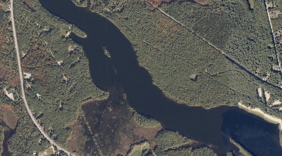
Lower Range Pond — Reservoirs 32.5 Miles SE of Chapman Inn
Androscoggin County, Maine · USGS Minot Quadrangle · GNIS 570537
32.5 miles southeast of Chapman Inn, on the USGS Minot topographic quadrangle, Lower Range Pond is a reservoir recorded in Androscoggin County, Maine by the federal Geographic Names Information System.
Landmark Profile
Classification & USGS reference
The USGS Minot 7.5-minute topographic quadrangle places Lower Range Pond in Androscoggin County, Maine (FIPS 23/001), classified as a reservoir in the federal GNIS (Feature ID 570537). Last revised by the Board on Geographic Names on 05/13/2018.
Coordinates & physical setting
Lower Range Pond sits at 44.04380° N, 70.36754° W (DMS 44°02′38″ N, 70°22′03″ W).
Other reservoirs in Androscoggin County, Maine
Androscoggin County, ME contains 23 reservoirs catalogued in the USGS Geographic Names Information System, counting Lower Range Pond itself. The ones closest to Lower Range Pond:
| Feature | USGS Quadrangle | Distance |
|---|---|---|
| Little Androscoggin River Reservoir | Minot | 3.5 mi |
| Little Androscoggin River Reservoir | Mechanic Falls | 4.8 mi |
| Taylor Brook | Minot | 6.4 mi |
| Barker Mill Dam Pond | Lewiston | 7.3 mi |
| Androscoggin River Reservoir | Lewiston | 8.3 mi |
| Androscoggin River Reservoir | Lewiston | 8.3 mi |
| The Basin | Lake Auburn West | 9.2 mi |
| Lake Auburn | Lake Auburn East | 9.9 mi |
| Androscoggin River Reservoir | Lake Auburn East | 10.4 mi |
| Montello Heights Reservoir | Lewiston | 10.5 mi |
Features on the USGS Minot Quadrangle
The Minot 7.5-minute topographic quadrangle holds 25 catalogued natural features alongside Lower Range Pond. A sampling nearest to this location:
| Feature | Type | County | Offset |
|---|---|---|---|
| Ricker Hill | Summits | Androscoggin County, ME | 1.4 mi |
| Bailey Hill | Summits | Androscoggin County, ME | 1.6 mi |
| Worthley Pond | Lakes | Androscoggin County, ME | 2 mi |
| Harris Hill | Summits | Androscoggin County, ME | 2.7 mi |
| Shaker Hill | Summits | Androscoggin County, ME | 2.8 mi |
| Grandview Hill | Summits | Cumberland County, ME | 2.9 mi |
| Worthley Brook | Streams | Androscoggin County, ME | 3.5 mi |
| Little Androscoggin River Reservoir | Reservoirs | Androscoggin County, ME | 3.5 mi |
| Christian Hill | Summits | Androscoggin County, ME | 3.7 mi |
| Morgan Brook | Streams | Androscoggin County, ME | 3.8 mi |
Visiting from Chapman Inn
Distance, bearing & drive time
Chapman Inn sits 32.5 miles southeast (bearing SE) of Lower Range Pond. At moderate back-road speeds the drive runs about 56 minutes — comfortably inside a half-day outing window after breakfast.
Best time to visit
June through September for paddling and swimming; January through March for ice fishing. At this latitude (44.044°), the shoulder seasons are workable — April and November can be comfortable on mild years. At 32.5 miles from the Inn, block the full day — sunrise start, late return, packed meals. Conditions at Lower Range Pond track the nearby Middle Range Pond lake (1.2 mi away) closely — if that is runnable, so is this.
Nearest features to Lower Range Pond
| Feature | Type | County | Distance |
|---|---|---|---|
| Middle Range Pond | Lakes | Androscoggin County, ME | 1.2 mi |
| Ricker Hill | Summits | Androscoggin County, ME | 1.4 mi |
| Bailey Hill | Summits | Androscoggin County, ME | 1.6 mi |
| Oak Hill | Summits | Androscoggin County, ME | 1.9 mi |
| White Oak Hill | Summits | Androscoggin County, ME | 2 mi |
Frequently Asked Questions
Where is Lower Range Pond located?
Lower Range Pond is in Androscoggin County, Maine, approximately 32.5 miles southeast of Chapman Inn in Bethel, Maine. It appears on the USGS Minot topographic quadrangle.
How far is Lower Range Pond from Chapman Inn?
The drive runs about 56 minutes, 32.5 miles southeast (bearing SE) of the Inn.
What type of natural feature is Lower Range Pond?
The U.S. Geological Survey classifies Lower Range Pond as a reservoir, catalogued under GNIS Feature ID 570537 on the Minot quadrangle.
When is the best time to visit Lower Range Pond?
June through September for paddling and swimming; January through March for ice fishing.
How many other reservoirs are in Androscoggin County, Maine?
GNIS lists 22 other reservoirs in Androscoggin County, Maine.
Wikidata: Q34904278.