 Aerial imagery: USGS National Map (public domain)
Androscoggin River Reservoir — Reservoirs 29.9 Miles E of Chapman Inn
Androscoggin County, Maine · USGS Livermore Falls Quadrangle · GNIS 1773532
Catalogued on the USGS Livermore Falls quadrangle in Androscoggin County, Maine, Androscoggin River Reservoir — a reservoir — lies 29.9 miles east of Chapman Inn.
Landmark Profile
Classification & USGS reference
Catalogued under GNIS Feature ID 1773532, Androscoggin River Reservoir is recorded as a reservoir on the USGS Livermore Falls quadrangle in Androscoggin County, Maine (FIPS 23/001). Last revised by the Board on Geographic Names on 05/24/2010.
Coordinates & physical setting
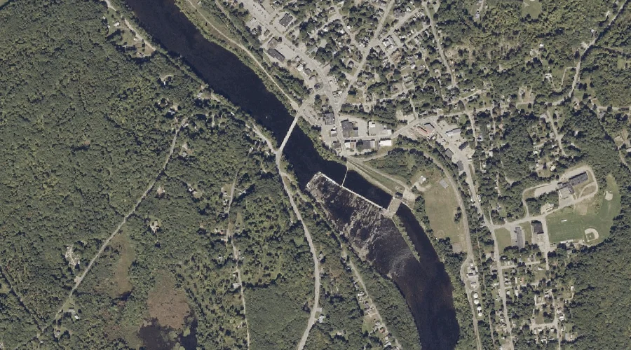
Androscoggin River Reservoir sits at 44.47129° N, 70.19070° W (DMS 44°28′17″ N, 70°11′27″ W).
Other reservoirs in Androscoggin County, Maine
Androscoggin County, ME contains 23 reservoirs catalogued in the USGS Geographic Names Information System, counting Androscoggin River Reservoir itself. The ones closest to Androscoggin River Reservoir:
| Feature | USGS Quadrangle | Distance |
|---|---|---|
| Brettuns Pond | Livermore Falls | 6.2 mi |
| Dead River Reservoir | Turner Center | 8.5 mi |
| Pleasant Pond | Turner Center | 10.7 mi |
| Nezinscot River Reservoir (historical) | Buckfield | 15.2 mi |
| Gulf Island Pond | Lake Auburn East | 21.1 mi |
| The Basin | Lake Auburn West | 22.5 mi |
| Lake Auburn | Lake Auburn East | 22.5 mi |
| Androscoggin River Reservoir | Lake Auburn East | 23.2 mi |
| Sabattus Pond | Lisbon Falls North | 24.5 mi |
| Montello Heights Reservoir | Lewiston | 24.6 mi |
Features on the USGS Livermore Falls Quadrangle
The Livermore Falls 7.5-minute topographic quadrangle holds 29 catalogued natural features alongside Androscoggin River Reservoir. A sampling nearest to this location:
| Feature | Type | County | Offset |
|---|---|---|---|
| Androscoggin River Reservoir | Reservoirs | Franklin County, ME | 0.7 mi |
| Clay Brook | Streams | Androscoggin County, ME | 0.9 mi |
| Treat Hill | Summits | Franklin County, ME | 0.9 mi |
| Redwater Brook | Streams | Androscoggin County, ME | 1 mi |
| Philbrick Hill | Summits | Franklin County, ME | 1.5 mi |
| Mosquito Brook | Streams | Franklin County, ME | 2.1 mi |
| Cow Hill | Summits | Franklin County, ME | 2.3 mi |
| Warren Hill | Summits | Franklin County, ME | 2.3 mi |
| Moose Hill Pond | Lakes | Androscoggin County, ME | 2.9 mi |
| Long Pond | Lakes | Androscoggin County, ME | 2.9 mi |
Visiting from Chapman Inn
Distance, bearing & drive time
A 51-minute drive along back roads separates the front door of Chapman Inn from Androscoggin River Reservoir — 29.9 miles east as the crow flies, on compass bearing E.
Best time to visit
June through September for paddling and swimming; January through March for ice fishing. At this latitude (44.471°), the shoulder seasons are workable — April and November can be comfortable on mild years. At 29.9 miles from the Inn, block the full day — sunrise start, late return, packed meals. Conditions at Androscoggin River Reservoir track the nearby Androscoggin River Reservoir (0.7 mi away) closely — if that is runnable, so is this.
Nearest features to Androscoggin River Reservoir
| Feature | Type | County | Distance |
|---|---|---|---|
| Androscoggin River Reservoir | Reservoirs | Franklin County, ME | 0.7 mi |
| Clay Brook | Streams | Androscoggin County, ME | 0.9 mi |
| Treat Hill | Summits | Franklin County, ME | 0.9 mi |
| Redwater Brook | Streams | Androscoggin County, ME | 1 mi |
| Philbrick Hill | Summits | Franklin County, ME | 1.5 mi |
Frequently Asked Questions
Where is Androscoggin River Reservoir located?
Androscoggin River Reservoir is in Androscoggin County, Maine, approximately 29.9 miles east of Chapman Inn in Bethel, Maine. It appears on the USGS Livermore Falls topographic quadrangle.
How far is Androscoggin River Reservoir from Chapman Inn?
The drive runs about 51 minutes, 29.9 miles east (bearing E) of the Inn.
What type of natural feature is Androscoggin River Reservoir?
The U.S. Geological Survey classifies Androscoggin River Reservoir as a reservoir, catalogued under GNIS Feature ID 1773532 on the Livermore Falls quadrangle.
When is the best time to visit Androscoggin River Reservoir?
June through September for paddling and swimming; January through March for ice fishing.
How many other reservoirs are in Androscoggin County, Maine?
GNIS lists 22 other reservoirs in Androscoggin County, Maine.