 Aerial imagery: USGS National Map (public domain)
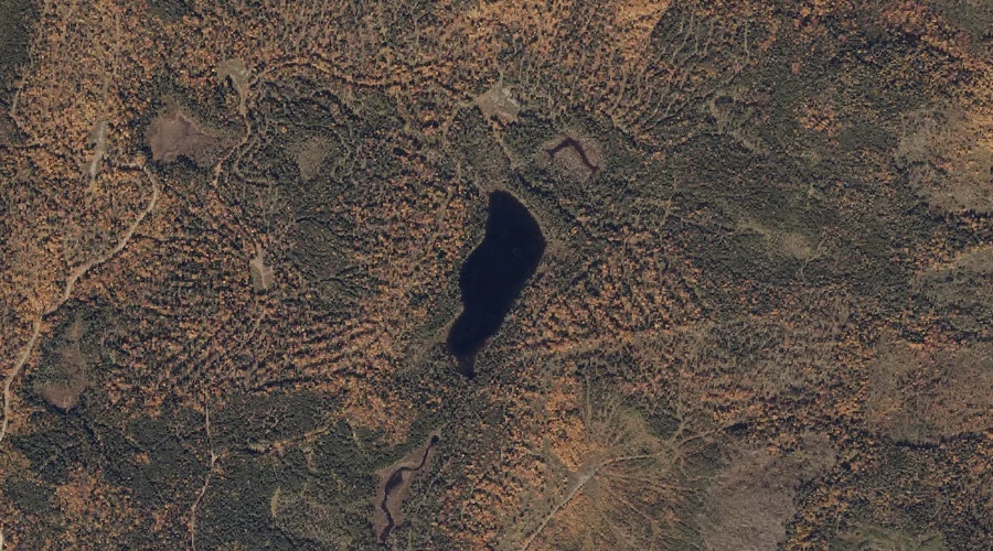
Swift River Pond — Lakes 31.7 Miles NNE of Chapman Inn
Franklin County, Maine · USGS Jackson Mountain Quadrangle · GNIS 576620
Tracing roughly 44 kilometres of Franklin County, Maine drainage, Swift River Pond is catalogued on the USGS Jackson Mountain quadrangle and reaches its closest point 31.7 miles north-northeast of Chapman Inn.
Wikidata short description: “left tributary of Androscoggin River in Maine, USA”
Landmark Profile
Classification & USGS reference
Within Franklin County, Maine, the U.S. Geological Survey lists Swift River Pond as a lake on the Jackson Mountain topographic quadrangle (FIPS 23/007), under Feature ID 576620. Last revised by the Board on Geographic Names on 05/12/2018.
Coordinates & physical setting
Swift River Pond sits at 44.84127° N, 70.59239° W (DMS 44°50′29″ N, 70°35′33″ W).
Dimensions & elevation
- Length 44.00 km / 27.34 mi
Other lakes in Franklin County, Maine
Franklin County, ME contains 98 lakes catalogued in the USGS Geographic Names Information System, counting Swift River Pond itself. The ones closest to Swift River Pond:
| Feature | USGS Quadrangle | Distance |
|---|---|---|
| Witham Bog | Jackson Mountain | 0.5 mi |
| Little Swift River Pond | Jackson Mountain | 0.7 mi |
| Witham Pond | Jackson Mountain | 0.7 mi |
| South Pond | Jackson Mountain | 2.5 mi |
| Southwest Pond | Jackson Mountain | 2.6 mi |
| Long Pond | Saddleback Mountain | 3.2 mi |
| Sabbath Day Pond | Houghton | 3.2 mi |
| Round Pond | Houghton | 3.9 mi |
| Beaver Pond | Houghton | 4 mi |
| Long Pond | Houghton | 4 mi |
Features on the USGS Jackson Mountain Quadrangle
The Jackson Mountain 7.5-minute topographic quadrangle holds 16 catalogued natural features alongside Swift River Pond. A sampling nearest to this location:
| Feature | Type | County | Offset |
|---|---|---|---|
| Witham Bog | Lakes | Franklin County, ME | 0.5 mi |
| Little Swift River Pond | Lakes | Franklin County, ME | 0.7 mi |
| Blue Mountains | Ranges | Franklin County, ME | 0.7 mi |
| Witham Pond | Lakes | Franklin County, ME | 0.7 mi |
| South Pond | Lakes | Franklin County, ME | 2.5 mi |
| Southwest Pond | Lakes | Franklin County, ME | 2.6 mi |
| Smalls Falls | Waterfalls | Franklin County, ME | 3.9 mi |
| Chandler Mill Stream | Streams | Franklin County, ME | 4 mi |
| Noon Mountain | Summits | Franklin County, ME | 4 mi |
| Harvey Pond | Lakes | Franklin County, ME | 4.5 mi |
Historical record
The Swift River is a 26.7-mile-long (43.0 km) river in western Maine. It is a tributary of the Androscoggin River, which flows to the Kennebec River near its mouth at the Atlantic Ocean. Read the full Wikipedia entry →
Visiting from Chapman Inn
Distance, bearing & drive time
Follow the compass bearing NNE out of Bethel for 31.7 miles (north-northeast) and you reach Swift River Pond; at typical rural speeds the trip runs roughly 54 minutes.
Best time to visit
June through September for paddling and swimming; January through March for ice fishing. Being this far north (lat 44.841°), first snows typically arrive by mid-October and linger into early May — narrow the window accordingly. At 31.7 miles from the Inn, block the full day — sunrise start, late return, packed meals. Conditions at Swift River Pond track the nearby Witham Bog lake (0.5 mi away) closely — if that is runnable, so is this.
Nearest features to Swift River Pond
| Feature | Type | County | Distance |
|---|---|---|---|
| Witham Bog | Lakes | Franklin County, ME | 0.5 mi |
| Little Swift River Pond | Lakes | Franklin County, ME | 0.7 mi |
| Blue Mountains | Ranges | Franklin County, ME | 0.7 mi |
| Witham Pond | Lakes | Franklin County, ME | 0.7 mi |
| South Pond | Lakes | Franklin County, ME | 2.5 mi |
Frequently Asked Questions
Where is Swift River Pond located?
Swift River Pond is in Franklin County, Maine, approximately 31.7 miles north-northeast of Chapman Inn in Bethel, Maine. It appears on the USGS Jackson Mountain topographic quadrangle.
How far is Swift River Pond from Chapman Inn?
The drive runs about 54 minutes, 31.7 miles north-northeast (bearing NNE) of the Inn.
What type of natural feature is Swift River Pond?
The U.S. Geological Survey classifies Swift River Pond as a lake, catalogued under GNIS Feature ID 576620 on the Jackson Mountain quadrangle.
When is the best time to visit Swift River Pond?
June through September for paddling and swimming; January through March for ice fishing.
How long is Swift River Pond?
Wikidata records a length of 44.00 km (27.34 mi) for Swift River Pond.
How many other lakes are in Franklin County, Maine?
GNIS lists 97 other lakes in Franklin County, Maine.
Wikidata: Q17106869.