 Aerial imagery: USGS National Map (public domain)
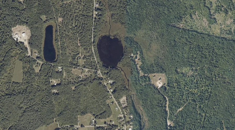
Schoolhouse Pond — Lakes 33.4 Miles E of Chapman Inn
Androscoggin County, Maine · USGS Fayette Quadrangle · GNIS 575028
33.4 miles east of Chapman Inn, on the USGS Fayette topographic quadrangle, Schoolhouse Pond is a lake recorded in Androscoggin County, Maine by the federal Geographic Names Information System.
Landmark Profile
Classification & USGS reference
The USGS Fayette 7.5-minute topographic quadrangle places Schoolhouse Pond in Androscoggin County, Maine (FIPS 23/001), classified as a lake in the federal GNIS (Feature ID 575028). Last revised by the Board on Geographic Names on 05/12/2018.
Coordinates & physical setting
Schoolhouse Pond sits at 44.43229° N, 70.11410° W (DMS 44°25′56″ N, 70°06′51″ W).
Other lakes in Androscoggin County, Maine
Androscoggin County, ME contains 44 lakes catalogued in the USGS Geographic Names Information System, counting Schoolhouse Pond itself. The ones closest to Schoolhouse Pond:
| Feature | USGS Quadrangle | Distance |
|---|---|---|
| Turner Pond | Fayette | 0.4 mi |
| Round Pond | Fayette | 0.6 mi |
| Rack Pond | Fayette | 0.8 mi |
| Moose Hill Pond | Livermore Falls | 2.5 mi |
| Long Pond | Livermore Falls | 4.6 mi |
| Bartlett Pond | Livermore Falls | 5 mi |
| Round Pond | Livermore Falls | 5.2 mi |
| Nelson Pond | Canton | 7.4 mi |
| Crystal Pond | Buckfield | 12.8 mi |
| Island Pond | Monmouth | 13 mi |
Features on the USGS Fayette Quadrangle
The Fayette 7.5-minute topographic quadrangle holds 29 catalogued natural features alongside Schoolhouse Pond. A sampling nearest to this location:
| Feature | Type | County | Offset |
|---|---|---|---|
| Turner Pond | Lakes | Androscoggin County, ME | 0.4 mi |
| Round Pond | Lakes | Androscoggin County, ME | 0.6 mi |
| Rack Pond | Lakes | Androscoggin County, ME | 0.8 mi |
| Fayette Ridge | Ridges | Kennebec County, ME | 0.9 mi |
| Burgess Pond | Lakes | Kennebec County, ME | 1.2 mi |
| Pine Hill | Summits | Kennebec County, ME | 1.9 mi |
| Baldwin Hill | Summits | Kennebec County, ME | 1.9 mi |
| Hales Pond | Lakes | Kennebec County, ME | 3.2 mi |
| Mount Winnebago | Summits | Kennebec County, ME | 3.3 mi |
| Mosher Pond | Lakes | Kennebec County, ME | 3.4 mi |
Visiting from Chapman Inn
Distance, bearing & drive time
Chapman Inn sits 33.4 miles east (bearing E) of Schoolhouse Pond. At moderate back-road speeds the drive runs about 57 minutes — comfortably inside a half-day outing window after breakfast.
Best time to visit
June through September for paddling and swimming; January through March for ice fishing. At this latitude (44.432°), the shoulder seasons are workable — April and November can be comfortable on mild years. At 33.4 miles from the Inn, block the full day — sunrise start, late return, packed meals. Conditions at Schoolhouse Pond track the nearby Turner Pond lake (0.4 mi away) closely — if that is runnable, so is this.
Nearest features to Schoolhouse Pond
| Feature | Type | County | Distance |
|---|---|---|---|
| Turner Pond | Lakes | Androscoggin County, ME | 0.4 mi |
| Round Pond | Lakes | Androscoggin County, ME | 0.6 mi |
| Rack Pond | Lakes | Androscoggin County, ME | 0.8 mi |
| Fayette Ridge | Ridges | Kennebec County, ME | 0.9 mi |
| Jug Hill | Summits | Androscoggin County, ME | 1.1 mi |
Frequently Asked Questions
Where is Schoolhouse Pond located?
Schoolhouse Pond is in Androscoggin County, Maine, approximately 33.4 miles east of Chapman Inn in Bethel, Maine. It appears on the USGS Fayette topographic quadrangle.
How far is Schoolhouse Pond from Chapman Inn?
The drive runs about 57 minutes, 33.4 miles east (bearing E) of the Inn.
What type of natural feature is Schoolhouse Pond?
The U.S. Geological Survey classifies Schoolhouse Pond as a lake, catalogued under GNIS Feature ID 575028 on the Fayette quadrangle.
When is the best time to visit Schoolhouse Pond?
June through September for paddling and swimming; January through March for ice fishing.
How many other lakes are in Androscoggin County, Maine?
GNIS lists 43 other lakes in Androscoggin County, Maine.
Wikidata: Q33306765.