 Aerial imagery: USGS National Map (public domain)
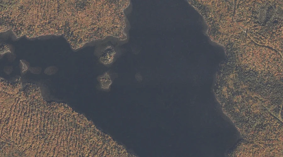
Pond in the River — Lakes 25.6 Miles NNW of Chapman Inn
Oxford County, Maine · USGS Middle Dam Quadrangle · GNIS 573585
25.6 miles north-northwest of Chapman Inn, on the USGS Middle Dam topographic quadrangle, Pond in the River is a lake recorded in Oxford County, Maine by the federal Geographic Names Information System.
Landmark Profile
Classification & USGS reference
The USGS Middle Dam 7.5-minute topographic quadrangle places Pond in the River in Oxford County, Maine (FIPS 23/017), classified as a lake in the federal GNIS (Feature ID 573585). Last revised by the Board on Geographic Names on 05/15/2018.
Coordinates & physical setting
Pond in the River sits at 44.76204° N, 70.92919° W (DMS 44°45′43″ N, 70°55′45″ W).
Other lakes in Oxford County, Maine
Oxford County, ME contains 157 lakes catalogued in the USGS Geographic Names Information System, counting Pond in the River itself. The ones closest to Pond in the River:
| Feature | USGS Quadrangle | Distance |
|---|---|---|
| B Pond | B Pond | 2 mi |
| Sunday Pond | Middle Dam | 2.8 mi |
| C Pond | B Pond | 3.8 mi |
| Upper Richardson Lake | Metallak Mountain | 5.2 mi |
| Fox Pond | Middle Dam | 6.4 mi |
| Cranberry Pond | Middle Dam | 6.8 mi |
| Surplus Pond | Andover | 6.8 mi |
| Metallak Pond | Metallak Mountain | 6.8 mi |
| Long Pond | Middle Dam | 7 mi |
| Skunk Pond | Middle Dam | 7.1 mi |
Features on the USGS Middle Dam Quadrangle
The Middle Dam 7.5-minute topographic quadrangle holds 27 catalogued natural features alongside Pond in the River. A sampling nearest to this location:
| Feature | Type | County | Offset |
|---|---|---|---|
| Richardson Lake | Reservoirs | Oxford County, ME | 0 mi |
| Blackcat Brook | Streams | Oxford County, ME | 1.2 mi |
| Rifle Point | Capes | Oxford County, ME | 1.3 mi |
| Carry Ridge | Ridges | Oxford County, ME | 2 mi |
| Lower Richardson Lake | Reservoirs | Oxford County, ME | 2.1 mi |
| Hardscrabble Island | Islands | Oxford County, ME | 2.3 mi |
| Jackson Point | Capes | Oxford County, ME | 2.4 mi |
| Spirt Island | Islands | Oxford County, ME | 2.6 mi |
| Sunday Pond | Lakes | Oxford County, ME | 2.8 mi |
| Horse Beef Point | Capes | Oxford County, ME | 2.9 mi |
Visiting from Chapman Inn
Distance, bearing & drive time
Chapman Inn sits 25.6 miles north-northwest (bearing NNW) of Pond in the River. At moderate back-road speeds the drive runs about 44 minutes — comfortably inside a half-day outing window after breakfast.
Best time to visit
June through September for paddling and swimming; January through March for ice fishing. At this latitude (44.762°), the shoulder seasons are workable — April and November can be comfortable on mild years. At 25.6 miles from the Inn, block the full day — sunrise start, late return, packed meals. Conditions at Pond in the River track the nearby Richardson Lake reservoir (essentially adjacent) closely — if that is runnable, so is this.
Nearest features to Pond in the River
| Feature | Type | County | Distance |
|---|---|---|---|
| Richardson Lake | Reservoirs | Oxford County, ME | 0 mi |
| Blackcat Brook | Streams | Oxford County, ME | 1.2 mi |
| Rifle Point | Capes | Oxford County, ME | 1.3 mi |
| B Pond | Lakes | Oxford County, ME | 2 mi |
| Carry Ridge | Ridges | Oxford County, ME | 2 mi |
Frequently Asked Questions
Where is Pond in the River located?
Pond in the River is in Oxford County, Maine, approximately 25.6 miles north-northwest of Chapman Inn in Bethel, Maine. It appears on the USGS Middle Dam topographic quadrangle.
How far is Pond in the River from Chapman Inn?
The drive runs about 44 minutes, 25.6 miles north-northwest (bearing NNW) of the Inn.
What type of natural feature is Pond in the River?
The U.S. Geological Survey classifies Pond in the River as a lake, catalogued under GNIS Feature ID 573585 on the Middle Dam quadrangle.
When is the best time to visit Pond in the River?
June through September for paddling and swimming; January through March for ice fishing.
How many other lakes are in Oxford County, Maine?
GNIS lists 156 other lakes in Oxford County, Maine.