 Aerial imagery: USGS National Map (public domain)
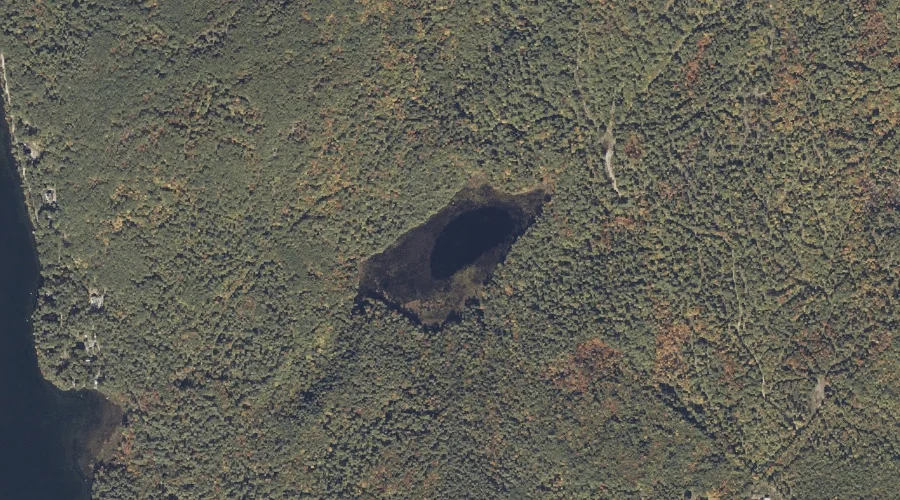
Owl Pond — Lakes 31.4 Miles SSE of Chapman Inn
Cumberland County, Maine · USGS Naples Quadrangle · GNIS 572881
Catalogued on the USGS Naples quadrangle in Cumberland County, Maine, Owl Pond — a lake — lies 31.4 miles south-southeast of Chapman Inn.
Landmark Profile
Classification & USGS reference
Catalogued under GNIS Feature ID 572881, Owl Pond is recorded as a lake on the USGS Naples quadrangle in Cumberland County, Maine (FIPS 23/005). Last revised by the Board on Geographic Names on 05/15/2018.
Coordinates & physical setting
Owl Pond sits at 43.99946° N, 70.50303° W (DMS 43°59′58″ N, 70°30′11″ W).
Other lakes in Cumberland County, Maine
Cumberland County, ME contains 47 lakes catalogued in the USGS Geographic Names Information System, counting Owl Pond itself. The ones closest to Owl Pond:
| Feature | USGS Quadrangle | Distance |
|---|---|---|
| Parker Pond | Naples | 0.8 mi |
| Dumpling Pond | Raymond | 1.4 mi |
| Coffee Pond | Raymond | 1.5 mi |
| Hog Meadow Pond | Raymond | 1.7 mi |
| The Heath | Mechanic Falls | 1.8 mi |
| Crescent Lake | Raymond | 2.9 mi |
| Nubble Pond | Raymond | 3.4 mi |
| Raymond Pond | Raymond | 4.2 mi |
| Brandy Pond | Naples | 5.3 mi |
| Trickey Pond | Naples | 6.6 mi |
Features on the USGS Naples Quadrangle
The Naples 7.5-minute topographic quadrangle holds 65 catalogued natural features alongside Owl Pond. A sampling nearest to this location:
| Feature | Type | County | Offset |
|---|---|---|---|
| Barton Hill | Summits | Cumberland County, ME | 0.7 mi |
| Parker Pond | Lakes | Cumberland County, ME | 0.8 mi |
| Leach Hill | Summits | Cumberland County, ME | 1.3 mi |
| Decker Brook | Streams | Cumberland County, ME | 2.5 mi |
| Quaker Hill | Summits | Cumberland County, ME | 2.6 mi |
| Tenny Hill | Summits | Cumberland County, ME | 2.8 mi |
| Mill Brook | Streams | Cumberland County, ME | 3.4 mi |
| Bartlett Brook | Streams | Cumberland County, ME | 3.5 mi |
| Mitchell Hill | Summits | Cumberland County, ME | 3.6 mi |
| Jackson Cove | Bays | Cumberland County, ME | 4.8 mi |
Visiting from Chapman Inn
Distance, bearing & drive time
A 54-minute drive along back roads separates the front door of Chapman Inn from Owl Pond — 31.4 miles south-southeast as the crow flies, on compass bearing SSE.
Best time to visit
June through September for paddling and swimming; January through March for ice fishing. At this latitude (43.999°), the shoulder seasons are workable — April and November can be comfortable on mild years. At 31.4 miles from the Inn, block the full day — sunrise start, late return, packed meals. Conditions at Owl Pond track the nearby Barton Hill summit (0.7 mi away) closely — if that is runnable, so is this.
Nearest features to Owl Pond
| Feature | Type | County | Distance |
|---|---|---|---|
| Barton Hill | Summits | Cumberland County, ME | 0.7 mi |
| Parker Pond | Lakes | Cumberland County, ME | 0.8 mi |
| Pine Hill | Summits | Cumberland County, ME | 0.8 mi |
| Leach Hill | Summits | Cumberland County, ME | 1.3 mi |
| Dumpling Pond | Lakes | Cumberland County, ME | 1.4 mi |
Frequently Asked Questions
Where is Owl Pond located?
Owl Pond is in Cumberland County, Maine, approximately 31.4 miles south-southeast of Chapman Inn in Bethel, Maine. It appears on the USGS Naples topographic quadrangle.
How far is Owl Pond from Chapman Inn?
The drive runs about 54 minutes, 31.4 miles south-southeast (bearing SSE) of the Inn.
What type of natural feature is Owl Pond?
The U.S. Geological Survey classifies Owl Pond as a lake, catalogued under GNIS Feature ID 572881 on the Naples quadrangle.
When is the best time to visit Owl Pond?
June through September for paddling and swimming; January through March for ice fishing.
How many other lakes are in Cumberland County, Maine?
GNIS lists 46 other lakes in Cumberland County, Maine.