 Aerial imagery: USGS National Map (public domain)
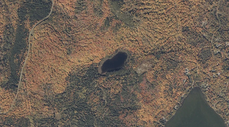
Nutting Pond — Lakes 40.9 Miles N of Chapman Inn
Franklin County, Maine · USGS Oquossoc Quadrangle · GNIS 572552
Within Franklin County, Maine, on the USGS Oquossoc quadrangle, the lake known as Nutting Pond sits 40.9 miles north of Chapman Inn.
Landmark Profile
Classification & USGS reference
Within Franklin County, Maine, the U.S. Geological Survey lists Nutting Pond as a lake on the Oquossoc topographic quadrangle (FIPS 23/007), under Feature ID 572552. Last revised by the Board on Geographic Names on 05/15/2018.
Coordinates & physical setting
Nutting Pond sits at 44.99661° N, 70.75205° W (DMS 44°59′48″ N, 70°45′07″ W).
Other lakes in Franklin County, Maine
Franklin County, ME contains 98 lakes catalogued in the USGS Geographic Names Information System, counting Nutting Pond itself. The ones closest to Nutting Pond:
| Feature | USGS Quadrangle | Distance |
|---|---|---|
| Quimby Pond | Rangeley | 0.7 mi |
| Beaver Bog | Kennebago Lake | 1 mi |
| Secret Bog | Kennebago Lake | 1.1 mi |
| Ellis Pond | Oquossoc | 1.3 mi |
| Round Pond | Rangeley | 1.7 mi |
| Kamankeag Pond | Kennebago | 2.5 mi |
| Cloutman Pond | Kennebago | 2.7 mi |
| Lost Logan | Kennebago Lake | 3.1 mi |
| Perk Pond | Kennebago Lake | 3.7 mi |
| Ross Pond | Rangeley | 4.1 mi |
Features on the USGS Oquossoc Quadrangle
The Oquossoc 7.5-minute topographic quadrangle holds 34 catalogued natural features alongside Nutting Pond. A sampling nearest to this location:
| Feature | Type | County | Offset |
|---|---|---|---|
| Hayno Bog | Swamps | Franklin County, ME | 0.8 mi |
| Ellis Pond | Lakes | Franklin County, ME | 1.3 mi |
| Whetstone Brook | Streams | Franklin County, ME | 1.6 mi |
| Kennebago River | Streams | Franklin County, ME | 1.6 mi |
| Indian Rock | Islands | Franklin County, ME | 2.1 mi |
| Rangeley River | Streams | Franklin County, ME | 2.3 mi |
| Spots Point | Capes | Franklin County, ME | 3.2 mi |
| Eagle Point | Capes | Franklin County, ME | 3.2 mi |
| Echo Cove | Bays | Franklin County, ME | 3.4 mi |
| Blueberry Island | Islands | Oxford County, ME | 3.5 mi |
Visiting from Chapman Inn
Distance, bearing & drive time
Follow the compass bearing N out of Bethel for 40.9 miles (north) and you reach Nutting Pond; at typical rural speeds the trip runs roughly 70 minutes.
Best time to visit
June through September for paddling and swimming; January through March for ice fishing. Being this far north (lat 44.997°), first snows typically arrive by mid-October and linger into early May — narrow the window accordingly. At 40.9 miles from the Inn, block the full day — sunrise start, late return, packed meals. Conditions at Nutting Pond track the nearby Quimby Pond lake (0.7 mi away) closely — if that is runnable, so is this.
Nearest features to Nutting Pond
| Feature | Type | County | Distance |
|---|---|---|---|
| Quimby Pond | Lakes | Franklin County, ME | 0.7 mi |
| Hayno Bog | Swamps | Franklin County, ME | 0.8 mi |
| Beaver Bog | Lakes | Franklin County, ME | 1 mi |
| Secret Bog | Lakes | Franklin County, ME | 1.1 mi |
| Ellis Pond | Lakes | Franklin County, ME | 1.3 mi |
Frequently Asked Questions
Where is Nutting Pond located?
Nutting Pond is in Franklin County, Maine, approximately 40.9 miles north of Chapman Inn in Bethel, Maine. It appears on the USGS Oquossoc topographic quadrangle.
How far is Nutting Pond from Chapman Inn?
The drive runs about 70 minutes, 40.9 miles north (bearing N) of the Inn.
What type of natural feature is Nutting Pond?
The U.S. Geological Survey classifies Nutting Pond as a lake, catalogued under GNIS Feature ID 572552 on the Oquossoc quadrangle.
When is the best time to visit Nutting Pond?
June through September for paddling and swimming; January through March for ice fishing.
How many other lakes are in Franklin County, Maine?
GNIS lists 97 other lakes in Franklin County, Maine.