 Aerial imagery: USGS National Map (public domain)
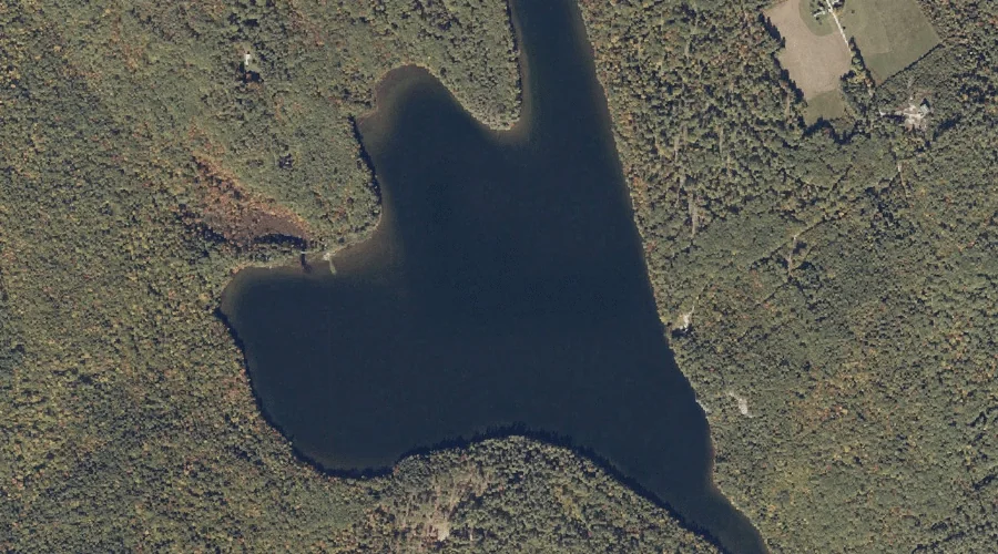
Little Loose Pond — Lakes 18.6 Miles S of Chapman Inn
Oxford County, Maine · USGS Waterford Flat Quadrangle · GNIS 569885
Within Oxford County, Maine, on the USGS Waterford Flat quadrangle, the lake known as Little Loose Pond sits 18.6 miles south of Chapman Inn.
Landmark Profile
Classification & USGS reference
Within Oxford County, Maine, the U.S. Geological Survey lists Little Loose Pond as a lake on the Waterford Flat topographic quadrangle (FIPS 23/017), under Feature ID 569885. Last revised by the Board on Geographic Names on 05/15/2018.
Coordinates & physical setting
Little Loose Pond sits at 44.13761° N, 70.74007° W (DMS 44°08′15″ N, 70°44′24″ W).
Other lakes in Oxford County, Maine
Oxford County, ME contains 157 lakes catalogued in the USGS Geographic Names Information System, counting Little Loose Pond itself. The ones closest to Little Loose Pond:
| Feature | USGS Quadrangle | Distance |
|---|---|---|
| Cabbage Yard Pond | Waterford Flat | 1 mi |
| Stearns Pond | Pleasant Mountain | 2.1 mi |
| Black Pond | North Waterford | 3 mi |
| Bog Pond | Waterford Flat | 3 mi |
| Duck Pond | North Waterford | 3.1 mi |
| Keoka Lake | Waterford Flat | 3.3 mi |
| Webber Pond | Pleasant Mountain | 3.9 mi |
| Keyes Pond | North Waterford | 4 mi |
| McWain Pond | Waterford Flat | 4.7 mi |
| Dan Charles Pond | North Waterford | 5.2 mi |
Features on the USGS Waterford Flat Quadrangle
The Waterford Flat 7.5-minute topographic quadrangle holds 47 catalogued natural features alongside Little Loose Pond. A sampling nearest to this location:
| Feature | Type | County | Offset |
|---|---|---|---|
| Brigham Ledge | Cliffs | Oxford County, ME | 0.4 mi |
| Packard Hill | Summits | Oxford County, ME | 0.5 mi |
| Hemlock Knoll | Summits | Oxford County, ME | 0.7 mi |
| Hedgehog Ledge | Cliffs | Oxford County, ME | 0.9 mi |
| Cabbage Yard Pond | Lakes | Oxford County, ME | 1 mi |
| Kimball Hill | Summits | Oxford County, ME | 1 mi |
| Bear Pond | Reservoirs | Oxford County, ME | 1.5 mi |
| Scoggins Brook | Streams | Oxford County, ME | 1.5 mi |
| Mill Brook | Streams | Oxford County, ME | 1.7 mi |
| Mutiny Brook | Streams | Oxford County, ME | 1.8 mi |
Visiting from Chapman Inn
Distance, bearing & drive time
Follow the compass bearing S out of Bethel for 18.6 miles (south) and you reach Little Loose Pond; at typical rural speeds the trip runs roughly 32 minutes.
Best time to visit
June through September for paddling and swimming; January through March for ice fishing. At this latitude (44.138°), the shoulder seasons are workable — April and November can be comfortable on mild years. At 18.6 miles from the Inn, plan on a comfortable day trip with time for lunch on the road. Conditions at Little Loose Pond track the nearby Brigham Ledge cliff face (0.4 mi away) closely — if that is runnable, so is this.
Nearest features to Little Loose Pond
| Feature | Type | County | Distance |
|---|---|---|---|
| Brigham Ledge | Cliffs | Oxford County, ME | 0.4 mi |
| Packard Hill | Summits | Oxford County, ME | 0.5 mi |
| Hemlock Knoll | Summits | Oxford County, ME | 0.7 mi |
| Marr Hill | Summits | Oxford County, ME | 0.8 mi |
| Hedgehog Ledge | Cliffs | Oxford County, ME | 0.9 mi |
Frequently Asked Questions
Where is Little Loose Pond located?
Little Loose Pond is in Oxford County, Maine, approximately 18.6 miles south of Chapman Inn in Bethel, Maine. It appears on the USGS Waterford Flat topographic quadrangle.
How far is Little Loose Pond from Chapman Inn?
The drive runs about 32 minutes, 18.6 miles south (bearing S) of the Inn.
What type of natural feature is Little Loose Pond?
The U.S. Geological Survey classifies Little Loose Pond as a lake, catalogued under GNIS Feature ID 569885 on the Waterford Flat quadrangle.
When is the best time to visit Little Loose Pond?
June through September for paddling and swimming; January through March for ice fishing.
How many other lakes are in Oxford County, Maine?
GNIS lists 156 other lakes in Oxford County, Maine.
Wikidata: Q33276332.