 Aerial imagery: USGS National Map (public domain)
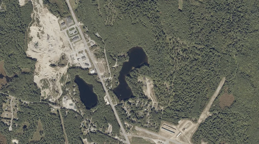
Lard Pond — Lakes 30.9 Miles ESE of Chapman Inn
Androscoggin County, Maine · USGS Lake Auburn East Quadrangle · GNIS 569383
Catalogued on the USGS Lake Auburn East quadrangle in Androscoggin County, Maine, Lard Pond — a lake — lies 30.9 miles east-southeast of Chapman Inn.
Landmark Profile
Classification & USGS reference
Catalogued under GNIS Feature ID 569383, Lard Pond is recorded as a lake on the USGS Lake Auburn East quadrangle in Androscoggin County, Maine (FIPS 23/001). Last revised by the Board on Geographic Names on 05/12/2018.
Coordinates & physical setting
Lard Pond sits at 44.19481° N, 70.23792° W (DMS 44°11′41″ N, 70°14′17″ W).
Other lakes in Androscoggin County, Maine
Androscoggin County, ME contains 44 lakes catalogued in the USGS Geographic Names Information System, counting Lard Pond itself. The ones closest to Lard Pond:
| Feature | USGS Quadrangle | Distance |
|---|---|---|
| Round Pond | Lake Auburn East | 0.3 mi |
| Sandy Bottom Pond | Lake Auburn West | 2.2 mi |
| Mud Pond | Lake Auburn West | 2.5 mi |
| Little Wilson Pond | Lake Auburn West | 2.6 mi |
| Black Pond | Lake Auburn West | 2.8 mi |
| Frog Pond | Lake Auburn West | 2.8 mi |
| Daggett Bog | Lake Auburn East | 3 mi |
| Berry Pond | Lake Auburn East | 3 mi |
| Mud Pond | Lake Auburn West | 3.4 mi |
| Lily Pond | Lake Auburn West | 3.5 mi |
Features on the USGS Lake Auburn East Quadrangle
The Lake Auburn East 7.5-minute topographic quadrangle holds 19 catalogued natural features alongside Lard Pond. A sampling nearest to this location:
| Feature | Type | County | Offset |
|---|---|---|---|
| Round Pond | Lakes | Androscoggin County, ME | 0.3 mi |
| Poplar Hill | Summits | Androscoggin County, ME | 0.3 mi |
| Bradford Brook | Streams | Androscoggin County, ME | 2.1 mi |
| Gulf Island Pond | Reservoirs | Androscoggin County, ME | 2.8 mi |
| Mount Giles | Summits | Androscoggin County, ME | 2.9 mi |
| Daggett Bog | Lakes | Androscoggin County, ME | 3 mi |
| Berry Pond | Lakes | Androscoggin County, ME | 3 mi |
| Lake Auburn | Reservoirs | Androscoggin County, ME | 3.4 mi |
| Merrill Hill | Summits | Androscoggin County, ME | 3.4 mi |
| Clark Mountain | Summits | Androscoggin County, ME | 3.4 mi |
Visiting from Chapman Inn
Distance, bearing & drive time
A 53-minute drive along back roads separates the front door of Chapman Inn from Lard Pond — 30.9 miles east-southeast as the crow flies, on compass bearing ESE.
Best time to visit
June through September for paddling and swimming; January through March for ice fishing. At this latitude (44.195°), the shoulder seasons are workable — April and November can be comfortable on mild years. At 30.9 miles from the Inn, block the full day — sunrise start, late return, packed meals. Conditions at Lard Pond track the nearby Round Pond lake (0.3 mi away) closely — if that is runnable, so is this.
Nearest features to Lard Pond
| Feature | Type | County | Distance |
|---|---|---|---|
| Round Pond | Lakes | Androscoggin County, ME | 0.3 mi |
| Poplar Hill | Summits | Androscoggin County, ME | 0.3 mi |
| Dillingham Hill | Summits | Androscoggin County, ME | 1.4 mi |
| Bradford Brook | Streams | Androscoggin County, ME | 2.1 mi |
| Sandy Bottom Pond | Lakes | Androscoggin County, ME | 2.2 mi |
Frequently Asked Questions
Where is Lard Pond located?
Lard Pond is in Androscoggin County, Maine, approximately 30.9 miles east-southeast of Chapman Inn in Bethel, Maine. It appears on the USGS Lake Auburn East topographic quadrangle.
How far is Lard Pond from Chapman Inn?
The drive runs about 53 minutes, 30.9 miles east-southeast (bearing ESE) of the Inn.
What type of natural feature is Lard Pond?
The U.S. Geological Survey classifies Lard Pond as a lake, catalogued under GNIS Feature ID 569383 on the Lake Auburn East quadrangle.
When is the best time to visit Lard Pond?
June through September for paddling and swimming; January through March for ice fishing.
How many other lakes are in Androscoggin County, Maine?
GNIS lists 43 other lakes in Androscoggin County, Maine.