 Aerial imagery: USGS National Map (public domain)
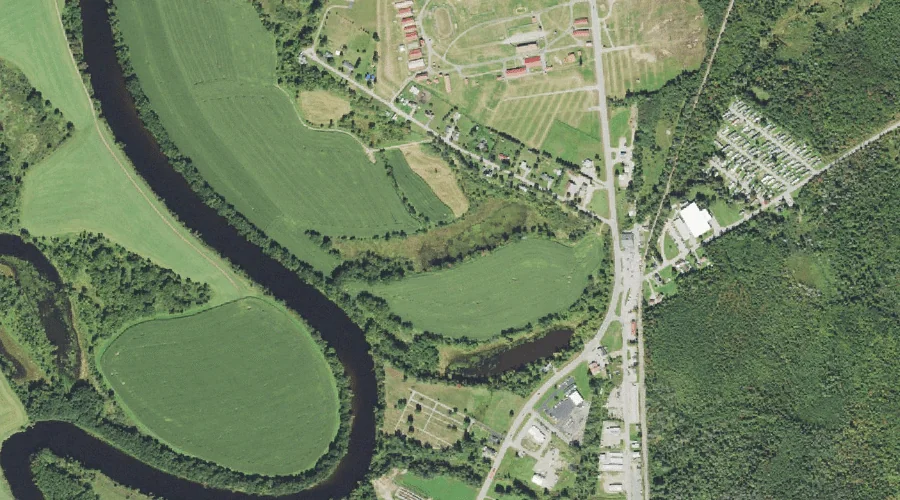
Kent Pond — Lakes 39.3 Miles W of Chapman Inn
Coos County, New Hampshire · USGS Groveton Quadrangle · GNIS 867847
Catalogued on the USGS Groveton quadrangle in Coos County, New Hampshire, Kent Pond — a lake — lies 39.3 miles west of Chapman Inn.
Landmark Profile
Classification & USGS reference
Catalogued under GNIS Feature ID 867847, Kent Pond is recorded as a lake on the USGS Groveton quadrangle in Coos County, New Hampshire (FIPS 33/007). Last revised by the Board on Geographic Names on 02/18/2018.
Coordinates & physical setting
Kent Pond sits at 44.50672° N, 71.57346° W (DMS 44°30′24″ N, 71°34′24″ W).
Other lakes in Coos County, New Hampshire
Coos County, NH contains 99 lakes catalogued in the USGS Geographic Names Information System, counting Kent Pond itself. The ones closest to Kent Pond:
| Feature | USGS Quadrangle | Distance |
|---|---|---|
| Baker Pond | Groveton | 0.2 mi |
| Martin Meadow Pond | Lancaster | 4.7 mi |
| Weeks Pond | Lancaster | 5.3 mi |
| Blood Pond | Lancaster | 5.5 mi |
| Weed Pond | Lancaster | 6 mi |
| Clark Pond | Gilman | 6.7 mi |
| Mud Pond | Lancaster | 8.4 mi |
| Mirror Lake | Lancaster | 8.4 mi |
| Little Cherry Pond | Lancaster | 8.9 mi |
| Unknown Pond | Stark | 9 mi |
Features on the USGS Groveton Quadrangle
The Groveton 7.5-minute topographic quadrangle holds 16 catalogued natural features alongside Kent Pond. A sampling nearest to this location:
| Feature | Type | County | Offset |
|---|---|---|---|
| Baker Pond | Lakes | Coos County, NH | 0.2 mi |
| Page Hill | Summits | Coos County, NH | 1.9 mi |
| Spalding Hill | Ridges | Coos County, NH | 2.2 mi |
| Whipple Brook | Streams | Coos County, NH | 2.7 mi |
| Beech Hill | Summits | Coos County, NH | 3.2 mi |
| Emery Brook | Streams | Essex County, NH | 3.6 mi |
| Connecticut River Reservoir | Reservoirs | Coos County, NH | 3.7 mi |
| Washburn Brook | Streams | Essex County, NH | 4 mi |
| Dean Brook | Streams | Coos County, NH | 4.3 mi |
| Parks Brook | Streams | Coos County, NH | 4.6 mi |
Visiting from Chapman Inn
Distance, bearing & drive time
A 67-minute drive along back roads separates the front door of Chapman Inn from Kent Pond — 39.3 miles west as the crow flies, on compass bearing W.
Best time to visit
June through September for paddling and swimming; January through March for ice fishing. Being this far north (lat 44.507°), first snows typically arrive by mid-October and linger into early May — narrow the window accordingly. At 39.3 miles from the Inn, block the full day — sunrise start, late return, packed meals. Conditions at Kent Pond track the nearby Baker Pond lake (0.2 mi away) closely — if that is runnable, so is this.
Nearest features to Kent Pond
| Feature | Type | County | Distance |
|---|---|---|---|
| Baker Pond | Lakes | Coos County, NH | 0.2 mi |
| Israel River | Streams | Coos County, NH | 1.6 mi |
| Bunker Hill | Summits | Coos County, NH | 1.7 mi |
| Page Hill | Summits | Coos County, NH | 1.9 mi |
| Otter Brook | Streams | Coos County, NH | 2.2 mi |
Frequently Asked Questions
Where is Kent Pond located?
Kent Pond is in Coos County, New Hampshire, approximately 39.3 miles west of Chapman Inn in Bethel, Maine. It appears on the USGS Groveton topographic quadrangle.
How far is Kent Pond from Chapman Inn?
The drive runs about 67 minutes, 39.3 miles west (bearing W) of the Inn.
What type of natural feature is Kent Pond?
The U.S. Geological Survey classifies Kent Pond as a lake, catalogued under GNIS Feature ID 867847 on the Groveton quadrangle.
When is the best time to visit Kent Pond?
June through September for paddling and swimming; January through March for ice fishing.
How many other lakes are in Coos County, New Hampshire?
GNIS lists 98 other lakes in Coos County, New Hampshire.