 Aerial imagery: USGS National Map (public domain)
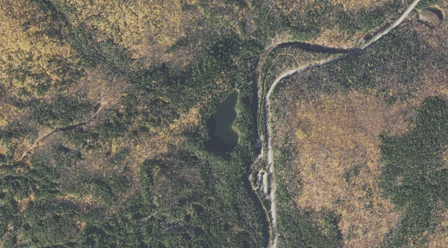
Falls Pond — Lakes 36.8 Miles SW of Chapman Inn
Carroll County, New Hampshire · USGS Bartlett Quadrangle · GNIS 871874
Within Carroll County, New Hampshire, on the USGS Bartlett quadrangle, the lake known as Falls Pond sits 36.8 miles southwest of Chapman Inn.
Landmark Profile
Classification & USGS reference
Within Carroll County, New Hampshire, the U.S. Geological Survey lists Falls Pond as a lake on the Bartlett topographic quadrangle (FIPS 33/003), under Feature ID 871874. Last revised by the Board on Geographic Names on 05/15/2018.
Coordinates & physical setting
Falls Pond sits at 44.00494° N, 71.28003° W (DMS 44°00′18″ N, 71°16′48″ W).
Other lakes in Carroll County, New Hampshire
Carroll County, NH contains 62 lakes catalogued in the USGS Geographic Names Information System, counting Falls Pond itself. The ones closest to Falls Pond:
| Feature | USGS Quadrangle | Distance |
|---|---|---|
| Moose Pond | Mount Chocorua | 2.1 mi |
| McKiels Pond | Bartlett | 4.6 mi |
| Iona Lake | Silver Lake | 5.2 mi |
| Back Pond | Silver Lake | 5.9 mi |
| Haunted Pond | Silver Lake | 5.9 mi |
| Whitton Pond | Silver Lake | 6.1 mi |
| Red Eagle Pond | Silver Lake | 6.4 mi |
| Lonely Lake | Silver Lake | 6.5 mi |
| James Pond | Mount Chocorua | 6.6 mi |
| Echo Lake | North Conway West | 6.9 mi |
Features on the USGS Bartlett Quadrangle
The Bartlett 7.5-minute topographic quadrangle holds 31 catalogued natural features alongside Falls Pond. A sampling nearest to this location:
| Feature | Type | County | Offset |
|---|---|---|---|
| Rocky Gorge | Valleys | Carroll County, NH | 0.2 mi |
| Cilley Brook | Streams | Carroll County, NH | 0.3 mi |
| Albany Intervale | Valleys | Carroll County, NH | 0.3 mi |
| Haskell Brook | Streams | Carroll County, NH | 1 mi |
| Bear Mountain | Summits | Carroll County, NH | 2 mi |
| Table Mountain | Summits | Carroll County, NH | 2.1 mi |
| Rob Brook | Streams | Carroll County, NH | 2.7 mi |
| Bear Notch | Gaps | Carroll County, NH | 3.2 mi |
| Pond Brook | Streams | Carroll County, NH | 3.8 mi |
| Louisville Brook | Streams | Carroll County, NH | 3.9 mi |
Visiting from Chapman Inn
Distance, bearing & drive time
Follow the compass bearing SW out of Bethel for 36.8 miles (southwest) and you reach Falls Pond; at typical rural speeds the trip runs roughly 63 minutes.
Best time to visit
June through September for paddling and swimming; January through March for ice fishing. At this latitude (44.005°), the shoulder seasons are workable — April and November can be comfortable on mild years. At 36.8 miles from the Inn, block the full day — sunrise start, late return, packed meals. Conditions at Falls Pond track the nearby Rocky Gorge valley (0.2 mi away) closely — if that is runnable, so is this.
Nearest features to Falls Pond
| Feature | Type | County | Distance |
|---|---|---|---|
| Rocky Gorge | Valleys | Carroll County, NH | 0.2 mi |
| Cilley Brook | Streams | Carroll County, NH | 0.3 mi |
| Albany Intervale | Valleys | Carroll County, NH | 0.3 mi |
| Steam Mill Brook | Streams | Carroll County, NH | 0.4 mi |
| Champney Brook | Streams | Carroll County, NH | 1 mi |
Frequently Asked Questions
Where is Falls Pond located?
Falls Pond is in Carroll County, New Hampshire, approximately 36.8 miles southwest of Chapman Inn in Bethel, Maine. It appears on the USGS Bartlett topographic quadrangle.
How far is Falls Pond from Chapman Inn?
The drive runs about 63 minutes, 36.8 miles southwest (bearing SW) of the Inn.
What type of natural feature is Falls Pond?
The U.S. Geological Survey classifies Falls Pond as a lake, catalogued under GNIS Feature ID 871874 on the Bartlett quadrangle.
When is the best time to visit Falls Pond?
June through September for paddling and swimming; January through March for ice fishing.
How many other lakes are in Carroll County, New Hampshire?
GNIS lists 61 other lakes in Carroll County, New Hampshire.