 Aerial imagery: USGS National Map (public domain)
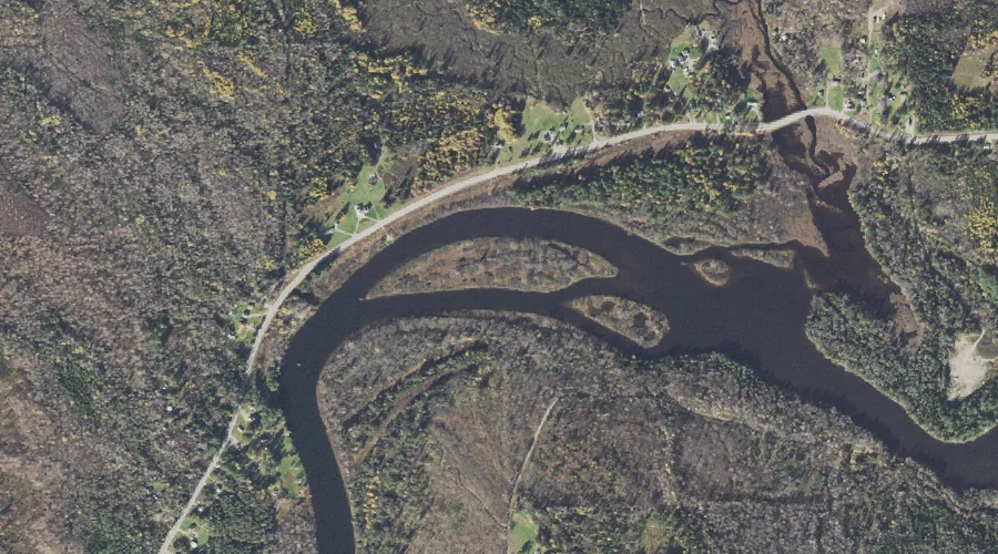
Wentworth Island — Islands 27.5 Miles NW of Chapman Inn
Coos County, New Hampshire · USGS Teakettle Ridge Quadrangle · GNIS 870732
27.5 miles northwest of Chapman Inn, on the USGS Teakettle Ridge topographic quadrangle, Wentworth Island is a island recorded in Coos County, New Hampshire by the federal Geographic Names Information System.
Wikidata short description: “island in Coos County, New Hampshire, United States”
Landmark Profile
Classification & USGS reference
The USGS Teakettle Ridge 7.5-minute topographic quadrangle places Wentworth Island in Coos County, New Hampshire (FIPS 33/007), classified as a island in the federal GNIS (Feature ID 870732). Catalogued in GNIS since 08/27/1980.
Coordinates & physical setting
Wentworth Island sits at 44.66311° N, 71.21369° W (DMS 44°39′47″ N, 71°12′49″ W).
Other islands in Coos County, New Hampshire
Coos County, NH contains 8 islands catalogued in the USGS Geographic Names Information System, counting Wentworth Island itself. The ones closest to Wentworth Island:
| Feature | USGS Quadrangle | Distance |
|---|---|---|
| Seven Islands | Teakettle Ridge | 3.8 mi |
| Big Island | Umbagog Lake South | 8.5 mi |
| Bear Island | Umbagog Lake South | 9.3 mi |
| Blake Island | Umbagog Lake South | 9.4 mi |
| Metallak Island | Umbagog Lake South | 10.1 mi |
| Buck Island | Berlin | 18.8 mi |
| Evans Island | Shelburne | 20 mi |
Features on the USGS Teakettle Ridge Quadrangle
The Teakettle Ridge 7.5-minute topographic quadrangle holds 26 catalogued natural features alongside Wentworth Island. A sampling nearest to this location:
| Feature | Type | County | Offset |
|---|---|---|---|
| Goose Pond | Swamps | Coos County, NH | 0.3 mi |
| Newell Brook | Streams | Coos County, NH | 0.5 mi |
| Sessions Brook | Streams | Coos County, NH | 0.6 mi |
| Lord Brook | Streams | Coos County, NH | 0.7 mi |
| Island Brook | Streams | Coos County, NH | 1.3 mi |
| Sugar Hill | Summits | Coos County, NH | 1.7 mi |
| Bog Brook | Streams | Coos County, NH | 1.7 mi |
| Pontook Reservoir | Reservoirs | Coos County, NH | 2.3 mi |
| Pond Hill | Summits | Coos County, NH | 2.6 mi |
| Veezey Hill | Summits | Coos County, NH | 2.6 mi |
Visiting from Chapman Inn
Distance, bearing & drive time
Chapman Inn sits 27.5 miles northwest (bearing NW) of Wentworth Island. At moderate back-road speeds the drive runs about 47 minutes — comfortably inside a half-day outing window after breakfast.
Best time to visit
Late May through early October, when the water is safe for small-boat access. Being this far north (lat 44.663°), first snows typically arrive by mid-October and linger into early May — narrow the window accordingly. At 27.5 miles from the Inn, block the full day — sunrise start, late return, packed meals. Conditions at Wentworth Island track the nearby Goose Pond swamp (0.3 mi away) closely — if that is runnable, so is this.
Nearest features to Wentworth Island
| Feature | Type | County | Distance |
|---|---|---|---|
| Goose Pond | Swamps | Coos County, NH | 0.3 mi |
| Newell Brook | Streams | Coos County, NH | 0.5 mi |
| Sessions Brook | Streams | Coos County, NH | 0.6 mi |
| Lord Brook | Streams | Coos County, NH | 0.7 mi |
| Island Brook | Streams | Coos County, NH | 1.3 mi |
Frequently Asked Questions
Where is Wentworth Island located?
Wentworth Island is in Coos County, New Hampshire, approximately 27.5 miles northwest of Chapman Inn in Bethel, Maine. It appears on the USGS Teakettle Ridge topographic quadrangle.
How far is Wentworth Island from Chapman Inn?
The drive runs about 47 minutes, 27.5 miles northwest (bearing NW) of the Inn.
What type of natural feature is Wentworth Island?
The U.S. Geological Survey classifies Wentworth Island as a island, catalogued under GNIS Feature ID 870732 on the Teakettle Ridge quadrangle.
When is the best time to visit Wentworth Island?
Late May through early October, when the water is safe for small-boat access.
How many other islands are in Coos County, New Hampshire?
GNIS lists 7 other islands in Coos County, New Hampshire.
Wikidata: Q130311148.