 Aerial imagery: USGS National Map (public domain)
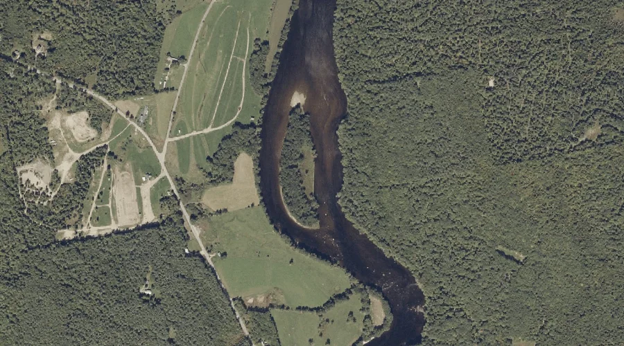
Lovewell Island — Islands 29.9 Miles E of Chapman Inn
Androscoggin County, Maine · USGS Turner Center Quadrangle · GNIS 570450
29.9 miles east of Chapman Inn, on the USGS Turner Center topographic quadrangle, Lovewell Island is a island recorded in Androscoggin County, Maine by the federal Geographic Names Information System.
Wikidata short description: “island in Androscoggin County, Maine, United States”
Landmark Profile
Classification & USGS reference
The USGS Turner Center 7.5-minute topographic quadrangle places Lovewell Island in Androscoggin County, Maine (FIPS 23/001), classified as a island in the federal GNIS (Feature ID 570450). Catalogued in GNIS since 09/30/1980.
Coordinates & physical setting
Lovewell Island sits at 44.35035° N, 70.18867° W (DMS 44°21′01″ N, 70°11′19″ W).
Other islands in Androscoggin County, Maine
Androscoggin County, ME contains 10 islands catalogued in the USGS Geographic Names Information System, counting Lovewell Island itself. The ones closest to Lovewell Island:
| Feature | USGS Quadrangle | Distance |
|---|---|---|
| Ram Island | Turner Center | 1.9 mi |
| Turtle Island | Turner Center | 2.1 mi |
| Little Ram Island | Turner Center | 2.1 mi |
| Griswold Island | Turner Center | 5.1 mi |
| Lothrop Island | Wayne | 5.4 mi |
| Boxer Island | Lewiston | 16.1 mi |
| Fox Island | Lewiston | 17.3 mi |
| Black Island | Mechanic Falls | 24.3 mi |
| Megquier Island | Mechanic Falls | 24.5 mi |
Features on the USGS Turner Center Quadrangle
The Turner Center 7.5-minute topographic quadrangle holds 21 catalogued natural features alongside Lovewell Island. A sampling nearest to this location:
| Feature | Type | County | Offset |
|---|---|---|---|
| Keith Brook | Streams | Androscoggin County, ME | 1.3 mi |
| Dead River | Streams | Androscoggin County, ME | 1.5 mi |
| Dead River Reservoir | Reservoirs | Androscoggin County, ME | 1.8 mi |
| Ram Island | Islands | Androscoggin County, ME | 1.9 mi |
| Turtle Island | Islands | Androscoggin County, ME | 2.1 mi |
| Little Ram Island | Islands | Androscoggin County, ME | 2.1 mi |
| Sand Hill | Summits | Androscoggin County, ME | 2.2 mi |
| Torry Hill | Summits | Androscoggin County, ME | 2.2 mi |
| Butter Hill | Summits | Androscoggin County, ME | 2.5 mi |
| Merrill Hill | Summits | Androscoggin County, ME | 2.7 mi |
Visiting from Chapman Inn
Distance, bearing & drive time
Chapman Inn sits 29.9 miles east (bearing E) of Lovewell Island. At moderate back-road speeds the drive runs about 51 minutes — comfortably inside a half-day outing window after breakfast.
Best time to visit
Late May through early October, when the water is safe for small-boat access. At this latitude (44.350°), the shoulder seasons are workable — April and November can be comfortable on mild years. At 29.9 miles from the Inn, block the full day — sunrise start, late return, packed meals. Conditions at Lovewell Island track the nearby Keith Brook stream (1.3 mi away) closely — if that is runnable, so is this.
Nearest features to Lovewell Island
| Feature | Type | County | Distance |
|---|---|---|---|
| Keith Brook | Streams | Androscoggin County, ME | 1.3 mi |
| Dead River | Streams | Androscoggin County, ME | 1.5 mi |
| Dead River Reservoir | Reservoirs | Androscoggin County, ME | 1.8 mi |
| Ram Island | Islands | Androscoggin County, ME | 1.9 mi |
| Turtle Island | Islands | Androscoggin County, ME | 2.1 mi |
Frequently Asked Questions
Where is Lovewell Island located?
Lovewell Island is in Androscoggin County, Maine, approximately 29.9 miles east of Chapman Inn in Bethel, Maine. It appears on the USGS Turner Center topographic quadrangle.
How far is Lovewell Island from Chapman Inn?
The drive runs about 51 minutes, 29.9 miles east (bearing E) of the Inn.
What type of natural feature is Lovewell Island?
The U.S. Geological Survey classifies Lovewell Island as a island, catalogued under GNIS Feature ID 570450 on the Turner Center quadrangle.
When is the best time to visit Lovewell Island?
Late May through early October, when the water is safe for small-boat access.
How many other islands are in Androscoggin County, Maine?
GNIS lists 9 other islands in Androscoggin County, Maine.
Wikidata: Q49654927.