 Aerial imagery: USGS National Map (public domain)
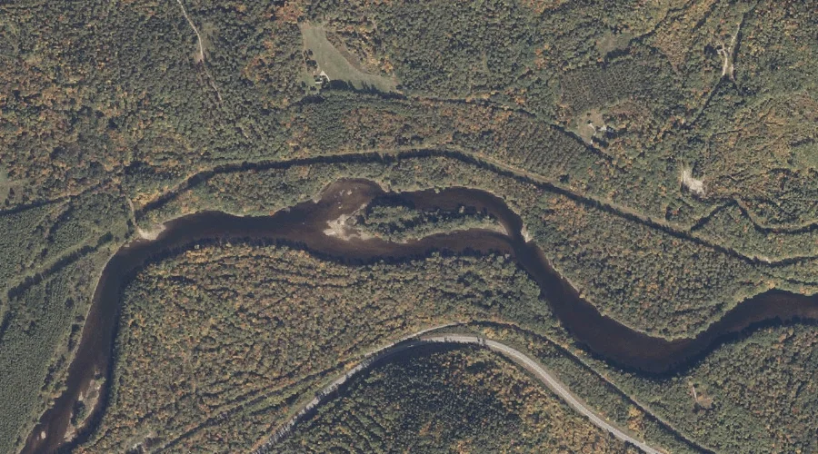
Lary Island — Islands 10.2 Miles W of Chapman Inn
Oxford County, Maine · USGS Gilead Quadrangle · GNIS 581091
10.2 miles west of Chapman Inn, on the USGS Gilead topographic quadrangle, Lary Island is a island recorded in Oxford County, Maine by the federal Geographic Names Information System.
Wikidata short description: “island in Oxford County, Maine, United States”
Landmark Profile
Classification & USGS reference
The USGS Gilead 7.5-minute topographic quadrangle places Lary Island in Oxford County, Maine (FIPS 23/017), classified as a island in the federal GNIS (Feature ID 581091). Catalogued in GNIS since 09/30/1980.
Coordinates & physical setting
Lary Island sits at 44.39867° N, 70.99507° W (DMS 44°23′55″ N, 70°59′42″ W).
Other islands in Oxford County, Maine
Oxford County, ME contains 44 islands catalogued in the USGS Geographic Names Information System, counting Lary Island itself. The ones closest to Lary Island:
| Feature | USGS Quadrangle | Distance |
|---|---|---|
| Peabody Island | Gilead | 1.5 mi |
| Philbrook Island | Gilead | 3.1 mi |
| Bond Island | Bethel | 9.3 mi |
| Hastings Island | Bethel | 10.2 mi |
| Birch Island | Center Lovell | 12 mi |
| Sheep Island | Center Lovell | 12.2 mi |
| Rattlesnake Island | Center Lovell | 12.4 mi |
| Timber Island | Center Lovell | 15.3 mi |
| Loon Island | Fryeburg | 21.1 mi |
| Wheeler Island | Rumford | 24 mi |
Features on the USGS Gilead Quadrangle
The Gilead 7.5-minute topographic quadrangle holds 31 catalogued natural features alongside Lary Island. A sampling nearest to this location:
| Feature | Type | County | Offset |
|---|---|---|---|
| French Brook | Streams | Oxford County, ME | 0.2 mi |
| Twitchell Brook | Streams | Oxford County, ME | 0.2 mi |
| Twin Mountain | Summits | Oxford County, ME | 0.7 mi |
| Wild River | Streams | Oxford County, NH | 0.8 mi |
| Gammon Brook | Streams | Oxford County, ME | 1 mi |
| Peabody Island | Islands | Oxford County, ME | 1.5 mi |
| Tumbledown Dick Mountain | Summits | Oxford County, ME | 2.9 mi |
| Robinson Peak | Summits | Oxford County, ME | 2.9 mi |
| Wheeler Brook | Streams | Oxford County, ME | 3 mi |
| Philbrook Island | Islands | Oxford County, ME | 3.1 mi |
Visiting from Chapman Inn
Distance, bearing & drive time
Chapman Inn sits 10.2 miles west (bearing W) of Lary Island. At moderate back-road speeds the drive runs about 17 minutes — comfortably inside a half-day outing window after breakfast.
Best time to visit
Late May through early October, when the water is safe for small-boat access. At this latitude (44.399°), the shoulder seasons are workable — April and November can be comfortable on mild years. At 10.2 miles from the Inn, plan on a comfortable day trip with time for lunch on the road. Conditions at Lary Island track the nearby French Brook stream (0.2 mi away) closely — if that is runnable, so is this.
Nearest features to Lary Island
| Feature | Type | County | Distance |
|---|---|---|---|
| French Brook | Streams | Oxford County, ME | 0.2 mi |
| Twitchell Brook | Streams | Oxford County, ME | 0.2 mi |
| Lary Brook | Streams | Oxford County, ME | 0.4 mi |
| Twin Mountain | Summits | Oxford County, ME | 0.7 mi |
| Wild River | Streams | Oxford County, NH | 0.8 mi |
Frequently Asked Questions
Where is Lary Island located?
Lary Island is in Oxford County, Maine, approximately 10.2 miles west of Chapman Inn in Bethel, Maine. It appears on the USGS Gilead topographic quadrangle.
How far is Lary Island from Chapman Inn?
The drive runs about 17 minutes, 10.2 miles west (bearing W) of the Inn.
What type of natural feature is Lary Island?
The U.S. Geological Survey classifies Lary Island as a island, catalogued under GNIS Feature ID 581091 on the Gilead quadrangle.
When is the best time to visit Lary Island?
Late May through early October, when the water is safe for small-boat access.
How many other islands are in Oxford County, Maine?
GNIS lists 43 other islands in Oxford County, Maine.
Wikidata: Q49650641.