 Aerial imagery: USGS National Map (public domain)
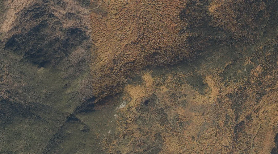
Whites Notch — Gaps 8.5 Miles WNW of Chapman Inn
Oxford County, Maine · USGS Gilead Quadrangle · GNIS 581268
8.5 miles west-northwest of Chapman Inn, on the USGS Gilead topographic quadrangle, Whites Notch is a mountain gap recorded in Oxford County, Maine by the federal Geographic Names Information System.
Landmark Profile
Classification & USGS reference
The USGS Gilead 7.5-minute topographic quadrangle places Whites Notch in Oxford County, Maine (FIPS 23/017), classified as a mountain gap in the federal GNIS (Feature ID 581268). Catalogued in GNIS since 09/30/1980.
Coordinates & physical setting
Whites Notch sits at 44.45367° N, 70.94757° W (DMS 44°27′13″ N, 70°56′51″ W).
Other gaps in Oxford County, Maine
Oxford County, ME contains 18 gaps catalogued in the USGS Geographic Names Information System, counting Whites Notch itself. The ones closest to Whites Notch:
| Feature | USGS Quadrangle | Distance |
|---|---|---|
| Jakes Notch | Gilead | 2.6 mi |
| Carlo Col | Shelburne | 3.9 mi |
| Mahoosuc Notch | Old Speck Mountain | 6.2 mi |
| Miles Notch | Old Speck Mountain | 7 mi |
| Notch 2 | Old Speck Mountain | 7.1 mi |
| Tyler Notch | Speckled Mountain | 7.3 mi |
| Haystack Notch | Speckled Mountain | 9 mi |
| Grafton Notch | Old Speck Mountain | 9.7 mi |
| Evans Notch | Speckled Mountain | 10.5 mi |
| Miles Notch | Speckled Mountain | 11 mi |
Features on the USGS Gilead Quadrangle
The Gilead 7.5-minute topographic quadrangle holds 31 catalogued natural features alongside Whites Notch. A sampling nearest to this location:
| Feature | Type | County | Offset |
|---|---|---|---|
| Bear Mountain | Summits | Oxford County, ME | 0.7 mi |
| Campbell Mountain | Summits | Oxford County, ME | 1.1 mi |
| Locke Hill | Summits | Oxford County, ME | 1.6 mi |
| Black Mountain | Summits | Oxford County, ME | 1.9 mi |
| Robinson Peak | Summits | Oxford County, ME | 1.9 mi |
| Wheeler Mountain | Summits | Oxford County, ME | 1.9 mi |
| Lary Brook Mountain | Summits | Oxford County, ME | 1.9 mi |
| South Branch Sunday River | Streams | Oxford County, ME | 2 mi |
| Jordan Mountain | Summits | Oxford County, ME | 2.1 mi |
| Little Bear Mountain | Summits | Oxford County, ME | 2.2 mi |
Visiting from Chapman Inn
Distance, bearing & drive time
Chapman Inn sits 8.5 miles west-northwest (bearing WNW) of Whites Notch. At moderate back-road speeds the drive runs about 15 minutes — comfortably inside a half-day outing window after breakfast.
Best time to visit
Late May through October; avoid black-fly peak in late May. At this latitude (44.454°), the shoulder seasons are workable — April and November can be comfortable on mild years. The 8.5-mile drive from Chapman Inn makes it practical for a half-day outing — you can check conditions in the morning and still turn back if the weather closes in. Conditions at Whites Notch track the nearby Bear Mountain summit (0.7 mi away) closely — if that is runnable, so is this.
Nearest features to Whites Notch
| Feature | Type | County | Distance |
|---|---|---|---|
| Bear Mountain | Summits | Oxford County, ME | 0.7 mi |
| Campbell Mountain | Summits | Oxford County, ME | 1.1 mi |
| Locke Hill | Summits | Oxford County, ME | 1.6 mi |
| Black Mountain | Summits | Oxford County, ME | 1.9 mi |
| Robinson Peak | Summits | Oxford County, ME | 1.9 mi |
Frequently Asked Questions
Where is Whites Notch located?
Whites Notch is in Oxford County, Maine, approximately 8.5 miles west-northwest of Chapman Inn in Bethel, Maine. It appears on the USGS Gilead topographic quadrangle.
How far is Whites Notch from Chapman Inn?
The drive runs about 15 minutes, 8.5 miles west-northwest (bearing WNW) of the Inn.
What type of natural feature is Whites Notch?
The U.S. Geological Survey classifies Whites Notch as a mountain gap, catalogued under GNIS Feature ID 581268 on the Gilead quadrangle.
When is the best time to visit Whites Notch?
Late May through October; avoid black-fly peak in late May.
How many other gaps are in Oxford County, Maine?
GNIS lists 17 other gaps in Oxford County, Maine.