 Aerial imagery: USGS National Map (public domain)
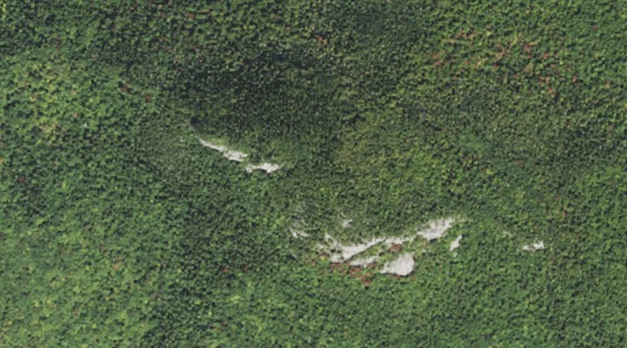
Owls Cliff — Cliffs 37.7 Miles SW of Chapman Inn
Carroll County, New Hampshire · USGS Bartlett Quadrangle · GNIS 872447
Within Carroll County, New Hampshire, on the USGS Bartlett quadrangle, the cliff face known as Owls Cliff sits 37.7 miles southwest of Chapman Inn.
Wikidata short description: “cliff in Carroll County, New Hampshire, United States”
Landmark Profile
Classification & USGS reference
Within Carroll County, New Hampshire, the U.S. Geological Survey lists Owls Cliff as a cliff face on the Bartlett topographic quadrangle (FIPS 33/003), under Feature ID 872447. Catalogued in GNIS since 08/27/1980.
Coordinates & physical setting
Owls Cliff sits at 44.04451° N, 71.35980° W (DMS 44°02′40″ N, 71°21′35″ W).
Features on the USGS Bartlett Quadrangle
The Bartlett 7.5-minute topographic quadrangle holds 31 catalogued natural features alongside Owls Cliff. A sampling nearest to this location:
| Feature | Type | County | Offset |
|---|---|---|---|
| Mount Tremont | Summits | Carroll County, NH | 0.6 mi |
| Bartlett Haystack | Summits | Carroll County, NH | 1.7 mi |
| Birch Hill | Summits | Carroll County, NH | 1.8 mi |
| Bear Notch | Gaps | Carroll County, NH | 2.2 mi |
| Stony Brook | Streams | Carroll County, NH | 2.5 mi |
| Pond Brook | Streams | Carroll County, NH | 2.9 mi |
| Sawyer Rock | Summits | Carroll County, NH | 2.9 mi |
| Sawyer River | Streams | Carroll County, NH | 3 mi |
| Bear Mountain | Summits | Carroll County, NH | 3 mi |
| Rob Brook | Streams | Carroll County, NH | 3.3 mi |
Visiting from Chapman Inn
Distance, bearing & drive time
Follow the compass bearing SW out of Bethel for 37.7 miles (southwest) and you reach Owls Cliff; at typical rural speeds the trip runs roughly 65 minutes.
Best time to visit
Accessible May through November in most years. At this latitude (44.045°), the shoulder seasons are workable — April and November can be comfortable on mild years. At 37.7 miles from the Inn, block the full day — sunrise start, late return, packed meals. Conditions at Owls Cliff track the nearby Mount Tremont summit (0.6 mi away) closely — if that is runnable, so is this.
Nearest features to Owls Cliff
| Feature | Type | County | Distance |
|---|---|---|---|
| Mount Tremont | Summits | Carroll County, NH | 0.6 mi |
| Sawyer Pond | Lakes | Grafton County, NH | 0.9 mi |
| Little Sawyer Pond | Lakes | Grafton County, NH | 1.1 mi |
| Bartlett Haystack | Summits | Carroll County, NH | 1.7 mi |
| Birch Hill | Summits | Carroll County, NH | 1.8 mi |
Frequently Asked Questions
Where is Owls Cliff located?
Owls Cliff is in Carroll County, New Hampshire, approximately 37.7 miles southwest of Chapman Inn in Bethel, Maine. It appears on the USGS Bartlett topographic quadrangle.
How far is Owls Cliff from Chapman Inn?
The drive runs about 65 minutes, 37.7 miles southwest (bearing SW) of the Inn.
What type of natural feature is Owls Cliff?
The U.S. Geological Survey classifies Owls Cliff as a cliff face, catalogued under GNIS Feature ID 872447 on the Bartlett quadrangle.
When is the best time to visit Owls Cliff?
Accessible May through November in most years.
Wikidata: Q49469907.