 Aerial imagery: USGS National Map (public domain)
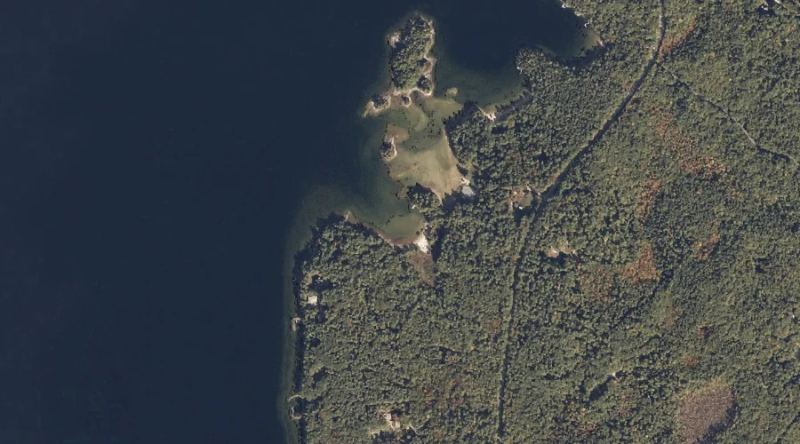
Lower Harvey Cove — Bays 38.6 Miles SSE of Chapman Inn
Cumberland County, Maine · USGS Naples Quadrangle · GNIS 1912676
Within Cumberland County, Maine, on the USGS Naples quadrangle, the bay known as Lower Harvey Cove sits 38.6 miles south-southeast of Chapman Inn.
Wikidata short description: “bay in Cumberland County, Maine, United States of America”
Landmark Profile
Classification & USGS reference
Within Cumberland County, Maine, the U.S. Geological Survey lists Lower Harvey Cove as a bay on the Naples topographic quadrangle (FIPS 23/005), under Feature ID 1912676. Catalogued in GNIS since 05/08/2001.
Coordinates & physical setting
Lower Harvey Cove sits at 43.87841° N, 70.52589° W (DMS 43°52′42″ N, 70°31′33″ W).
Other bays in Cumberland County, Maine
Cumberland County, ME contains 32 bays catalogued in the USGS Geographic Names Information System, counting Lower Harvey Cove itself. The ones closest to Lower Harvey Cove:
| Feature | USGS Quadrangle | Distance |
|---|---|---|
| Upper Harvey Cove | Naples | 0.4 mi |
| Shingle Cove | Naples | 0.7 mi |
| Schooner Cove | Naples | 1.1 mi |
| Burnell Cove | Naples | 1.5 mi |
| Turtle Cove | Naples | 1.6 mi |
| Jordan Bay | Raymond | 1.7 mi |
| Camp Cove | North Windham | 2.5 mi |
| Cub Cove | Naples | 2.7 mi |
| New Place Cove | Naples | 2.8 mi |
| Maple Cove | Naples | 2.8 mi |
Features on the USGS Naples Quadrangle
The Naples 7.5-minute topographic quadrangle holds 65 catalogued natural features alongside Lower Harvey Cove. A sampling nearest to this location:
| Feature | Type | County | Offset |
|---|---|---|---|
| Blueberry Island | Islands | Cumberland County, ME | 0.1 mi |
| Rookies Island | Islands | Cumberland County, ME | 0.3 mi |
| Upper Harvey Cove | Bays | Cumberland County, ME | 0.4 mi |
| Shingle Cove | Bays | Cumberland County, ME | 0.7 mi |
| Battleship Island | Islands | Cumberland County, ME | 0.8 mi |
| Schooner Cove | Bays | Cumberland County, ME | 1.1 mi |
| Millstone Island | Islands | Cumberland County, ME | 1.2 mi |
| Burnell Cove | Bays | Cumberland County, ME | 1.5 mi |
| Outer Doctor Island | Islands | Cumberland County, ME | 1.5 mi |
| Doctor Island | Islands | Cumberland County, ME | 1.6 mi |
Visiting from Chapman Inn
Distance, bearing & drive time
Follow the compass bearing SSE out of Bethel for 38.6 miles (south-southeast) and you reach Lower Harvey Cove; at typical rural speeds the trip runs roughly 66 minutes.
Best time to visit
June through September for paddling and swimming; January through March for ice fishing. At this latitude (43.878°), the shoulder seasons are workable — April and November can be comfortable on mild years. At 38.6 miles from the Inn, block the full day — sunrise start, late return, packed meals. Conditions at Lower Harvey Cove track the nearby Blueberry Island (essentially adjacent) closely — if that is runnable, so is this.
Nearest features to Lower Harvey Cove
| Feature | Type | County | Distance |
|---|---|---|---|
| Blueberry Island | Islands | Cumberland County, ME | 0.1 mi |
| Rookies Island | Islands | Cumberland County, ME | 0.3 mi |
| Upper Harvey Cove | Bays | Cumberland County, ME | 0.4 mi |
| Raymond Neck | Capes | Cumberland County, ME | 0.6 mi |
| Shingle Cove | Bays | Cumberland County, ME | 0.7 mi |
Frequently Asked Questions
Where is Lower Harvey Cove located?
Lower Harvey Cove is in Cumberland County, Maine, approximately 38.6 miles south-southeast of Chapman Inn in Bethel, Maine. It appears on the USGS Naples topographic quadrangle.
How far is Lower Harvey Cove from Chapman Inn?
The drive runs about 66 minutes, 38.6 miles south-southeast (bearing SSE) of the Inn.
What type of natural feature is Lower Harvey Cove?
The U.S. Geological Survey classifies Lower Harvey Cove as a bay, catalogued under GNIS Feature ID 1912676 on the Naples quadrangle.
When is the best time to visit Lower Harvey Cove?
June through September for paddling and swimming; January through March for ice fishing.
How many other bays are in Cumberland County, Maine?
GNIS lists 31 other bays in Cumberland County, Maine.
Wikidata: Q49383872.