 Aerial imagery: USGS National Map (public domain)
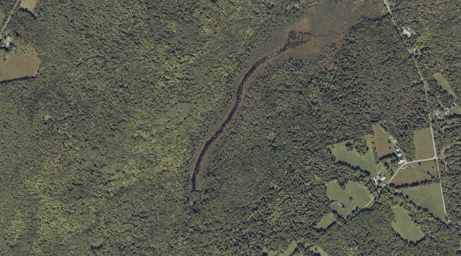
Hartwell Intervale — Basins 39.0 Miles NE of Chapman Inn
Franklin County, Maine · USGS Strong Quadrangle · GNIS 567714
One of only 11 basins catalogued within the 80 km reach of Chapman Inn, Hartwell Intervale lies on the USGS Strong quadrangle in Franklin County, Maine — 39.0 miles northeast of the Inn.
Landmark Profile
Classification & USGS reference
The USGS Strong 7.5-minute topographic quadrangle places Hartwell Intervale in Franklin County, Maine (FIPS 23/007), classified as a basin in the federal GNIS (Feature ID 567714). Catalogued in GNIS since 09/30/1980.
Coordinates & physical setting
Hartwell Intervale sits at 44.78200° N, 70.19812° W (DMS 44°46′55″ N, 70°11′53″ W).
Features on the USGS Strong Quadrangle
The Strong 7.5-minute topographic quadrangle holds 23 catalogued natural features alongside Hartwell Intervale. A sampling nearest to this location:
| Feature | Type | County | Offset |
|---|---|---|---|
| Hunter Mountain | Summits | Franklin County, ME | 1.1 mi |
| Dyer Hill | Summits | Franklin County, ME | 1.2 mi |
| Hartwell Mountain | Summits | Franklin County, ME | 1.3 mi |
| Pratt Mountain | Summits | Franklin County, ME | 1.7 mi |
| Valley Brook | Streams | Franklin County, ME | 2 mi |
| Nash Pond | Lakes | Franklin County, ME | 2 mi |
| McLeary Brook | Streams | Franklin County, ME | 2.2 mi |
| Stubbs Mountain | Summits | Franklin County, ME | 2.3 mi |
| Day Mountain Pond | Lakes | Franklin County, ME | 2.5 mi |
| Bean Brook | Streams | Franklin County, ME | 2.5 mi |
Ranking & rarity
- Among the 11 basins catalogued within 80 km of Chapman Inn, Hartwell Intervale ranks #3 by proximity to the Inn (closer than 73%).
- This is one of only 11 basins catalogued within Chapman Inn’s 80 km reach — a rare classification in the local landscape.
Visiting from Chapman Inn
Distance, bearing & drive time
Chapman Inn sits 39.0 miles northeast (bearing NE) of Hartwell Intervale. At moderate back-road speeds the drive runs about 67 minutes — comfortably inside a half-day outing window after breakfast.
Best time to visit
Late May through October; avoid black-fly peak in late May. Being this far north (lat 44.782°), first snows typically arrive by mid-October and linger into early May — narrow the window accordingly. At 39.0 miles from the Inn, block the full day — sunrise start, late return, packed meals. Conditions at Hartwell Intervale track the nearby Hunter Mountain summit (1.1 mi away) closely — if that is runnable, so is this.
Nearest features to Hartwell Intervale
| Feature | Type | County | Distance |
|---|---|---|---|
| Hunter Mountain | Summits | Franklin County, ME | 1.1 mi |
| Dyer Hill | Summits | Franklin County, ME | 1.2 mi |
| Hartwell Mountain | Summits | Franklin County, ME | 1.3 mi |
| Pratt Mountain | Summits | Franklin County, ME | 1.7 mi |
| Valley Brook | Streams | Franklin County, ME | 2 mi |
Frequently Asked Questions
Where is Hartwell Intervale located?
Hartwell Intervale is in Franklin County, Maine, approximately 39.0 miles northeast of Chapman Inn in Bethel, Maine. It appears on the USGS Strong topographic quadrangle.
How far is Hartwell Intervale from Chapman Inn?
The drive runs about 67 minutes, 39.0 miles northeast (bearing NE) of the Inn.
What type of natural feature is Hartwell Intervale?
The U.S. Geological Survey classifies Hartwell Intervale as a basin, catalogued under GNIS Feature ID 567714 on the Strong quadrangle.
When is the best time to visit Hartwell Intervale?
Late May through October; avoid black-fly peak in late May.
How rare is basins as a classification near Chapman Inn?
Only 11 basins are catalogued within the 80 km radius of the Inn — a comparatively rare classification.
Wikidata: Q34953390.